
Trongsa District
Central Bhutan district centered on Trongsa Dzong. Mountainous highlands, historic administrative role, parts of two national parks, agriculture-based economy and several gewogs (village blocks).
Overview
Trongsa District is a centrally located dzongkhag (district) of Bhutan, known for its strategic position in the kingdom's highlands. The district's administrative centre and most prominent landmark is Trongsa Dzong, a fortress-monastery that dominates a deep river gorge. Coordinates for the district lie near 27°20′N 90°25′E, placing it roughly in Bhutan’s central belt.
Image gallery
2 Images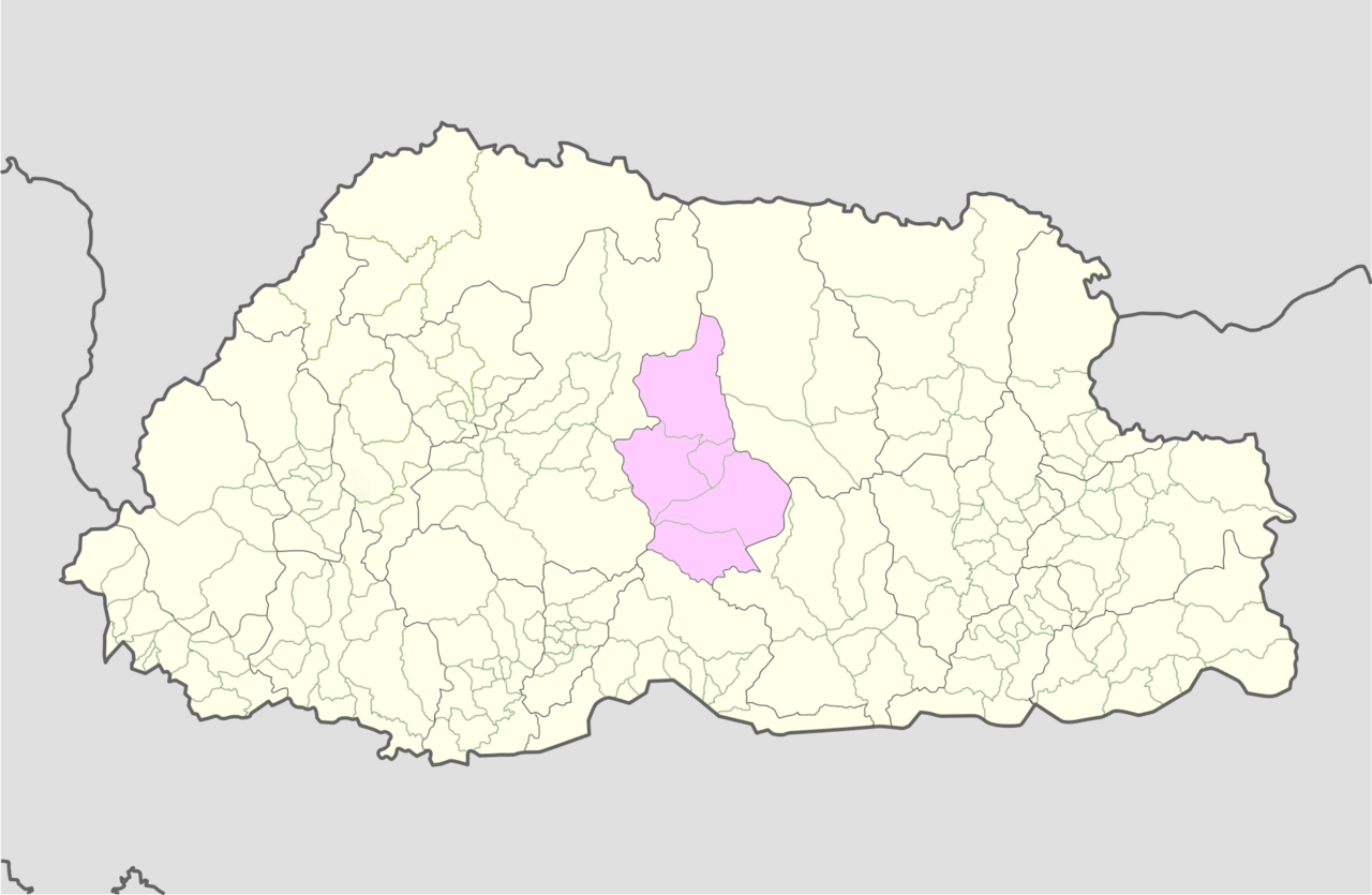

Geography and environment
Terrain in Trongsa is predominantly mountainous with valleys cut by rivers and streams. Elevations range from temperate mid-hills to higher alpine ridges. The district includes substantial tracts of forest and high-altitude pastures, and its varied altitudes create a range of climatic zones and habitats typical of Bhutan’s central highlands.
Protected areas and biodiversity
Parts of two major protected areas extend into Trongsa: Wangchuck Centennial Park and Jigme Singye Wangchuck National Park. These parks conserve large swathes of Himalayan ecosystems and support wildlife typical of Bhutan such as large ungulates and predators adapted to alpine and subalpine environments. The parks are important for habitat connectivity and for conserving species that move across elevation gradients.
Administration and communities
Administratively, Trongsa is divided into several gewogs (village blocks). These gewogs are the basic rural local government units, each containing a number of villages and hamlets where people practice small-scale farming, animal husbandry and local crafts. Dzongkhag-level government is based at the district centre in Trongsa Dzong.
History and cultural significance
Trongsa has long held a special place in Bhutanese history. The dzong has been a regional administrative and religious center for centuries and the office of the Penlop (governor) of Trongsa was historically influential in national affairs. Because of this role, Trongsa features prominently in accounts of Bhutan’s political development and in the lineage of the modern royal family.
Economy, transport and notable facts
The local economy is primarily agrarian, based on subsistence crops, horticulture and livestock. Trongsa lies along Bhutan’s main east–west roadway corridor, which connects it to other parts of the country and supports trade and travel. Notable features of the district are its commanding dzong overlooking a gorge, its role as a historical administrative hub, and the presence of internationally significant protected areas that conserve central Himalayan landscapes.
- Administrative centre: Trongsa Dzong
- Protected areas: Wangchuck Centennial Park, Jigme Singye Wangchuck National Park
- Coordinates: 27°20′N 90°25′E
- Country: Bhutan
Questions and answers
Q: What are the coordinates of Trongsa District?
A: The coordinates of Trongsa District are 27°20′N 90°25′E / 27.333°N 90.417°E / 27.333; 90.417.
Q: How many districts are there in Bhutan?
A: There are 20 districts in Bhutan.
Q: What is the administrative centre of Trongsa District?
A: The administrative centre of Trongsa District is Trongsa Dzong.
Q: What national parks are located in Trongsa District?
A: Wangchuck Centennial Park and Jigme Singye Wangchuck National Park are both located in Trongsa District.
Q: How many village blocks are there in Trongsa District?
A: There are five village blocks in Trongsa District.
Q: What are the names of the national parks in Trongsa District?
A: The names of the national parks in Trongsa District are Wangchuck Centennial Park and Jigme Singye Wangchuck National Park.
Q: What is Trongsa Dzong?
A: Trongsa Dzong is the administrative centre of Trongsa District.
Related articles
Author
AlegsaOnline.com Trongsa District Leandro Alegsa
URL: https://en.alegsaonline.com/art/101642