
Tassili n'Ajjer
Tassili n'Ajjer is a sandstone plateau in southeastern Algeria, famed for dramatic eroded landscapes and an extensive corpus of prehistoric rock art and archaeological remains.
Overview
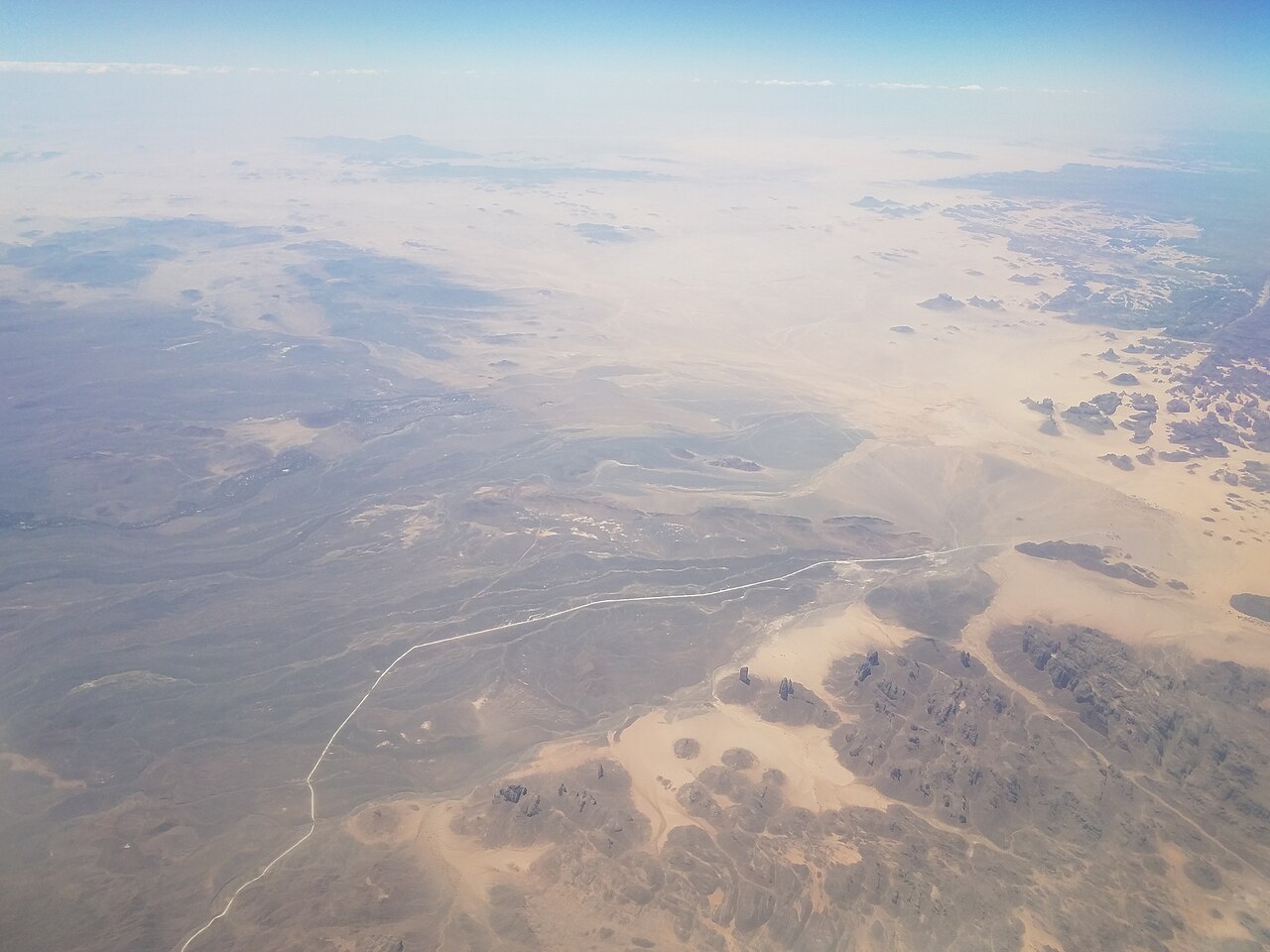
Tassili n'Ajjer is a high, rocky mountain range and plateau region in the Algerian Sahara. Its name is commonly rendered as the "Plateau of the Rivers," a reference to ancient watercourses that once shaped the area. Covering tens of thousands of square kilometers, the region combines wide, flat expanses with dramatic cliffs, natural arches and isolated spires carved into sandstone.
Image gallery
10 Images




Geology and landscape
The landscape is dominated by heavily eroded sandstone that yields a variety of landforms: mesa tops, narrow gorges, freestanding pillars and expansive rock shelters. Over millennia wind and episodic water action sculpted the stone, producing fragile arches and cavernous recesses. The plateau rises above surrounding dunes and supports scattered oases and seasonal wadis where life concentrates.
Rock art and archaeology
Tassili is internationally renowned for one of the largest and most impressive concentrations of prehistoric rock paintings and engravings in the world. The panels document a long sequence of human presence and environmental change: scenes depict groups of people, hunting and ritual activities, herds of domestic cattle, diverse wild animals — notably species no longer native to the central Sahara — and even crocodiles, indicating much wetter conditions in the past. Scholarly study places these artworks across many millennia, reflecting changing economies and climate.
Significance, protection and research
Because of its exceptional cultural and natural values, Tassili n'Ajjer was inscribed on the UNESCO World Heritage List, and it remains a key site for archaeology, paleoenvironmental study and rock-art conservation. Fieldwork and careful preservation efforts aim to document fragile pictographs while limiting damage from tourism and environmental deterioration. For general introductions and tourist information see a basic guide to the rock art.
Ecology and human use
Today the area supports desert-adapted plants and animals and is sparsely inhabited by nomadic and settled communities whose livelihoods rely on oases, small-scale herding and seasonal tourism. The nearby town of Djanet serves as the usual access point for visitors and researchers. Sustainable visitation and local engagement are important to protect archaeological panels and the delicate sandstone formations.
Notable facts and visitor points
- Remarkable sandstone arches and pillars formed by wind and rare rains.
- Thousands of rock-art panels record shifting human activities and climates.
- Recognition as a protected heritage site supports conservation and study.
- Access is typically organized from the regional center near Djanet; visitors should follow guidelines to avoid damaging rock art.
Related articles
Author
AlegsaOnline.com Tassili n'Ajjer Leandro Alegsa
URL: https://en.alegsaonline.com/art/96482
Sources
- rsis.ramsar.org : "La Vallée d'Iherir"