
Taal Volcano (Philippines)
Taal Volcano is a small but highly active complex volcano in the caldera of Taal Lake on Luzon, Philippines. It is notable for frequent eruptions, a central island, and significant local hazards and history.
Overview
Taal Volcano is a complex volcanic system located on the island of Luzon in the Philippines. It occupies a central island within Taal Lake, itself nested inside a large caldera formed by earlier, much larger eruptions. Despite its modest size, Taal is among the most active volcanic centers in the country, with 34 documented eruptions in historical records; this activity pattern makes it a major focus for volcanic monitoring and hazard planning. The volcano’s frequent activity and proximity to populated and tourist areas give it outsized social and economic significance.
Image gallery
10 Images




Structure and characteristics
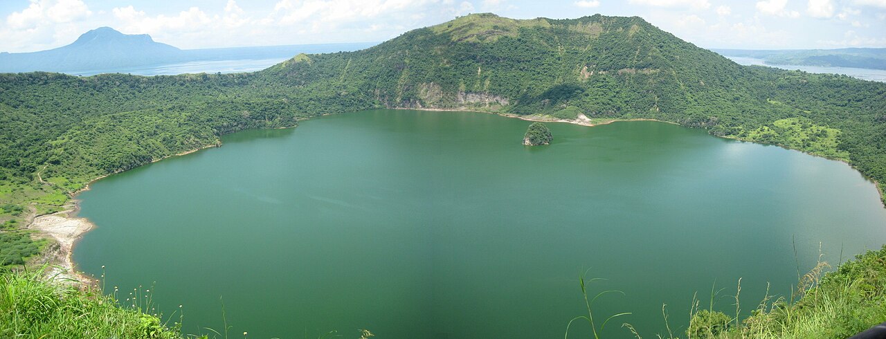
Taal is classified as a complex volcano because it consists of multiple vents, craters, and eruptive centers rather than a single cone. The most prominent feature is Volcano Island, which sits within the freshwater Taal Lake. On Volcano Island sits the Main Crater, which at times contains a small crater lake or a steam-filled depression depending on eruptive state. The system is fed by a shallow magmatic plumbing and exhibits phreatomagmatic activity—interaction between magma and lake or groundwater—along with strombolian and ash-producing eruptions.
Eruptive history and notable events
Historically recorded eruptions show a variety of styles, from steam-driven explosions to larger ash columns and lava emissions. Among these, the early 20th century and several later 20th- and 21st-century episodes caused significant local disruption. On 12 January 2020 the volcano began an eruption that produced ash plumes, prompted evacuations of communities near the lake, affected air travel and agriculture, and drew international attention to its hazards. For a concise listing of documented activity see resources on recorded eruptions.
Hazards and monitoring
Taal’s hazards include ashfall, volcanic gas emissions (notably sulfur dioxide), phreatic explosions, pyroclastic density currents in extreme cases, and local tsunamis or waves generated within the lake. Because the volcano lies close to densely inhabited towns and popular tourist sites—such as the Tagaytay ridge overlooking the lake—authorities maintain hazard zones, enforce evacuation orders when necessary, and continuously monitor seismicity, ground deformation and gas output. The 2020 crisis illustrated the need for rapid response plans and public communication.
Importance, tourism and management
Taal is a cultural and scenic landmark: it draws domestic and international visitors who travel to viewpoints and boat to Volcano Island when conditions permit. It is also important for local livelihoods—farming, fisheries, and tourism—but its eruptions periodically damage crops, disrupt transport and require emergency sheltering. Ongoing research, hazard mapping and community preparedness aim to reduce risk while allowing safe access when volcano conditions are stable.
Distinctive facts
- Its location inside a lake within a larger caldera makes Taal a classic example of a nested volcanic system.
- Although not tall compared with many stratovolcanoes, its activity is frequent and often explosive because of interaction with water.
- Recent decades have reinforced the role of observation networks and public evacuation procedures; detailed information about the 2020 event and monitoring upgrades can be found via updates on the 2020 eruption and official monitoring agencies.
Related articles
Author
AlegsaOnline.com Taal Volcano (Philippines) Leandro Alegsa
URL: https://en.alegsaonline.com/art/95776