
Southern Red Sea Region (Eritrea)
A narrow coastal region of Eritrea along the Red Sea, covering the Danakil Desert coastline. Capital Assab; notable for arid plains, salt flats, sparse population, port activity and distinctive desert ecology.
The Southern Red Sea Region is an administrative region in eastern Eritrea that occupies a long, narrow strip of coastline along the Red Sea. Its administrative centre and principal port is Assab. The region stretches for roughly 500 km along the coast while remaining only about 50 km wide in most places, making it one of the country's most elongated regions.
Image gallery
3 Images
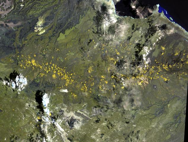

Geography and climate
The region forms the main Eritrean portion of the Danakil area, an arid landscape of coastal plains, salt flats and rocky desert. Much of the territory lies at low elevation and is subject to extreme heat and low rainfall. Geologically, the wider Danakil area is associated with rift-related volcanic and geothermal activity; on the regional scale this produces barren lava fields, isolated volcanic cones and areas of evaporite deposits near the shoreline.
Administrative divisions and population
Administratively the region is divided into subregions, commonly listed as Are'eta, Central Denkalya and Southern Denkalya. Settlements are sparse and concentrated near the coast and around Assab. The human population is relatively low density; traditional livelihoods and local cultures include Afar communities and other groups adapted to the harsh environment.
Economy and human activities
Economic activity centres on the port of Assab, fishing, and extraction of salt and other mineral resources from coastal flats. Agriculture is very limited and typically confined to small-scale, irrigated plots where groundwater allows. The maritime position gives the region strategic value for shipping and regional trade across the Red Sea.
Natural history and notable facts
Vegetation is sparse but includes halophytic (salt-tolerant) plants in flats and grasses in seasonal wadis. The adjacent Red Sea supports coral reefs and marine life important to local fisheries. The Southern Red Sea Region is also noteworthy for its connection to the broader Danakil Depression, among the hottest and geologically dynamic places on Earth.
For reference, the region's approximate central coordinates are given here: 13°45′N 41°30′E. The coastline and environmental conditions shape a distinctive zone within Eritrea, where desert landscapes meet a biologically productive sea. Additional administrative and geographic details are recorded in national and regional sources accessible through official portals and mapping services (Red Sea area).
- Major centre: Assab
- Major subregions: Are'eta, Central Denkalya, Southern Denkalya
- Key features: coastal plain, salt flats, Danakil desert environment
Questions and answers
Q: What is the Southern Red Sea Region?
A: The Southern Red Sea Region is a region of Eritrea.
Q: What is the capital city of the Southern Red Sea Region?
A: The capital city of the Southern Red Sea Region is Assab.
Q: What is the size of the Southern Red Sea Region along the Red Sea coast?
A: The Southern Red Sea Region extends over 500 km (310 mi) along Red Sea coast.
Q: What is the width of the Southern Red Sea Region?
A: The Southern Red Sea Region is only around 50 km (31 mi) wide.
Q: What kind of region is the major part of the Danakil Desert?
A: The Southern Red Sea Region is the major part of the Danakil Desert.
Q: What are the subregions of the Southern Red Sea Region?
A: The Southern Red Sea Region has the following subregions: Are'eta Subregion, Central Denkalya Subregion, and Southern Denkalya Subregion.
Q: What are the coordinates of the Southern Red Sea Region?
A: The coordinates of the Southern Red Sea Region are 13°45′N 41°30′E / 13.750°N 41.500°E / 13.750; 41.500.
Related articles
Author
AlegsaOnline.com Southern Red Sea Region (Eritrea) Leandro Alegsa
URL: https://en.alegsaonline.com/art/92316