San Gabriel Mountains
Mountain range north of Los Angeles separating the LA Basin from the Mojave; known for Mount San Antonio, diverse habitats, recreation, water supply and protected public lands.
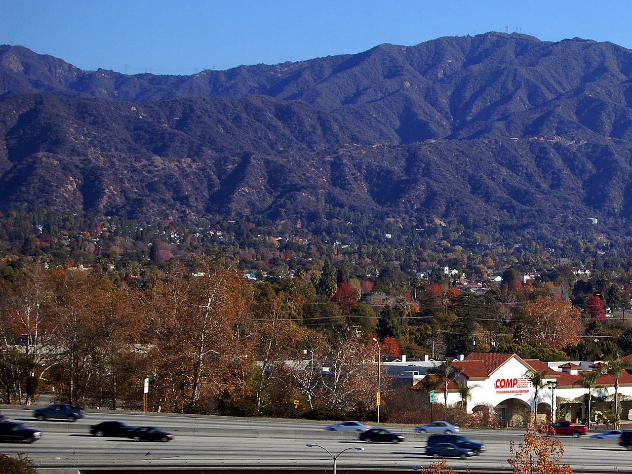
The San Gabriel Mountains are a rugged mountain range north of the Los Angeles Basin in southern California, United States. Rising abruptly from the coastal plain, the range forms a natural barrier that separates the Mediterranean coastal lowlands from the high desert to the north. The highest summit is Mount San Antonio (locally Mount Baldy), which reaches 10,064 feet (3,067 m).
Image gallery
10 Images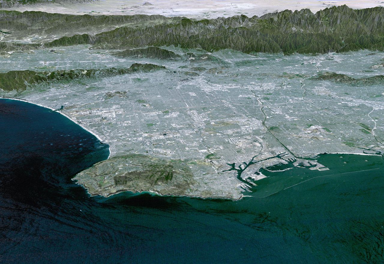


Geography and geology
The range is part of the Transverse Ranges and owes its steep relief to active tectonic uplift and faulting. The San Gabriel Mountains extend across both Los Angeles County and San Bernardino County. Steep canyons and narrow ridges are typical; glaciation during past ice ages and repeated episodes of uplift and erosion have shaped the present landscape.
Rivers, roads, and watersheds
Many of Southern California's streams begin in the San Gabriels. The range feeds important river systems, notably the San Gabriel River and the Los Angeles River, and supplies water to communities in the basin and the desert. These are among the major rivers whose headwaters and floodplains are influenced by mountain runoff. Access through the mountains is provided by several routes, most famously California State Route 2, the Angeles Crest Highway (Route 2), which traverses high country and connects multiple trailheads.
Ecology and climate
The climate ranges from warm, dry lowlands to cooler, wetter high slopes where winter snows are common. Vegetation zones include chaparral and coastal sage at lower elevations, oak woodlands on mid slopes, and mixed conifer stands near the highest peaks. Wildlife includes mule deer, coyotes, various birds of prey and smaller mammals typical of Southern California mountains. Large tracts of the range lie within the Angeles National Forest and the federally designated San Gabriel Mountains National Monument, areas managed for both conservation and recreation.
Human history and recreation
For millennia the region was used by Indigenous peoples such as the Tongva and Serrano. During the 19th and 20th centuries the mountains supported logging, mining, and watershed development as Los Angeles expanded. Today the San Gabriels are a major outdoor destination: hiking, rock climbing, mountain biking, camping, winter sports (near Mount San Antonio) and day trips to scenic overlooks are popular.
- Notable peaks: Mount San Antonio (Mount Baldy), Mount Wilson, San Gabriel Peak.
- Common activities: hiking, trail running, skiing/snowplay, observatory visits and wildlife viewing.
Despite its popularity the range faces natural hazards and management challenges: frequent wildfires, post-fire debris flows, erosion, and pressures from urban runoff and recreation. Ongoing conservation and watershed management aim to protect habitat, reduce hazard risks, and preserve the mountains' role as a critical natural resource for the Los Angeles region.
Related articles
Author
AlegsaOnline.com San Gabriel Mountains Leandro Alegsa
URL: https://en.alegsaonline.com/art/86828