
Pir Panjal Range
Mountain range of the Lesser Himalaya running ESE–WNW across parts of India and Pakistan; notable for its elevation, river divides, historic Mughal Road, and distinct ecology.
Overview
The Pir Panjal Range is a major chain within the Lesser Himalaya that stretches roughly east-southeast to west-northwest across northern South Asia. It forms the outermost main highland barrier before the higher Great Himalaya and acts as a prominent physiographic and climatic divide in the region. The range rises to heights typically between about 1,400 and 4,100 metres and includes extensive ridges, passes and valleys that influence river catchments and human movement.
Image gallery
3 Images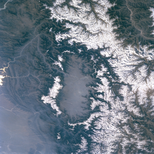


Location and geography
The range crosses several political and geographic units: the Indian state of Himachal Pradesh, the region commonly referred to as Jammu and Kashmir, and the territory known as Azad Kashmir on the Pakistani side; it is also described in local sources by its Kashmiri name. Viewed on maps and surveys referenced as part of the broader mountain system, the Pir Panjal forms a long, curving ridge that separates different river basins and provides the watershed between smaller tributaries.
On its southern slopes the range descends toward plains and lower hills, while toward the north it drops to the valley floors that feed major rivers. It helps divide the catchments of rivers such as the Beas and Ravi on one side and the Chenab on the other, and the slopes of the Pir Panjal feed many local streams and springs.
Physical characteristics and ecology
Elevations in the Pir Panjal vary considerably, with many ridgelines and passes falling in the subalpine to montane zone. Forests of pine, deodar and fir occur on the mid slopes, while higher altitudes support alpine meadows and seasonal pastures. Snow accumulation in winter and spring is important for sustaining downstream rivers through meltwater. The range is the largest component of the Lesser Himalaya in this part of the subcontinent, and it includes notable subranges such as the Galyat hills.
History, routes and human use
For centuries the Pir Panjal carried historic tracks and trade routes between the plains of northern India and the Kashmir Valley. The Mughal Road, still a recognized route and tourist corridor, crosses the range and links lowland areas with the Valley of Kashmir; the road follows or replaces older caravan tracks and several important passes. These connections made the range strategically significant for commerce, seasonal pastoralism and military movement.
- Major passes: several passes have long been used by local people and travellers; modern roads and tunnels supplement the older tracks.
- Water resources: snowmelt and springs support rivers and irrigation downstream; the range contributes to regional hydrology as recorded in elevation and climate summaries (elevation data).
Distinctive facts and contemporary importance
The Pir Panjal remains important for biodiversity, watershed services and regional transport. Its slopes sustain agriculture, timber resources and summer grazing, while scenic ridges and passes attract visitors. Because the range extends across administrative boundaries, it is also a feature in discussions of regional planning, conservation and cross-border connectivity. General descriptions and maps of the area are available in many geographic references and local studies (regional overview, administrative context, territorial descriptions, physical classification, river systems, local names).
Related articles
Author
AlegsaOnline.com Pir Panjal Range Leandro Alegsa
URL: https://en.alegsaonline.com/art/77063