Galyat — the mountain passes and hill stations of northern Pakistan
Galyat is a chain of wooded valleys and hill towns northeast of Islamabad, straddling Khyber Pakhtunkhwa and Punjab. It is known for pine forests, summer resorts, colonial‑era hill stations and scenic walking trails.
Overview
The Galyat (from the Urdu word gali, meaning a mountain alley) denotes a string of wooded valleys, passes and small towns roughly 50–80 km north‑east of Islamabad in Pakistan. Straddling the boundary between Khyber Pakhtunkhwa and Punjab, the area is characterised by narrow ridges, bowl‑shaped hollows and coniferous forests rather than very high peaks. The name Galyat is plural: many settlements include the word "gali" in their names, reflecting local topography.
Image gallery
2 Images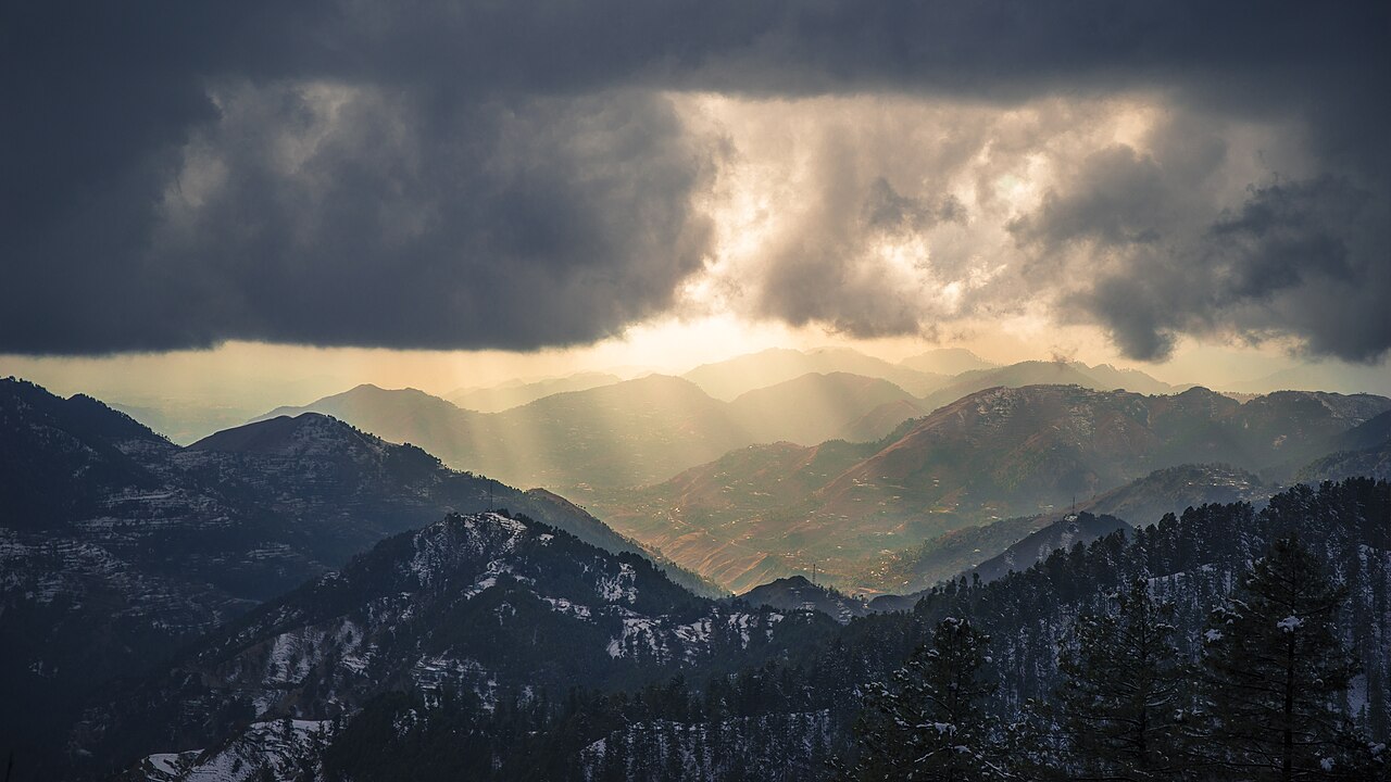

Etymology and place names
The term comes from Urdu usage for an alley or narrow pass between hills. Examples of place names include Nathia Gali, Dunga Gali and Changla Gali; these toponyms indicate the landscape form and often the location of a settlement on a ridge or saddle.
Geography and climate
Located on the lower foothills of the western Himalaya, the Galyat experiences cool summers and cold winters with occasional heavy snowfall at higher elevations. Vegetation typically includes pine, oak and mixed broadleaf stands. Moisture-bearing winds in the summer bring mist and rain, producing the region's characteristic lush, green appearance in the warm months.
Notable towns and settlements
- Nathia Gali — a popular viewpoint and base for short treks.
- Dunga Gali and Changla Gali — known for forest walks and picnic areas.
- Ayubia — frequented for family recreation and trails.
- Murree — the largest and most developed hill station in the broader Galyat area, with hotels, markets and transport links to the plains.
History and development
Many Galyat settlements expanded as summer retreats during the 19th and early 20th centuries when British administrators and military personnel sought cooler residences. Over time mule tracks and narrow roads were improved for motor vehicles and small tourist infrastructures, such as guesthouses and local markets, developed. After independence the towns continued to serve as domestic holiday destinations and have subsequently expanded commercial services.
Ecology and conservation
The local ecosystems support a variety of montane flora and fauna typical of western Himalayan lower montane zones. Increased visitation, seasonal construction and informal settlement growth have created conservation challenges including habitat fragmentation, pressure on water resources and waste management issues. Provincial authorities and local conservation groups have sought measures such as protected zones, regulated construction and trail maintenance to reduce environmental impacts.
Access, tourism and practical information
The Galyat is accessible by road from Islamabad and other nearby cities; public buses, private cars and tour operators serve the area. Travelers are advised to check road and weather conditions in winter when snow can close higher sections. Because the region lies at the interface of two provinces, administration and services are provided by both the Khyber Pakhtunkhwa and Punjab authorities; visitors may consult provincial tourism offices or local visitor centres for up‑to‑date advice.
Visitor tips and cultural notes
Respect for local customs and attention to conservation measures help maintain the Galyat's environment and hospitality. Accommodation ranges from small guesthouses to larger hotels in centres such as Murree. For language and toponym context, see local usage of Urdu place‑name elements. For official information and travel advisories consult regional tourism resources and provincial offices before planning a visit (national and provincial sources).
Questions and answers
Q: What is the Galyat region?
A: The Galyat region is an area located north-east of Islamabad, Pakistan, on both sides of the Khyber Pakhtunkhwa-Punjab border.
Q: What is the meaning of the word Galyat?
A: The word Galyat is the plural form of the Urdu word gali, which refers to an alley located between two mountains on both sides of which there are valleys, and it is not the highest point in the range.
Q: What is the significance of the word gali in the towns of the Galyat area?
A: Many of the towns in the Galyat area have the word gali as part of their names.
Q: What is the relevance of the Galyat area in Pakistan?
A: The Galyat area is a popular summer-holiday destination in Pakistan.
Q: Which town in the Galyat area is the largest?
A: Murree is the largest town in the Galyat area and one of the most popular hill stations of Pakistan.
Q: How far is the Galyat area from Islamabad?
A: The Galyat area is roughly 50-80 km north-east of Islamabad, Pakistan.
Q: In which province of Pakistan is the Galyat area located?
A: The Galyat area is located on both sides of the Khyber Pakhtunkhwa-Punjab border.
Related articles
Author
AlegsaOnline.com Galyat — the mountain passes and hill stations of northern Pakistan Leandro Alegsa
URL: https://en.alegsaonline.com/art/37352