Li River — geography, karst scenery, culture and tourism
The Li River (Li Jiang) in Guangxi, China, is noted for its dramatic karst peaks and scenic waterway. This article outlines its geography, landscape, cultural significance, tourism and conservation issues.
The Li River, known in Chinese as Li Jiang, flows through the prefecture-level city of Guilin, Guangxi in China. It is widely admired for the line of steep limestone karst hills, meandering channels and riverbanks that have inspired artists and poets for centuries. The river and its surrounding terrain are often presented as an archetypal image of southern Chinese landscape scenery.
Image gallery
10 Images


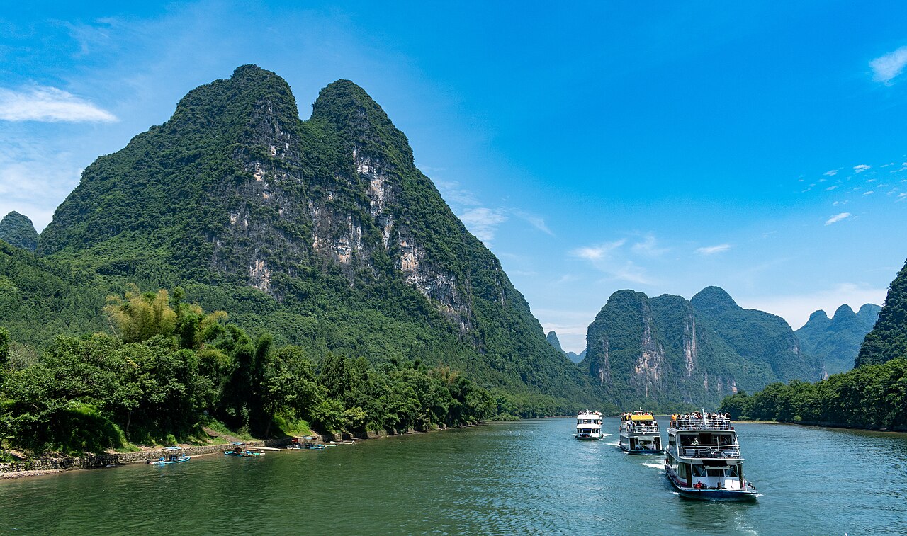

Geography and course
The Li River rises in the mountains of Guangxi province and runs through a sequence of towns and agricultural lowlands before joining larger waterways downstream. The most celebrated stretch is the midsection between Guilin and Yangshuo, where the river passes close to villages, rice paddies and dramatic karst formations. Navigation on parts of the river has long supported local transport and small-scale commerce.
Karst landscape and natural features
Karst topography along the Li River is characterized by steep, nearly vertical limestone peaks, caves and sinkholes formed by dissolution of soluble rock over geological time. Vegetation, terraces and occasional cliffs add to the visual contrast. These features produce distinctive reflections and silhouettes that change with weather, season and light.
History, culture and significance
The river and its scenery have a long presence in Chinese painting, poetry and folk tradition. Historically it has linked rural communities and served local industries such as fishing, small-scale irrigation and timber transport. Many local legends and cultural motifs reference particular peaks, pavilions or stretches of river.
Tourism, activities and conservation
The Li River is a major tourist draw: visitors commonly take river cruises, bamboo raft trips and photographic excursions, and explore nearby towns for cycling, rock climbing and markets. Popular activities include:
- Scenic river cruises between Guilin and Yangshuo
- Bamboo raft rides on quieter channels
- Hiking and cycling around rural terraces and viewpoints
Increased tourism and local development have raised conservation concerns. Authorities and communities have worked on measures such as regulated boat traffic, pollution control and protected-area planning to balance visitor use with habitat and cultural preservation.
Related articles
Author
AlegsaOnline.com Li River — geography, karst scenery, culture and tourism Leandro Alegsa
URL: https://en.alegsaonline.com/art/57682