Koekelare: municipality in West Flanders, Belgium
Koekelare is a small municipality in West Flanders, Belgium. This article covers its location, components, history, landscape, and local life, with basic demographic and geographic notes.

Koekelare is a rural municipality located in the northwestern part of Belgium, in the province of West Flanders. It lies at approximately 51°05′N, 2°58′E, placing it within the low, gently rolling agricultural landscape of Flanders. In 2007 the population was around 8,300 residents, and the community remains a small, Dutch-speaking (Flemish) local centre.

Image gallery
2 Images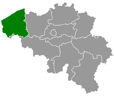

Geography and subdivisions
The municipality covers a modest area of farmland, villages and small hamlets. It comprises the central town of Koekelare and nearby villages such as Bovekerke and Zande, together forming a predominantly rural municipality with fields, hedgerows and pockets of forest. Its location places it within convenient distance of larger regional towns and the historic coastal plain of West Flanders.
History and heritage
Like much of West Flanders, the Koekelare area has a long rural history and was shaped by agriculture and local parish life. The region experienced significant upheaval during the First World War and the wider Yser salient campaigns, and traces of that era — cemeteries, memorials and preserved sites in the surrounding countryside — are part of the local historical landscape. The town itself grew around local churches and marketplaces typical of Flemish rural municipalities.
Economy, culture and services
The local economy is largely agricultural, supplemented by small businesses, local shops and commuting to nearby urban centres. Community life centers on parish and municipal events, local schools and cultural associations. The area attracts visitors interested in rural tourism, cycling routes and the nearby commemorative sites of the Western Front.
Practical information and points of interest
- Language: Dutch (Flemish) is the official language of administration.
- Coordinates: about 51°05′N, 02°58′E.
- Visitor interests: quiet countryside, local villages and access to World War I memorials in the wider region.
Koekelare is representative of many small Flemish municipalities: modest in size, rooted in agriculture and local traditions, and connected to broader historical currents that shaped West Flanders. For administrative details and services consult the municipal pages linked above.
Related articles
Author
AlegsaOnline.com Koekelare: municipality in West Flanders, Belgium Leandro Alegsa
URL: https://en.alegsaonline.com/art/54090
Sources
- statbel.fgov.be : Werkelijke bevolking per gemeente op 1 januari 2007 / Population de droit par commune au 1 janvier 2007 (.xls)
- statbel.fgov.be : Geografische coördinaten van de gemeenten (.xls)