Belgium: Kingdom, Regions, Languages, and Political Structure
Belgium is a small Western European kingdom known for its federal system, three language communities, Brussels as an international capital, and a rich cultural and economic mix shaped by its history and location.
Overview
Belgium, officially the Kingdom of Belgium, is a compact country in Western Europe that combines a dense population with a prominent international role. It covers roughly 30,600 square kilometres and has a population of around 11–12 million. The capital city is Brussels, which hosts major international institutions including the headquarters of the European Union and NATO. Belgium borders the Netherlands to the north, Germany to the east, Luxembourg to the southeast and France to the south.
Image gallery
10 Images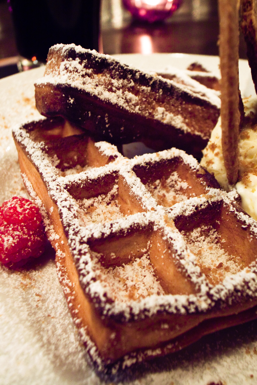


Regions, Languages and Identity
Belgium is a federal state organized to accommodate distinct linguistic and cultural communities. It comprises three main regions: Flanders in the north where Dutch (often called Flemish) predominates; Wallonia in the south where French is the dominant language; and the Brussels-Capital Region, a formally bilingual enclave that is surrounded by Flanders and where French is widely used alongside Dutch. A small German-speaking community exists along the eastern border, and the main languages are often referenced as Dutch, French and German.
Government and Political Structure
The country’s administrative architecture is intentionally complex to balance regional autonomy and national unity. Legislative and executive powers are divided among federal institutions, regional governments, and community councils that manage language, education and cultural affairs. That multilayered arrangement is part of Belgium’s broader system of government, developed through successive reforms to reduce tensions between linguistic groups while preserving shared institutions such as the monarchy and federal judiciary.
Historical Background
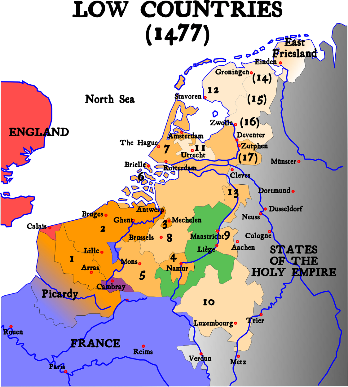
Belgium’s territory has been shaped by centuries of shifting rule: from medieval principalities and the Low Countries to Habsburg, Spanish and Austrian control, and later French and Dutch influence. The modern Belgian state emerged in the 19th century as a constitutional monarchy after breaking from a union with the Netherlands. Industrialization in the 19th and early 20th centuries, along with its strategic ports and crossroads location, cemented Belgium’s economic and political importance in Europe.
Economy, Culture and International Role
Today Belgium has a diversified, high-income economy with strong services and manufacturing sectors, important ports such as Antwerp, and a well-developed transport network. It is internationally notable for its role as a diplomatic and administrative hub: many international organizations and non-governmental actors base operations in Brussels, and Belgium participates actively in European and transatlantic institutions. Culturally the country is known for cuisine (chocolate, waffles, fries), beer traditions, and a lively comic-art heritage; these local specialities coexist with the everyday multilingualism of towns and cities.
Distinctive Features and Contemporary Issues
- Three-language reality: the coexistence of Dutch, French and German shapes public life, education and media.
- Regional autonomy: Flanders and Wallonia pursue distinct economic and social policies through their regional governments (Flanders, Wallonia), while the Brussels-Capital Region manages affairs in the national capital.
- International presence: hosting the European Union and NATO gives Belgium a diplomatic footprint far larger than its territory.
- Geography and neighbours: close ties and shared borders with the Netherlands, Germany, Luxembourg and France influence transport, commerce and cross-border communities.
For readers seeking further detail about administrative arrangements, language laws, or Brussels’s international institutions, each of these topics connects to a web of legal and historical developments that have shaped modern Belgium’s identity and public life.
Country name and overview
The name Belgium is based on the Roman province of Gallia Belgica. This northeastern part of Gaul was inhabited by tribes of Celtic (i.e. the Belgae) and Germanic (i.e. Germani cisrhēnani) origin. In the 18th century, the French adjective belge or belgique was considered the equivalent of Nederlands 'Dutch'; the short-lived independent Belgian State of 1790, for example, was called États belgiques unis in French and was usually called Verenigde Nederlandse Staten in Dutch. Later, the use of belge and belgique became increasingly restricted to the southern Netherlands, now Belgium.
From the High Middle Ages to the mid-17th century, Belgium was a hotbed of cultural and economic creativity and wealth. From the 16th century onwards, Belgium was the theatre of many battles fought by European powers, such as during the Coalition Wars and the First and Second World Wars. Belgium participated intensively in the Industrial Revolution and from 1885 to 1960 possessed the huge colony of the Belgian Congo in Central Africa, since the First World War including the adjacent territory of Rwanda-Urundi.
Geography
Geology and geomorphology
In the wake of the post-glacial Flandrian transgression, beach walls were formed, which are still present today as a closed belt of dunes up to 50 metres high along the Belgian coast. This is followed by a zone of marshland about 10 to 20 kilometres wide.
Further inland lies the so-called Flussgeest. Here the deposits of the Maas alluvial fan were covered with sands of great thickness during the last cold period. In the slightly undulating countryside, fields and meadows alternate with patches of woodland and heathland; upland moors also occur in places. To the west of an Antwerp-Brussels line is the wide Flanders plain. In its northern part it is also covered by sands, in the south clay soils dominate, which are more favourable for agriculture. Here the plain is overlooked by a loose chain of Tertiary hills. Towards the west, the plain already mediates with the Northern French stratified plain, which is largely composed of Mesozoic sediments.
The valleys of the Sambre and Meuse rivers form a sharp boundary on a tectonic fault zone separating the Tertiary and Cretaceous plateaus in the northwest from the Ardennes as part of the Rhenish Slate Mountains in the southeast. The heavily forested Ardennes are composed of variably recalcitrant Palaeozoic shales, sandstones, greywackes and quartzites. They reach a height of 694 metres in Belgium with the Botrange in the Hautes Fagnes.
The fault zone of the Haine-Sambre-Meuse furrow is rich in coal deposits. This is where the first continental European mining and heavy industry district developed from 1830 onwards.
Flanders and Brussels-Capital Region
Flanders forms the northern part of the country and consists largely of flat land. It is the most populous region of the country. The politically independent capital region of Brussels is located as an enclave within the Flemish region. This part of the country consists partly of sandy geest ridges - for example in the province of Limburg, which is located in the east of the Flemish Region. However, the Geest is also interrupted by marshlands, which particularly affects the area around the rivers. The most important of these are the Meuse and the Scheldt. In the far west of Flanders is the 65 kilometre long coastline with the port city of Ostend. Especially the provinces of Antwerp and Flemish Brabant with the surrounding area of Brussels are very densely populated.
Walloon Region
The Walloon Region covers the southern part of Belgium. It is the largest region of the country in terms of area. Its territory is mountainous and sparsely populated in the area of the Ardennes and is cut by the river valleys of the Meuse, Sambre and Ourthe. The main cities of the region are located along these rivers, in particular Liège, Namur and Charleroi. Mons, Mouscron and Tournai are also located in the west of the region, in a cross-border conurbation with the northern French city of Lille. Nil-Saint-Vincent (municipality of Walhain) in the densely populated province of Walloon Brabant is the geographical centre of Belgium. The highest elevation in the country is Signal de Botrange (694 m E.P. ) in the Hautes Fagnes in eastern Belgium near the border with Germany. The highest village in Belgium is Mürringen in eastern Belgium (655 m asl).
Numbers
|
|

25% of Belgium's land area is used for agriculture. About 95% of all Belgians live in cities. According to the calculations of the Royal Belgian Institute of Natural Sciences, Belgium has an area of 30,688 km².
Of which includes
- the Brussels-Capital Region 162 km²
- the region of Flanders 13,624 km²
- the Walloon Region 16,901 km² (including the German-speaking Community 854 km²)
Waters
Among others, there are the following rivers and canals:
|
|

Questions and answers
Q: What is the official name of Belgium?
A: The official name of Belgium is the Kingdom of Belgium.
Q: What are the countries that border Belgium?
A: The countries that border Belgium are The Netherlands in the north, Germany to the east, Luxembourg to the southeast and France to the south.
Q: How many people live in Belgium?
A: Around 11.6 million people live in Belgium.
Q: What organizations are based in Brussels, which is the capital city of Belgium?
A: The European Union, NATO and other famous organizations are based in Brussels, which is the capital city of Belgium.
Q: What are the three regions of Belgium?
A: The three regions of Belgium are Flanders (in northern half), Wallonia (in southern half) and Brussels-Capital Region (where capital city Brussels is found).
Q: What languages do people speak in each region?
A: In Flanders most people speak Dutch; In Wallonia most people speak French; In Brussels-Capital Region French is mostly spoken with some Dutch; And there's a small part of Wallonia next to Germany where people speak German.
Q: How does Belgian government look after all these groups speaking different languages?
A:Belgium has a complicated system of government to look after all these groups speaking different languages.
Related articles
Author
AlegsaOnline.com Belgium: Kingdom, Regions, Languages, and Political Structure Leandro Alegsa
URL: https://en.alegsaonline.com/art/10235
Sources
- cia.gov : "Government type: Belgium"
- ibz.rrn.fgov.be : "Bevolkingscijfers per provincie en per gemeente op 1 januari 2017/Chiffres de la population par province et par commune, a la date du 1er Janvier 2017"
- imf.org : "Belgium"
- appsso.eurostat.ec.europa.eu : "Gini coefficient of equivalised disposable income (source: SILC)"
- hdr.undp.org : "Human Development Report 2015"
- const-court.be : The Belgian Constitution
- authorama.com : "Chapter I: The Burgundian Netherlands"
- socrel.oxfordjournals.org : "From Pillar to Postmodernity: The Changing Situation of Religion in Belgium"
- belgium.be : "National Day and feast days of Communities and Regions"
- bbc.co.uk : "The Congolese Civil War 1960–1964"
- eda.europa.eu : "Defence Data Portal"
- plantaardigheden.nl : "Rembert Dodoens: iets over zijn leven en werk—Dodoens' werken"
- www-groups.dcs.st-andrews.ac.uk : "Simon Stevin"
- content.karger.com : "Abstract (*)"
- catholiceducation.org : "'A Day Without Yesterday': Georges Lemaitre & the Big Bang"