
Ismayilli District — geography, history, economy and culture
Ismayilli District in northern Azerbaijan is a mountainous, forested region centered on the city of Ismayilli, known for agriculture, crafts, mountain villages and growing rural tourism within Mountainous Shirvan.
Overview
Ismayilli District is an administrative district in northern Azerbaijan with its administrative centre in the city of Ismayilli. In Azerbaijani the district is called İsmayıllı rayonu. It lies within the Mountainous Shirvan area and combines mountain terrain, woodland and river valleys with cultivated lowlands. The district is one of the country's 66 administrative districts and forms part of the Mountainous Shirvan Economic Region.
Image gallery
4 Images


Location and geography
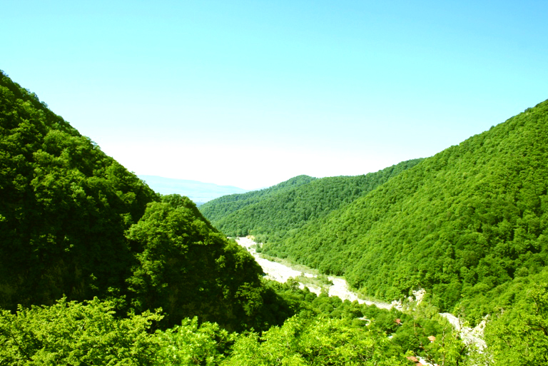
Ismayilli occupies foothills of the Greater Caucasus and includes a range of elevations, from lower agricultural plains to steep forested slopes. The landscape is marked by mixed forests, pastures and narrow mountain valleys that support small-scale farming and grazing. It shares administrative borders with several neighbouring districts, among them Qabala, Quba, Goychay, Kurdamir, Agsu and Shamakhi.
History and name
The territory of present-day Ismayilli has long been connected to the historical and cultural region of Shirvan in the eastern Caucasus. Administrative arrangements changed through imperial, Soviet and post-Soviet periods, shaping current district borders and local governance. Local tradition holds that the district name commemorates a respected elder and philanthropist, Ismayil Baghiyev; this explanation is widespread in municipal accounts though local records vary.
Population and administration
As of 2020 the district's population was reported at about 87,400. The administrative structure centres on the city of Ismayilli and includes numerous small towns and villages. Municipal authorities are responsible for basic services, education, rural development and maintenance of local roads and utilities. Detailed administrative listings and statistical summaries are available in national district overviews and official district listings.
Economy and infrastructure
The local economy is largely rural and diversified across agriculture, animal husbandry, forestry and small manufacturing. Orchards, field crops and livestock are important for household incomes, while timber and forest products have local significance. Traditional crafts, particularly in historic mountain settlements, contribute to cultural tourism and artisanal trade. Infrastructure is a mix of regional roads linking villages to Ismayilli city and to neighbouring districts; transport links support market access but remain less developed than in major urban centres.
Culture, notable settlements and tourism
Ismayilli is known for mountain villages with distinctive handicrafts and stone architecture. One well-known example is the mountain settlement of Lahij, celebrated for its metalworking and craft traditions; such places attract visitors interested in traditional crafts, local cuisine and hiking. The district's natural scenery—wooded slopes, river valleys and mountain trails—supports growing rural and eco-tourism. Local festivals, markets and seasonal agricultural activities reflect the region's cultural rhythms and provide opportunities for visitors to experience local life.
Conservation of forests and promotion of sustainable tourism are recurring topics in regional planning. For administrative context and further reading consult the economic region profile (Mountainous Shirvan) and national district listings, alongside municipal information from the city of Ismayilli and neighbouring districts such as Qabala, Goychay, Kurdamir, Agsu and Shamakhi.
Related articles
Author
AlegsaOnline.com Ismayilli District — geography, history, economy and culture Leandro Alegsa
URL: https://en.alegsaonline.com/art/48462