
Floodplain: lands shaped by rivers and seasonal flooding
A floodplain is the flat land adjacent to a river that periodically floods. It supports fertile soils, diverse ecosystems, and poses both benefits and risks for agriculture, settlements, and flood management.
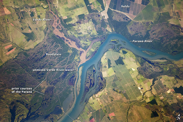
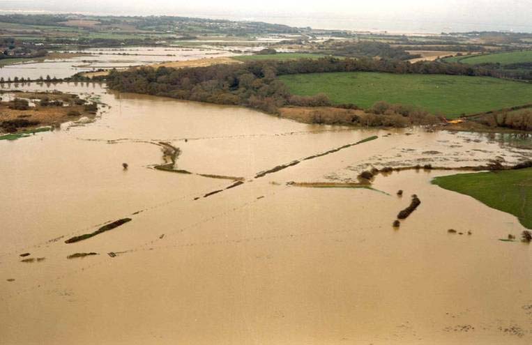
A floodplain is the relatively flat or gently sloping area beside a river or stream that becomes inundated when water levels rise. Floodplains form where flowing water deposits silt, sand and organic material during overbank flows. The repeated addition of this alluvium produces fertile soils, distinct landforms such as natural levees and oxbow lakes, and a landscape that differs from the higher, non-flooded terraces nearby.
Image gallery
9 Images




Formation and characteristic features
Floodplains develop through the interaction of hydraulic forces and sediment supply. During floods, currents slow as they spill out of a channel, dropping heavier particles near the bank and finer particles farther away. Over time this creates layered soils and subtle topographic variation. Typical features include natural levees built by successive deposits on the channel rim, backswamps or marshy low spots, meander scars and abandoned channels, and floodplain wetlands that act as temporary storage for floodwaters.
Ecological and economic importance
Floodplains host rich plant and animal communities adapted to cycles of wetting and drying. Their nutrient-rich soils make them valuable for agriculture, and many human settlements historically locate on floodplains for access to water and fertile land. Floodplains also provide ecosystem services: they absorb and slow floodwaters, recharge groundwater, filter sediments and nutrients, and support fisheries and wildlife habitat.
Human modification and flood management
To protect property and increase arable area, people have altered floodplains by building structures such as levees, drainage channels, and floodways. A raised embankment along a river is often called a levee, and such structures can be natural or engineered. While levees and dams reduce the frequency of flooding locally, they can transfer risk downstream or encourage development in areas that remain at risk from extreme events.
Risks, restoration, and planning
Living or farming on floodplains involves trade-offs: high productivity and access to water versus exposure to flood hazards. Climate variability and land-use change can increase flood frequency or magnitude in some regions. Contemporary planning emphasizes a mix of strategies — zoning, set-back levees, floodplain restoration, and the preservation of wetlands — to lower risk while maintaining ecological functions.
Notable distinctions and examples
- Floodplain vs. floodway: a floodway is usually the channel and immediate area required to convey high flows; the floodplain is the broader inundation zone.
- Floodplain vs. riparian zone: riparian refers more narrowly to the interface between land and a river, including vegetation and bank processes.
- Examples: extensive river systems worldwide have broad floodplains that shaped civilizations, agriculture and transport along their lengths.
Understanding floodplains requires integrating hydrology, geomorphology, ecology and human geography. Effective stewardship balances the benefits these lands provide with policies and practices that reduce hazard and conserve natural functions.
Related articles
Author
AlegsaOnline.com Floodplain: lands shaped by rivers and seasonal flooding Leandro Alegsa
URL: https://en.alegsaonline.com/art/35161