
Edirne: Gateway of Thrace — history, culture and landmarks
Edirne is a northwestern Turkish city near Greece and Bulgaria, once the Ottoman capital. This article outlines its geography, history, architecture, festivals and transport links.
Overview
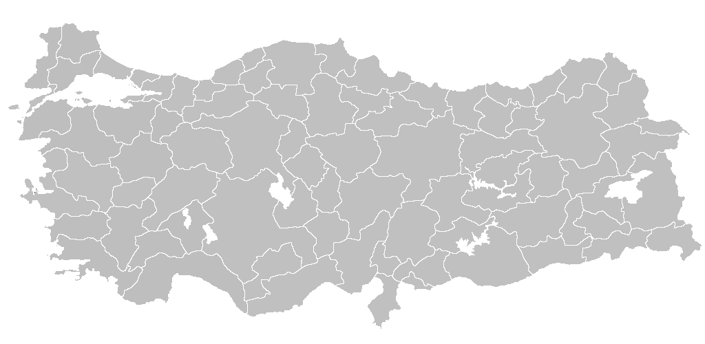
Edirne (historically Adrianople) sits in the European part of Turkey, in the province of Edirne, close to the borders with Greece and Bulgaria. The city is part of the Thrace region and has long been a crossroads of cultures and trade. In different languages its name reflects this layered past: in Greek it is known as Adrianoúpolis, and in Bulgarian as Odrin. Modern Edirne has a population of roughly 185,000 (late 2010s), composed of people with diverse Thracian and Anatolian roots, including Turkish, Pomak, Crimean Tatar and Romani communities.
Image gallery
10 Images




Historical development
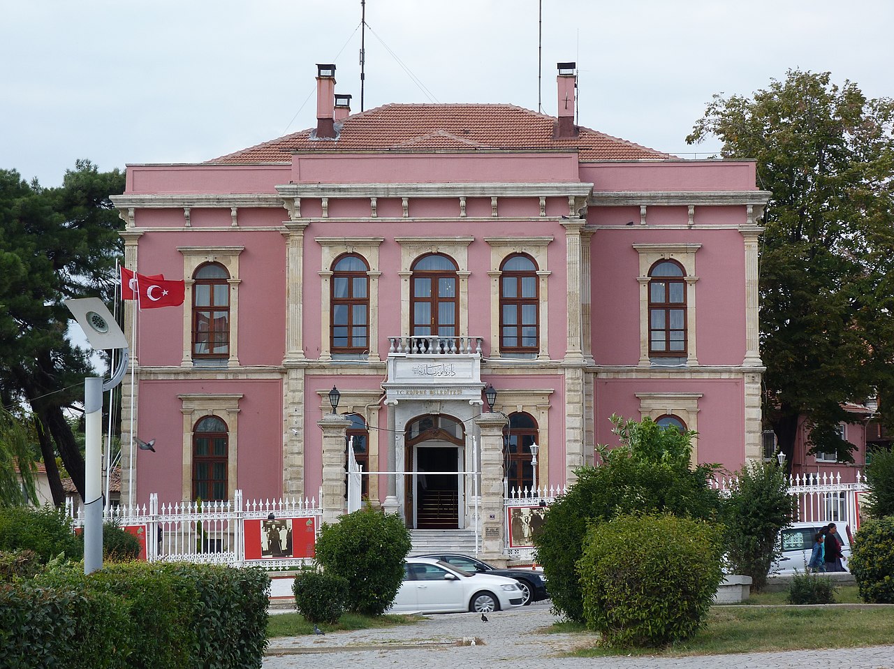
The site of Edirne has been inhabited since antiquity because of its strategic position on the routes between Europe and Asia. It became prominent under the Roman and Byzantine eras and was renamed Adrianople after the Roman emperor Hadrian. From the mid-14th century until the conquest of Constantinople, Edirne served as the capital of the Ottoman Empire (approximately 1361–1453). As an imperial centre it attracted monumental architecture, educational institutions and administrative functions; many surviving buildings reflect that period.
Culture, communities and festivals
Edirne's cultural life is shaped by its Thracian location and multiethnic population. Traditional crafts, regional cuisine and seasonal markets persist alongside modern industries. Two well-known cultural events draw national and international attention: the annual Kırkpınar oil-wrestling tournament, a traditional form of wrestling held near Edirne since the Ottoman era and inscribed on UNESCO's list of intangible cultural heritage; and local Romani celebrations such as the Kakava festival, which commemorate community legends like Baba Fingo. The city is also home to mosques, churches and synagogues that attest to its plural past.
Notable landmarks and architecture
- Selimiye Mosque – Designed by the imperial architect Mimar Sinan, this 16th-century mosque is regarded as a masterpiece of Ottoman architecture.
- Eski Camii (Old Mosque) – A large medieval mosque with distinctive stonework and tile decoration.
- Bridges and rivers – The city lies at the confluence of the Meriç (Maritsa) and Tunca (Tundzha) rivers, with several historic bridges spanning their courses.
- Palace remains and bazaars – Remnants of former palaces, caravanserais and historic market streets recall Edirne's role as an administrative and commercial centre.
Transport and regional importance
Edirne occupies a strategic transportation node in the western Balkans and eastern Mediterranean. It lies on the historic Istanbul–Pythio railway that connects Istanbul and Sofia, and border agreements in the early 20th century—most notably the Treaty of Lausanne—helped define the international lines of communication in the area. For a period, some rail services required brief passages through neighbouring territory until routes were adjusted in the mid-20th century. Today Edirne's economy blends agriculture (Turanian plain crops), cross-border trade, light industry and tourism focused on its monuments and festivals.
Significance and distinctions
Because it functioned as a capital before Constantinople/Istanbul and because of its preserved Ottoman monuments, Edirne is frequently studied by historians and visited by cultural tourists. Its festivals and living traditions keep regional customs visible, while its geography continues to make it an important meeting point between Turkey and the Balkans. For further reading on local history, architecture and cultural events consult regional guides and academic studies (see local archives and museum resources for primary material).
References and links within this article point to brief identifiers rather than external websites: see provincial context, names in Greek and Bulgarian, population and community notes related to Thracians, and transport connections between Istanbul and Sofia. Political and diplomatic background is indicated by the Treaty of Lausanne, and the city's imperial past by its role in the Ottoman Empire.
Geography
Location
Edirne is located about 220 km west of Istanbul near the border triangle of Bulgaria, Greece and Turkey on the north bank of the Turkish-Bulgarian-Greek border river Meriç (Greek Evros, Bulgarian Mariza). The tributary Tunca (Greek Tonzos, Bulgarian Tundscha) reaches Edirne from the north, encompasses the western half of the city centre in a large arc with its wide flood bed, and flows into the Meriç Nehri south of the centre. The city has therefore hardly expanded to the west, but mainly to the southeast. The city lies in the fertile Thracian lowlands.
County
The central county (Merkez) of Edirne borders Lalapaşa County to the northeast, Süloğlu and Havsa Counties to the east, and Uzunköprü County to the south. The county shares a border with Bulgaria to the north and Greece to the west.
With an area of 844 km² it ranks third in the province, it is the most populous county with 180,901 inhabitants and with 214 inhabitants per square kilometre it also has the highest population density (provincial average: 66 inhabitants per km²). In addition to the county seat, the county consists of 37 villages (Köy) with an average of 330 inhabitants. Tayakadın, with 1537 inhabitants, is both the most populous and the only village with more than 1000 inhabitants.
Climate
| Edirne (51 m) | ||||||||||||||||||||||||||||||||||||||||||||||||
| Climate diagram | ||||||||||||||||||||||||||||||||||||||||||||||||
| ||||||||||||||||||||||||||||||||||||||||||||||||
| Monthly average temperatures and precipitation for Edirne (51 m)
Source: MGM, normal period 1991-2020; wetterkontor.de (humidity) | |||||||||||||||||||||||||||||||||||||||||||||||||||||||||||||||||||||||||||||||||||||||||||||||||||||||||||||||||||||||||||||||||||||||||||||||||||||||||||||||||||||||||||||||||||||||||||||||||||||||||||||||||||||||||||||||||||||||||||||||||||||||||||||||||||||||||||
Population
Population development
As a result of the constant changes of rulers, the population of the city is composed of Turks, Greeks, Armenians, Israelites, Jews and smaller nationalities. - The following table shows the comparative year-end population figures for the province, the central county and the city of Edirne, as well as their respective shares in the higher administrative level. The figures refer to the address-based population register (ADNKS) introduced in 2007.
| Year | Province | County | City | ||
| real | % | real | % | real | |
| 2020 | 407.763 | 44,36 | 180.901 | 93,24 | 168.680 |
| 2019 | 413.903 | 44,80 | 185.408 | 93,20 | 172.802 |
| 2018 | 411.528 | 43,82 | 180.327 | 92,86 | 167.443 |
| 2017 | 406.855 | 43,97 | 178.910 | 93,06 | 166.494 |
| 2016 | 401.701 | 43,08 | 173.037 | 92,60 | 160.233 |
| 2015 | 402.537 | 42,58 | 171.386 | 92,40 | 158.369 |
| 2014 | 400.280 | 41,47 | 165.979 | 91,96 | 152.628 |
| 2013 | 398.582 | 41,16 | 164.048 | 91,60 | 150.260 |
| 2012 | 399.708 | 40,57 | 162.161 | 91,56 | 148.474 |
| 2011 | 399.316 | 39,80 | 158.929 | 90,94 | 144.531 |
| 2010 | 390.428 | 39,19 | 152.993 | 90,72 | 138.793 |
| 2009 | 395.463 | 39,49 | 156.155 | 90,66 | 141.570 |
| 2008 | 394.644 | 38,82 | 153.199 | 90,22 | 138.222 |
| 2007 | 396.462 | 38,02 | 150.717 | 90,28 | 136.070 |
Related articles
Author
AlegsaOnline.com Edirne: Gateway of Thrace — history, culture and landmarks Leandro Alegsa
URL: https://en.alegsaonline.com/art/30144