
Djibouti (city) — capital and principal port of the Republic of Djibouti
Djibouti is the capital and largest city of the Republic of Djibouti, a strategic port on a peninsula between the Gulf of Aden and the Gulf of Tadjoura with a lively market, seaside districts, and important transport links.
Djibouti is the national capital and largest urban centre of the Republic of Djibouti. Situated on a rocky peninsula at the meeting of two waterways, the city occupies a strategic position between the Gulf of Aden and the Gulf of Tadjoura. Its harbour and proximity to major shipping lanes have shaped the city's economy and role in regional trade. The municipality is home to roughly around 400,000 residents, making it by far the country's most populous settlement.
Image gallery
10 Images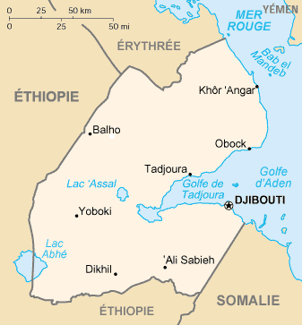


Geography and climate
The urban area of Djibouti extends along the headland and into adjacent low hills and coastal plains. The shoreline includes rocky coves and small sandy bays, and city neighbourhoods often open directly onto the water. The climate is arid and hot, with brief, infrequent rains; coastal breezes moderate daytime temperatures compared with the hotter interior.
History and development
Djibouti’s modern development accelerated during the colonial era when French administrators established a port and administrative centre. After independence, the city remained the political and economic heart of the young nation, hosting government institutions and foreign missions. Growth has been linked to its role as a regional entrepôt and to infrastructure projects connecting Djibouti with neighbouring countries.
Landmarks and culture
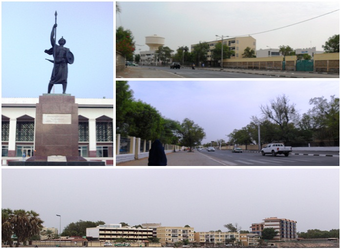
The city combines commercial districts, government quarters and coastal leisure zones. Notable sites include the bustling Central Market, waterfront promenades and local mosques. Recreational beaches and seafood restaurants draw residents and visitors. Sports and civic events take place at Stade du Ville, while the Presidential Palace and other official buildings mark the administrative core.
- Beaches and coastal walkways for swimming and fishing
- Historic districts with colonial-era architecture
- Markets, cafés and neighbourhood shops that reflect a mix of Somali, Afar and Arab influences
Transport and economy
Djibouti functions as a major port for landlocked Ethiopia and a hub for regional trade. The city is served by Djibouti–Ambouli International Airport and by rail and road links. The metre-gauge and newer standard-gauge lines historically and currently link Djibouti to Addis Ababa and inland Ethiopia, facilitating freight movement. Local commerce, port services, logistics and government employment dominate the urban economy.
Visitors encounter a compact capital with functional services, a lively market culture and clear maritime character. For more detailed maps and municipal services consult official sources and travel references. For introductions to local history and modern development see general overviews of the city of Djibouti and national context.
Practical information: Djibouti’s port and airport make it an entry point for the region; transport connections and coastal attractions are highlights for many travellers and traders alike.


City breakdown
The city consists of three communes, which are further divided into six arrondissements. The arrondissements in turn consist of quartiers.
- Ras-Dika
- Sixth arrondissement (Arrondissement du Plateau or Plateau-Marabout-Héron) (Plateau, Marabout, Héron, Serpent, Paid)
- Boulaos
- First arrondissement (quartiers 1, 2, 3 and 4)
- Second arrondissement (quartiers 5, 6, 7, 7 bis, Arhiba and Stade)
- Third arrondissement (Ambouli)
- Hayableh
- Fourth arrondissement (quartiers PK20, Balbala 04 and PK12)
- Fifth arrondissement (quartiers Balabala 05, Hablayeh and Doraleh)
The third commune, located to the west, appears in a more recent (2013) publication under the name Balbala. Balbala was formerly a refugee camp.
The sixth arrondissement (Arrondissement du Plateau), which was created in 2003 and coincides with the commune of Ras-Dika, also includes the Îles Moucha.
Climate
| Djibouti | ||||||||||||||||||||||||||||||||||||||||||||||||
| Climate diagram | ||||||||||||||||||||||||||||||||||||||||||||||||
| ||||||||||||||||||||||||||||||||||||||||||||||||
| Monthly average temperatures and precipitation for Djibouti
Source: wetterkontor.de | ||||||||||||||||||||||||||||||||||||||||||||||||||||||||||||||||||||||||||||||||||||||||||||||||||||||||||||||||||||||||||||||||||||||||||||||||||||||||||||||||||||||||||||||||||||||||||||||||||||||||||||||||||||||||||||||||||||||||||||||||||||||||||||||||||||||||||||||||||||||||||
Author
AlegsaOnline.com Djibouti (city) — capital and principal port of the Republic of Djibouti Leandro Alegsa
URL: https://en.alegsaonline.com/art/28041