
Western Victorian Volcanic Plains (Newer Volcanic Province)
Extensive basalt plains in western Victoria, Australia, formed by monogenetic volcanism over the last 6 million years; notable for fertile soils, many small volcanoes, Indigenous links and scientific interest.
The Western Victorian Volcanic Plains, commonly called the Newer Volcanic Province, are a broad expanse of basaltic lava fields in western Victoria, Australia. Covering roughly 2.3 million hectares—more than 10% of the state—the plains are one of the largest volcanic provinces of its kind. Their scale is often compared with other major lava plains such as the Deccan Plateau in India and the Snake River Plain in the United States, although each of these regions has a different geological history and character.
Image gallery
6 Images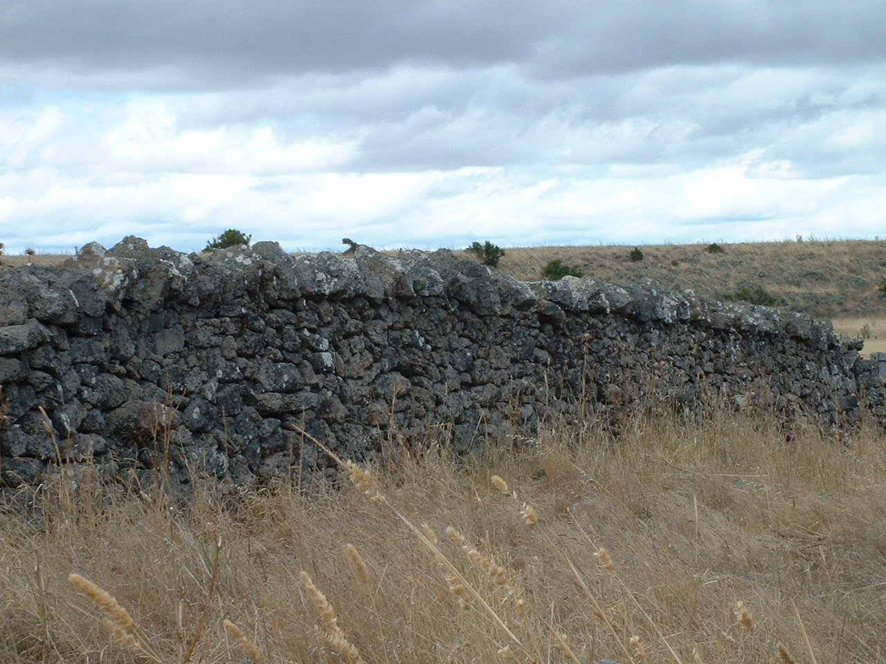


Geology and formation
The plains were built by many relatively small, basaltic eruptions that began about six million years ago and continued episodically into the late Holocene. Most vents on the plains produced short-lived, fluid lava flows and simple volcanic cones—a style of activity described as largely monogenetic, where each volcano typically erupts only once. More than 400 volcanic sites have been mapped across the region. These repeated flows accumulated to form a generally flat landscape with a typical lava thickness on the order of tens of metres; averaged values cited for parts of the province are around 60 metres of basalt cover, though local depths vary widely.
Landscape, water and vegetation
The basalt plain is characteristically flat or gently undulating, punctuated by discrete volcanic features such as scoria cones, maar craters, small lava fields and isolated basalt-capped rises. Surface drainage is limited: only a handful of rivers traverse the plains and their courses are important for local ecology and agriculture. Notable watercourses include the Barwon, Hopkins, Leigh, Maribyrnong, Wannon and Werribee Rivers and tributaries such as Mount Emu Creek. Much of the original native vegetation has been cleared—over 90% of the area is used for agriculture—so remnant grasslands and wetlands remain conservation priorities.
Human history and use
Indigenous peoples of the region observed and incorporated volcanic phenomena into oral histories; archaeological finds such as stone tools discovered beneath volcanic ash near Warrnambool indicate human presence at times close to some eruptions. European explorers and settlers also recorded the volcanic landscape. In 1836, Major Thomas Mitchell climbed Mount Napier and remarked on the recent appearance of volcanic activity. The soils derived from weathered basalt are typically fertile and attracted pastoralists and cereal growers; basalt blocks were also used in early dry-stone walls and buildings.
Recent activity, monitoring and scientific interest
The most recent well-dated eruption on the plains occurred at Mount Napier about 7,200 years ago. Since then the region has shown no clear signs of continuing activity: there are no widespread hot springs or active fumaroles and recorded seismicity over human timescales has been minimal (no notable contemporary earthquakes linked to volcanic unrest
Nevertheless, volcanologists debate whether the province should be considered strictly extinct or merely dormant. Because the volcanic field was active in geological recent times, many researchers treat it as potentially dormant and continue to study its history, eruption rates and underlying mantle processes that produced the long-lived sequence of basaltic eruptions. This question—whether future eruptions might occur—has practical implications for hazard assessment, land use planning and the conservation of geological and cultural heritage (dormant vs extinct).
- Area: ~2.3 million hectares, >10% of Victoria.
- Volcanic sites: >400 vents including cones, maar craters and lava flows.
- Age span: from ~6 million years ago to the late Holocene (last large flows ~7,200 years ago).
- Land use: predominantly agriculture; remnants of native grassland and wetlands are conservation priorities.
The Western Victorian Volcanic Plains combine geological interest, cultural history and practical importance for agriculture. Their numerous, relatively young volcanic landforms make the area a key location for studying monogenetic volcanic fields and for understanding how landscapes shaped by basaltic eruptions influence ecosystems and human use over millennia.
Related articles
Author
AlegsaOnline.com Western Victorian Volcanic Plains (Newer Volcanic Province) Leandro Alegsa
URL: https://en.alegsaonline.com/art/107542
Sources
- dpi.vic.gov.au : "6.1 Volcanic plains"
- home.iprimus.com.au : "Romsey Australia: Volcanic eruption risk and maps"
- dse.vic.gov.au : "Eruption Points of the Newer Volcanic Province"
- vhd.heritage.vic.gov.au : "The Stony Rises"
- seismicity.see.uwa.edu.au : "Seismicity of Western Australia - Volcanoes & Earthquakes in south-eastern Australia"