Earthquake: causes, effects, detection, and societal responses
An earthquake is the sudden release of energy in Earth's crust that produces seismic waves. This article explains causes, measurements, wave types, hazards such as tsunamis and landslides, and risk reduction.
Overview
An earthquake is the abrupt shaking of the ground produced when stress accumulated in Earth’s crust is released. That release radiates energy as seismic waves that travel through and across the surface. The initial point of rupture deep inside the ground is called the hypocenter or focus (hypocenter), and the location on the surface directly above it is called the epicenter (epicenter). Small earthquakes happen every day worldwide; only a few reach sizes that cause major damage or loss of life.
Image gallery
10 Images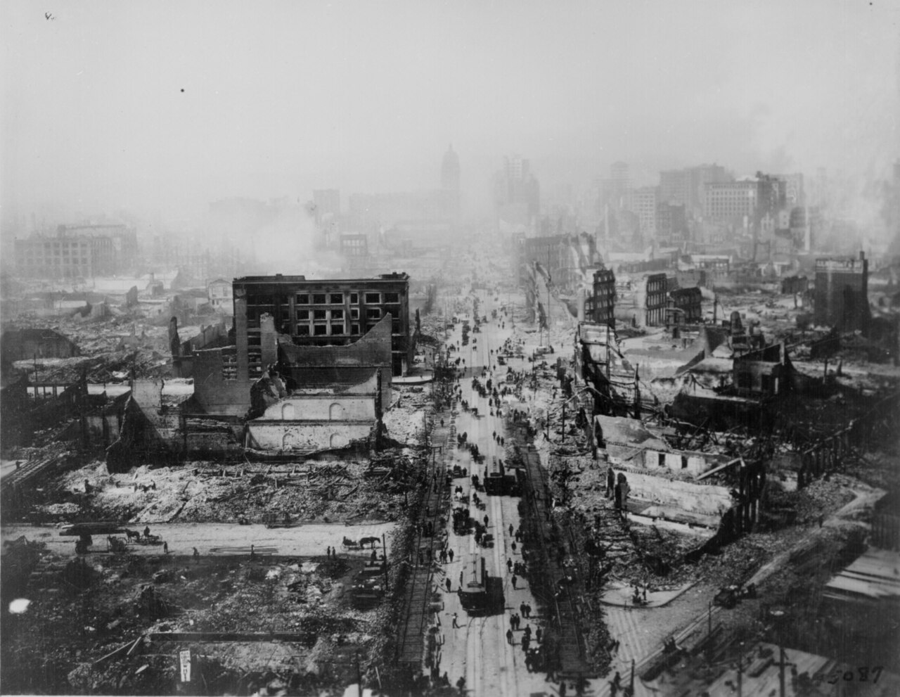


Causes and seismic waves
Most earthquakes are associated with the motion of tectonic plates. Plates slide, collide, or move past one another along faults; when friction temporarily locks a segment of a fault, strain builds until it is released in a sudden slip. That slip generates different types of seismic waves: compressional P-waves, shear S-waves, and slower surface waves that usually do the most damage. Seismology (seismology) is the scientific study of these waves, their sources, and what they reveal about Earth’s interior.
Detection and measurement
Ground motions are recorded by instruments called seismometers or seismographs (seismometer), which allow scientists to determine an event’s location, depth, and timing. Earthquake size is described in two different ways: magnitude and intensity. Magnitude expresses the energy released by an event; traditional local magnitude scales such as the Richter scale (Richter scale) are now largely superseded by the moment magnitude scale (Mw) for large earthquakes. Intensity measures the strength of shaking and its effects at particular places, commonly expressed with the Modified Mercalli Intensity scale. A large historic quake reached magnitude 9.5 in Chile in 1960, the largest instrumentally recorded event.
Hazards and effects
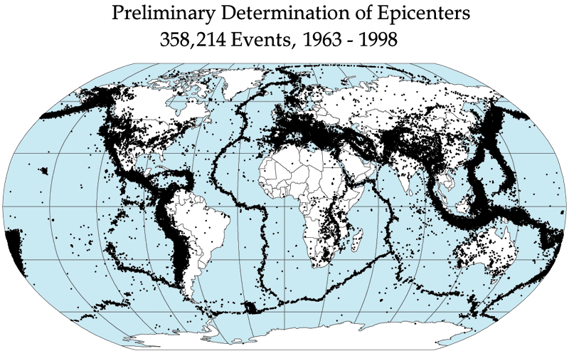
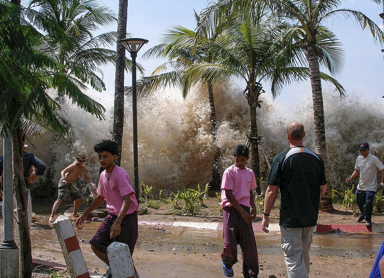
Direct effects of earthquakes include ground rupture, severe shaking, and secondary hazards. Shaking frequently triggers landslides (landslides) on slopes or causes liquefaction in water-saturated sediments. Underwater earthquakes can displace large volumes of water and generate tsunamis (tsunami) that travel great distances and amplify coastal damage. The distribution of earthquakes is not random: most events cluster along plate boundaries and known fault zones (fault lines), though damaging intraplate earthquakes also occur.
Human response, mitigation, and notable facts
Because the exact timing of earthquakes cannot be reliably predicted, preparedness focuses on reducing vulnerability: seismic building codes, retrofitting older structures, public education, land-use planning, and early-warning systems that detect initial P-waves and send rapid alerts can provide seconds to tens of seconds of advance notice. After a major rupture, foreshocks and aftershocks are common; the latter can continue for days to years and complicate recovery.
- Who studies them: seismologists and earthquake engineers analyze causes and design resilient structures.
- Measurement tools: seismometers, accelerometers, and networks of stations improve location and magnitude estimates.
- Important distinction: magnitude (energy released) vs intensity (local shaking and damage).
Understanding earthquakes combines field observations, laboratory experiments, and computer models to refine hazard maps and inform policy. While prediction of exact events remains beyond current capability, improved monitoring and engineering have reduced loss of life in many earthquake-prone regions. For further technical information see seismology resources (seismology) and instrument descriptions (seismometer).
Additional references and regional guides may be found via geological surveys and emergency management organizations; examples and educational material are available through many public portals (hypocenter, epicenter, Richter, fault, tsunami, landslide).

Historical
enlarge and show information about the picture
![]()
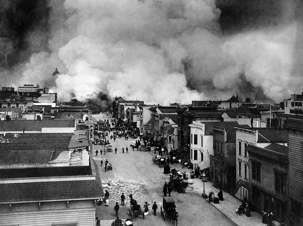
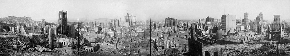
Panoramic photo of San Francisco after the 1906 earthquake
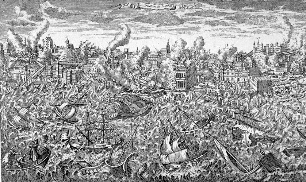
Even in ancient times, people wondered how earthquakes and volcanic eruptions occur. People often attributed these events to gods (Poseidon in Greek mythology). Some scientists in ancient Greece believed the continents floated on water and rocked back and forth like a ship. Other people believed earthquakes erupted from caves. In Japan, there was the myth of the dragon that made the ground tremble and breathed fire when it was angry. In the European Middle Ages, natural disasters were attributed to the work of God. With the discovery and study of magnetism, the theory arose that earthquakes could be conducted like lightning. It was therefore recommended that earthquake arrestors be built in the manner of the first lightning rods.
It was not until the beginning of the 20th century that the now generally accepted theory of plate tectonics and continental drift emerged through Alfred Wegener. From the middle of the 20th century, the explanatory patterns of tectonic quakes were widely discussed. Until the beginning of the 21st century, however, no technique for the reliable prediction of earthquakes could be developed from this.
Historical earthquakes
The most important known earthquake areas are listed in the List of Earthquake Areas. A comprehensive listing of historically surviving earthquake events is in the List of Earthquakes.
Questions and answers
Q: What is an earthquake?
A: An earthquake is a sudden movement or trembling of the Earth's tectonic plates, that creates shaking of the ground. This shaking can destroy buildings and break the Earth's surface.
Q: What causes earthquakes?
A: Earthquakes are caused by disturbances in the balance of the earth. The different tectonic plates slowly move past each other. When they get stuck, they build up tension and when this tension is suddenly released, it causes an earthquake.
Q: Who studies earthquakes?
A: People who study about earthquakes are called seismologists. They study the cause, repeats, type, and size of earthquakes as well as their effects on people and property.
Q: How do we measure an earthquake's magnitude?
A: The strength or magnitude of an earthquake is measured using the Richter scale which was invented by Charles Francis Richter in 1935. It ranges from 0-10 with 2 being scarcely noticeable and 5 (or more) creating damage over a wide area. The largest ever recorded was 9.5 but 10 has never been recorded on this scale before.
Q: Can we predict when an earthquake will happen?
A: Scientists cannot predict an earthquake before it happens but they can identify areas where future earthquakes may occur such as close to fault lines so people can be prepared for them if they do happen in those areas.
Q: What kind of destruction can be caused by an Earthquake?
A: Earthquakes can cause destruction to buildings and break the Earth's surface as well as create huge waves called tsunamis which can create just as much destruction as the earthquake itself and also landslides which can further damage land and property around it
Related articles
Author
AlegsaOnline.com Earthquake: causes, effects, detection, and societal responses Leandro Alegsa
URL: https://en.alegsaonline.com/art/29584
Sources
- earthquake.usgs.gov : "What are aftershocks, foreshocks, and earthquake clusters?"
- earthquake.usgs.gov : "Repeating earthquakes"
- volcanoes.usgs.gov : "Earthquake swarms at Yellowstone"
- water.stanford.edu : "Poseidon's horses: plate tectonics and earthquake storms in the late [Bronze Age] Aegean and Eastern [[Mediterranean]]"
- doi.org : 10.1006/jasc.1999.0431
- worldcat.org : 0305-4403
- bbc.co.uk : "Earthquake storms"
- earthquake.usgs.gov : USGS Poster of the Near the East Coast of Honshu, Japan Earthquake of 11 March 2011 - Magnitude 8.9
- ptwc.weather.gov : Pacific Tsunamy Warning Center