
Wacker Drive — Chicago's multilevel riverfront thoroughfare
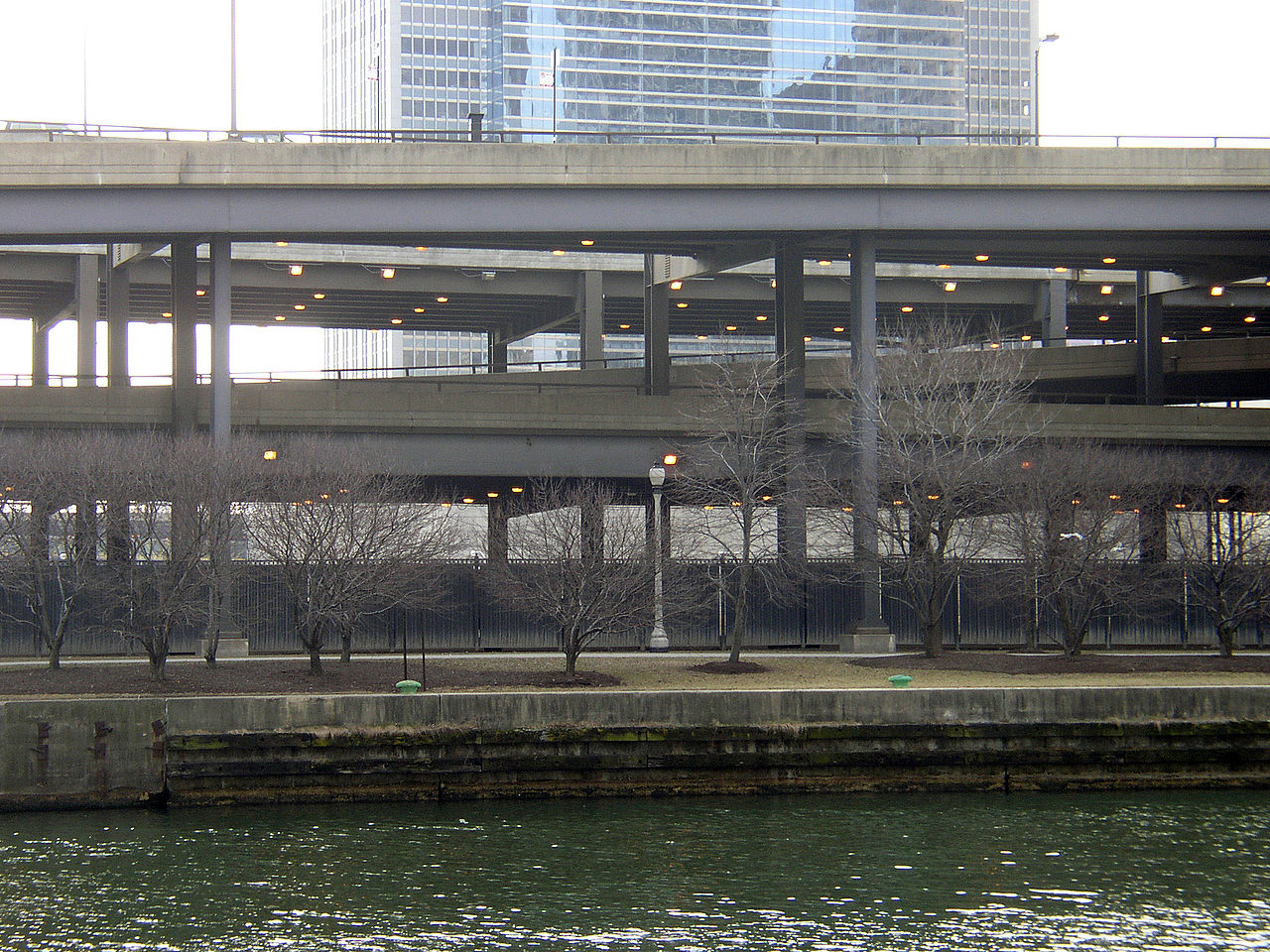
Wacker Drive is a prominent multilevel street along the Chicago River in downtown Chicago, designed to separate local and through traffic and to provide service access to riverfront buildings.
Overview
Wacker Drive is a major downtown street in Chicago, Illinois, United States, that runs beside the Chicago River. It forms part of the Loop's riverfront circulation system and is notable for its stacked roadway design that separates different kinds of traffic and services along the riverbanks.
Image gallery
8 Images




Design and characteristics
The roadway is predominantly double-decked: an upper level intended for local traffic, pedestrians, and building access, and a lower level designed for through-traffic, delivery vehicles, and utilities. Some stretches have additional intermediary elements, ramps and service alleys that allow access to loading docks, parking garages and mechanical systems hidden from the riverfront promenade. The multi-tier arrangement improves traffic flow in a dense urban core while preserving the river edge for promenades and river crossings.
History and development
Conceived as part of broader efforts to organize Chicago's downtown circulation, Wacker Drive evolved in stages during the early and mid-20th century. The street replaced earlier, narrower riverfront roads and incorporated contemporary engineering solutions for grade separation and flood resilience. Over time it has been reconstructed and modernized to meet changing safety standards, utility needs and the demands of heavier vehicles and increased tourist activity along the river.
Function and uses
Wacker Drive performs several roles at once: it is a commuter route carrying substantial volumes of traffic, a service corridor for deliveries and building access, and a component of the city's flood-control and infrastructure network. The separation of levels keeps freight and service operations out of sight of pedestrians and motorists on the upper deck, which improves safety and the aesthetic quality of the riverfront.
Urban context and significance
Located adjacent to major commercial and civic buildings, Wacker Drive is frequently photographed and appears in films, books and guides about Chicago. Its engineering and urban-design approach became a model for other cities seeking to reconcile waterfront access with heavy urban traffic. The street's relationship to bridges, riverwalks and the Loop's grid is integral to downtown circulation.
Distinctive facts
- Often described simply as "multilevel," Wacker Drive actually consists of distinct upper and lower roadways with separate signage and traffic rules.
- It is divided into segments commonly referred to according to their compass orientation and the river branches they parallel.
- Maintenance and periodic reconstruction reflect the complexity of running utilities, drainage and load-bearing structures along an active riverfront.
For additional maps, images and technical descriptions consult local transportation resources and planning histories that document Wacker Drive's role in shaping Chicago's riverfront. See city engineering publications and historical overviews for more detailed timelines and project specifics.
Related articles
Author
AlegsaOnline.com Wacker Drive — Chicago's multilevel riverfront thoroughfare Leandro Alegsa
URL: https://en.alegsaonline.com/art/106087