
Tropical Storm Peter (2003)
A late-season Atlantic cyclone that evolved from an extratropical system and briefly reached 70 mph (110 km/h) on December 9, 2003 before weakening.
Overview
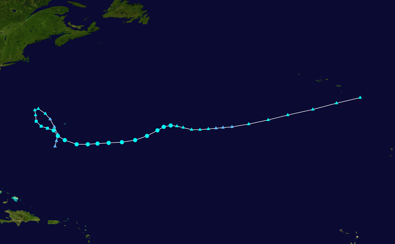
Tropical Storm Peter was a short-lived Atlantic cyclone that developed in early December 2003, after the calendar close of the official Atlantic hurricane season. It evolved from an extratropical disturbance into a subtropical system and then into a fully tropical storm on December 9, 2003. At peak intensity Peter approached hurricane strength but did not reach it.
Image gallery
10 Images




Formation and lifecycle
The system originated as an extratropical low. As it moved over relatively warmer ocean waters and convection increased, it acquired subtropical characteristics and was classified as a subtropical cyclone. Continued organization and the development of a centralized convection core led forecasters to declare it tropical on December 9. Its transition sequence — extratropical to subtropical to tropical — illustrates how baroclinic systems can become warm-core cyclones when environmental conditions permit.
Structure and intensity
During its tropical phase Peter developed some features typical of organized tropical cyclones, including a compact central convective area and a small, transient eye-like feature. Maximum sustained winds were estimated at about 70 mph (110 km/h), just below the 74 mph threshold for hurricane status. The storm remained relatively small in size and short in duration, with the strongest winds confined near its center.
Weakening and dissipation
Peter's rapid weakening was driven by two principal environmental factors. Increasing upper-level wind shear disrupted the storm's core convection and tilted its circulation, while movement into cooler sea-surface temperatures reduced the energy available to sustain deep convection. Together these conditions caused Peter to lose its tropical characteristics and dissipate within a few days of peak intensity.
Significance and impacts
As a late-season storm, Peter is an example of how tropical cyclones can form outside the conventional June–November window when atmospheric and oceanic conditions align. It produced no widely reported major land impacts and largely remained an oceanic event, of greater interest to meteorologists studying cyclone transitions than to disaster response agencies.
Key points
- Formed from an extratropical low and briefly became a tropical storm on December 9, 2003.
- Reached peak winds near 70 mph (110 km/h), just under hurricane strength.
- Developed an eye-like feature but was small and short-lived.
- Weakened rapidly due to wind shear and cooler waters and caused no notable land damage.
Questions and answers
Q: When did Tropical Storm Peter form?
A: Tropical Storm Peter formed after the end of the Atlantic hurricane season.
Q: How did Tropical Storm Peter form?
A: Tropical Storm Peter formed from an extratropical storm and was initially a subtropical cyclone.
Q: What happened as Tropical Storm Peter moved over warmer waters?
A: As Tropical Storm Peter moved over warmer waters, it began to gain strength, and an eye formed within the cyclone.
Q: Did Tropical Storm Peter become a hurricane?
A: Tropical Storm Peter almost became a hurricane, but wind shear and cooler waters quickly caused it to lose strength.
Q: What were the peak winds of Tropical Storm Peter?
A: The peak winds of Tropical Storm Peter were 70 mph (110 km/h).
Q: Why was Tropical Storm Peter short-lived?
A: Tropical Storm Peter was short-lived because wind shear and cooler waters caused it to lose strength quickly.
Q: What year did Tropical Storm Peter occur?
A: Tropical Storm Peter occurred in 2003.
Related articles
Author
AlegsaOnline.com Tropical Storm Peter (2003) Leandro Alegsa
URL: https://en.alegsaonline.com/art/101728
Sources
- australiasevereweather.com : "Tropical Storm Peter track prior to cyclogenesis"
- nhc.noaa.gov : "Tropical Storm Peter Tropical Cyclone Report"
- nhc.noaa.gov : "Tropical Storm Peter Discussion One"
- nhc.noaa.gov : "Hurdat Data for Tropical Cyclones 1851-2005"