San Fernando Valley: geography, history, culture, and municipalities
Urban valley north of central Los Angeles with about 1.8 million residents; notable for its surrounding mountains, suburban neighborhoods, entertainment industry, and mixed governance across several cities.
The San Fernando Valley, commonly called "the Valley," is an urbanized inland valley at the northwest edge of the Los Angeles metropolitan area. It sits north of the Los Angeles Basin and is ringed by portions of the Transverse Ranges. Today the Valley supports roughly 1.8 million residents across a mix of dense neighborhoods, commercial corridors and open hillsides; it is often discussed as a distinct subregion within the larger Los Angeles metropolitan area.
Image gallery
10 Images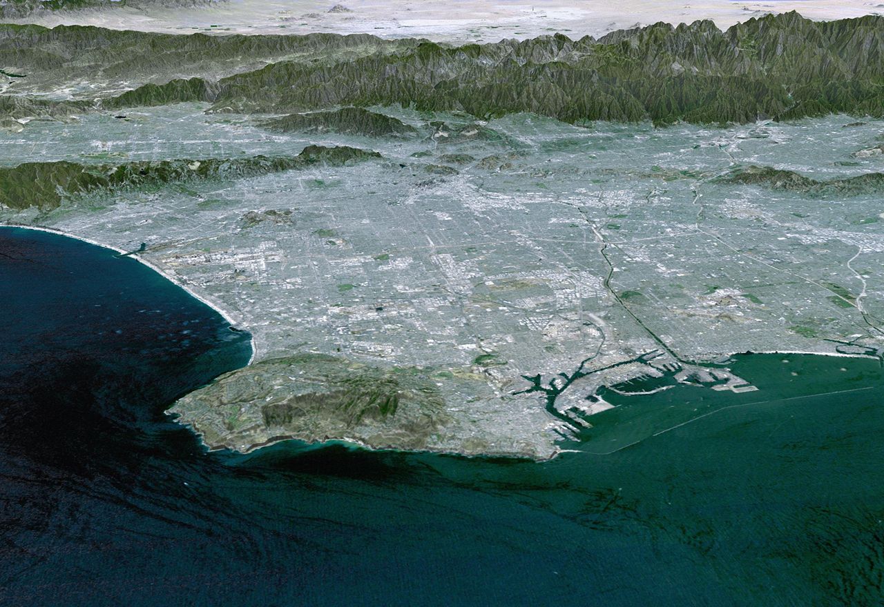


Geography and climate
The Valley is enclosed by mountain ridges that include parts of the San Gabriel, Santa Monica and Santa Susana ranges. Its floor is primarily alluvial and gently sloping, with pockets of pockets of floodplain and arroyo channels. The climate is Mediterranean: warm, dry summers and mild, wetter winters. Local weather is influenced by coastal marine layers, mountain shading and occasional Santa Ana wind events that can raise fire risk and dust levels.
History and development
Indigenous peoples, principally the Tongva (Gabrielino), lived in the region long before Spanish colonization introduced missions and ranchos in the 18th and 19th centuries. In the 20th century the Valley transformed from agricultural and ranch lands into a broad suburban and industrial expanse as rail, road and later freeway connections to central Los Angeles expanded. The Valley has also experienced major events that shaped its built environment, including the 1994 Northridge earthquake and periodic civic debates over governance and municipal boundaries.
Municipal organization
Nearly two-thirds of the San Fernando Valley's land area falls within the City of Los Angeles, with the remaining territory made up of independent municipalities and enclaves. Several incorporated cities and communities lie wholly or partly in the Valley; examples include Glendale, Burbank, San Fernando, Hidden Hills and Calabasas. For a general overview of the multiple jurisdictions and neighborhood councils, see other incorporated cities and local governance.
Economy, culture and notable institutions
The Valley supports a diversified local economy. It is an important center for the entertainment and media industries, hosting long-established studios and production facilities as well as post-production and independent companies. The region also saw significant aerospace and manufacturing activity in the mid-20th century. Culturally, the Valley is known for its suburban character, varied immigrant communities, and popular images such as the "Valley Girl" stereotype from late-20th-century media. Neighborhood shopping districts, parks and cultural centers serve its wide population.
Transportation and neighborhoods
Major freeways cross or border the Valley, providing connections to the rest of Los Angeles and Southern California: U.S. Route 101, Interstate 405, Interstate 5 and state routes that serve north–south and east–west travel. Airports within or adjacent to the Valley include Hollywood Burbank Airport and Van Nuys Airport for general aviation. Well-known neighborhoods include North Hollywood, Van Nuys, Northridge, Reseda, Sherman Oaks, Studio City, Encino and Pacoima, each with distinct residential patterns and commercial centers.
Because of its size, diverse communities and economic role, the San Fernando Valley remains a vital and often debated part of greater Los Angeles. Its boundaries, governance, and identity continue to evolve as development, transportation, and demographic changes reshape the region.
Related articles
Author
AlegsaOnline.com San Fernando Valley: geography, history, culture, and municipalities Leandro Alegsa
URL: https://en.alegsaonline.com/art/86813