Baltistan: geography, history and culture of the Karakoram highlands
Baltistan is a high‑altitude region in the Karakoram south of K2, with Balti‑speaking communities of Tibetan origin. It has a distinct culture and a complex modern political history within the Kashmir area.
Overview
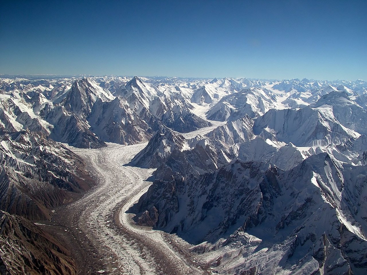
Baltistan (Balti: Baltiyul) is a mountainous region located in the greater Kashmir area of northern South Asia. Today most of Baltistan lies under the administration of Pakistan, and the region borders the Chinese Xinjiang Autonomous Region of China. It occupies valleys and high plateaus of the Karakoram range immediately south of K2, the world’s second‑highest mountain. Average elevations exceed 3,000 meters, making Baltistan one of the most rugged inhabited landscapes in the world.
Image gallery
10 Images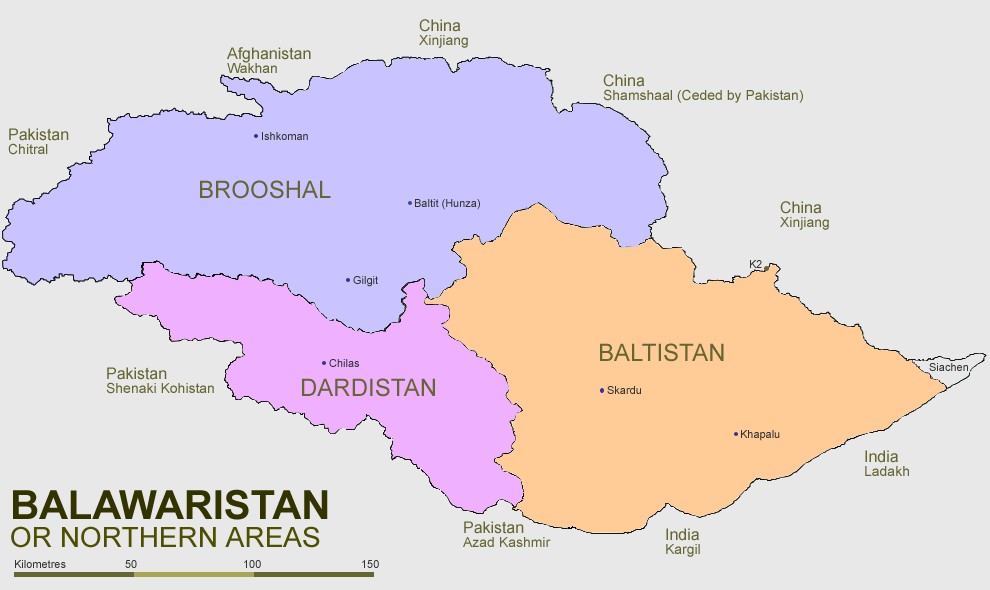


Geography and population
The region is defined by deep glacial valleys drained by tributaries of the Indus River, steep passes and extensive moraine fields. Major centers include Skardu and smaller districts and valleys that vary in climate from arid high steppe to cold, glacier‑fed river valleys. The local population primarily speaks Balti, a Tibetic language; many inhabitants trace cultural and genetic roots to Tibetan peoples and to historical communities that practiced Tibetan Buddhism before conversion to Islam.

History and political status
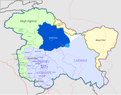
Baltistan was historically organized under local rulers and rajas, and in the 19th century it came under the influence or control of the Raja of Kashmir. With the partition of British India in 1947 and the creation of India and Pakistan, Baltistan became part of the wider Kashmir dispute; parts of the traditional region remain under different administrations. Throughout the 20th and early 21st centuries, local governance, land rights and representation have changed, including reforms and elections that reduced some feudal structures and increased local civil administration.
Culture, economy and daily life
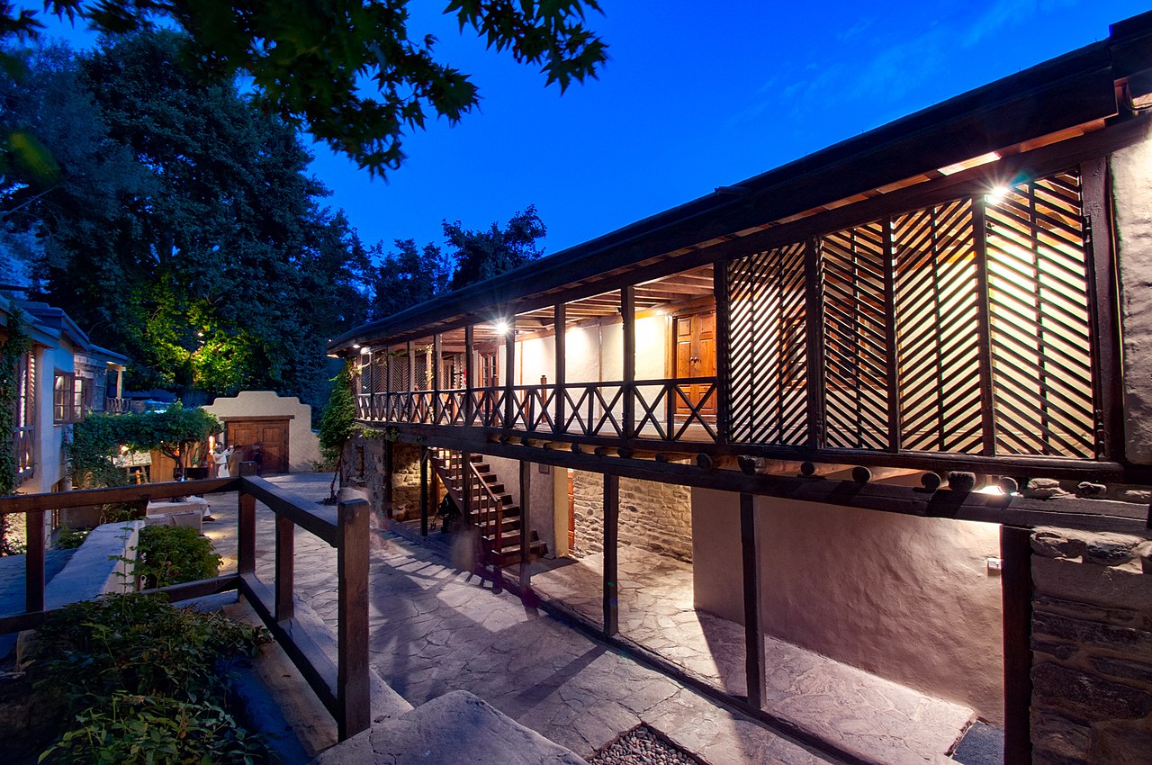
Baltistan’s culture blends Tibetan heritage with Islamic traditions, expressed in language, music, crafts and architecture. Agriculture in valley floors supports local cereals and orchard crops where irrigation is possible; pastoralism, small‑scale trade and increasingly tourism (mountaineering, trekking and cultural tourism) supplement livelihoods. Traditional handicrafts, carved woodwork and woven garments remain important for identity and income.

Transport, tourism and significance
Access to many parts of Baltistan remains difficult: mountain roads, seasonal passes and long valley routes connect settlements. The Karakoram Highway and local roads link Skardu and other hubs to national networks, though many routes are remote and weather‑dependent. The region draws climbers and trekkers because of peaks such as K2 and extensive glacial landscapes. Conservation of fragile ecosystems and management of glacial water resources are growing priorities.
Notable facts and distinctions
- Baltistan’s language, Balti, belongs to the Tibetic family and preserves several archaic features.
- The high altitude and glacier cover make Baltistan strategically and hydrologically important for downstream river systems.
- Its modern political status is linked to the larger Kashmir conflict and to border arrangements with neighboring regions.
For further regional information and administrative context consult sources on the Balti language (Balti), Pakistan (Pakistan), Xinjiang (Xinjiang), autonomous arrangements (Autonomous Region), China (China), the Karakoram (Karakoram), K2 (K2), Tibetan heritage (Tibetan), pre‑Islamic religion (Tibetan Buddhism), historical rulers (Raja), Kashmir (Kashmir) and the wider subcontinental context (India).
Related articles
Author
AlegsaOnline.com Baltistan: geography, history and culture of the Karakoram highlands Leandro Alegsa
URL: https://en.alegsaonline.com/art/8611