Nautical chart
A nautical chart is a specialized map for marine navigation showing depths, hazards, aids to navigation, and coastlines; available as paper charts and electronic charts used by mariners worldwide.
A nautical chart is a map designed specifically for use at sea and along coasts. It depicts water depths, shoreline features, navigational aids such as buoys and lighthouses, seabed types, hazards and man-made structures. Charts are essential tools for planning voyages, maintaining safe courses, and carrying out precise approaches to ports and anchorages. For further reading on chart basics see basic chart elements.
Image gallery
8 Images


Common elements and symbols
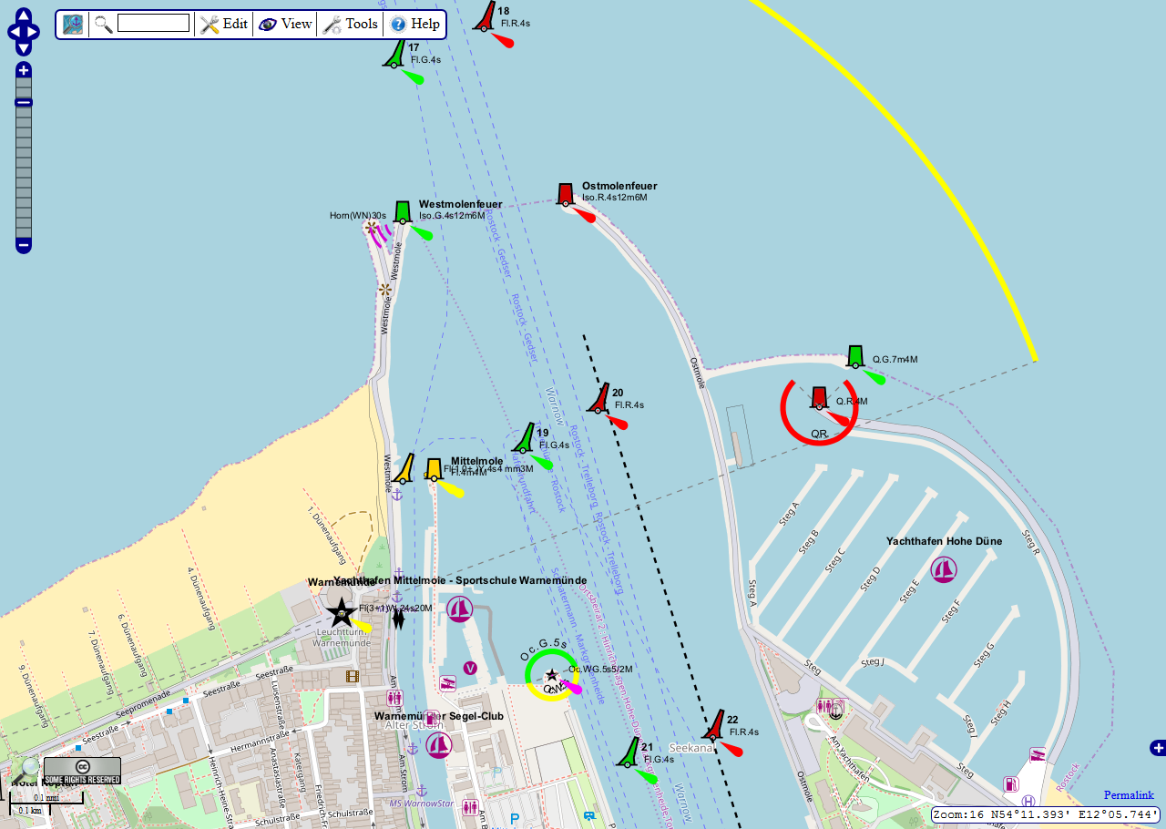
Charts compress diverse information into a readable form. Typical elements include depth soundings and contours, wrecks and obstructions, compass roses, scales and grid references, tidal information and notes about local regulations. Cartographic conventions and symbols are standardized so mariners can interpret charts consistently across different publishers. A concise guide to symbols may be found at chart symbols.
Important components include:
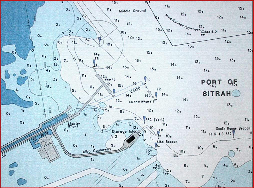
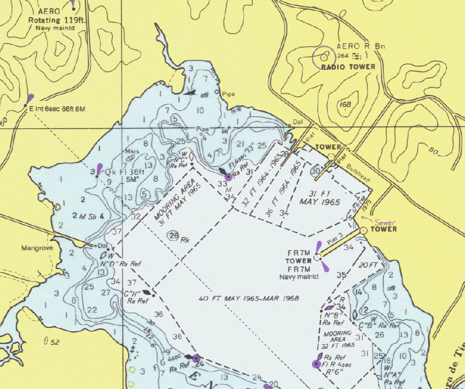
- Soundings and depth contours (often referenced to a chart datum)
- Nautical aids (lights, buoys, beacons)
- Seabed composition and special use zones
- Topographic features and port details
History and development
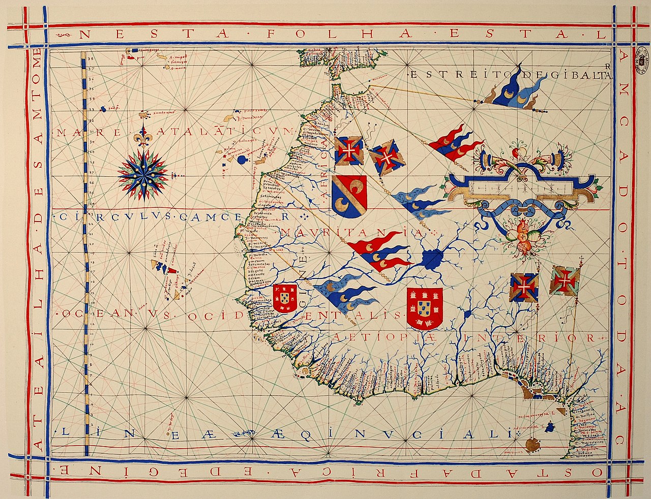
The practice of charting coasts and sea lanes dates back many centuries. Early portolan charts and coastal sketches emerged in medieval Mediterranean trade between the 13th and 15th centuries and were refined through the Age of Exploration. The introduction of the Mercator projection in the 16th century made long-distance course plotting easier. Nautical charts continued evolving as surveying techniques, printing and later electronic methods improved; more on historical styles is available at chart history and navigation history.
Modern production and use
Today charts are produced by national hydrographic offices and private publishers. They exist both as traditional paper charts and as digital vector products for Electronic Chart Display and Information Systems (ECDIS). Electronic Navigational Charts (ENCs) integrate with GPS and other instruments to support real-time navigation, route planning and automatic alerts. Mariners rely on regular updates and Notices to Mariners to correct changes; a practical resource is chart updates.
While technology has expanded options, accurate chart interpretation, seamanship and cross-checking with other navigation methods remain critical for safe passage. Charts are legal documents for many aspects of maritime operations and continue to be taught in navigation training and certification worldwide.
Related articles
Author
AlegsaOnline.com Nautical chart Leandro Alegsa
URL: https://en.alegsaonline.com/art/68817