Navy Yard (Near Southeast), Washington, D.C.
Neighborhood on the Anacostia River centered on the historic Washington Navy Yard; transformed from industrial and military uses into mixed-use residential, commercial, recreation and federal spaces.
Overview
Navy Yard, often called Near Southeast, is a neighborhood on the west bank of the Anacostia River in Southeast Washington, D.C. It is named for the historic Washington Navy Yard, an active naval shore establishment founded in 1799. The neighborhood blends active federal facilities with dense new housing, offices and public attractions; its geographic point is sometimes given by coordinates.
Image gallery
10 Images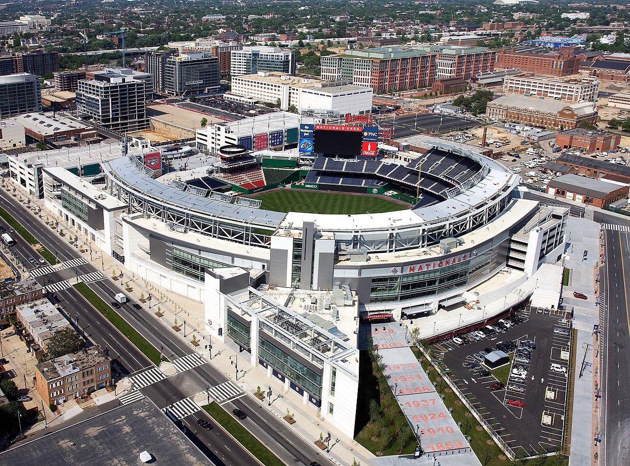


Boundaries and access
- Common boundaries are Interstate 395 to the north, South Capitol Street to the west, and the Anacostia River to the south and east.
- Public transit access centers on the Navy Yard–Ballpark Metro station (Green Line). The area is also served by bus routes, bicycle lanes and riverfront pedestrian paths.
Historic role
The Washington Navy Yard established the neighborhood’s early identity as a shipbuilding, ordnance and logistics facility. Over two centuries the Yard has performed a range of naval and federal functions and has been a significant employer and industrial presence in the city. Portions of the Yard remain federal property while surrounding parcels shifted from heavy industrial use toward other civic and private functions; see further background on the Navy Yard itself at the Navy Yard.
Redevelopment and contemporary character
Beginning in the late 20th and early 21st centuries, Navy Yard experienced major redevelopment. Former industrial sites and warehouses have been transformed into mixed-use residential towers, offices, restaurants and cultural venues. A professional baseball stadium and a waterfront park are important anchors for visitor activity and neighborhood life. The area also contains converted historic buildings alongside contemporary architecture, with a growing mix of retail, food and entertainment options.
Landmarks and institutions
- The Washington Navy Yard remains an active federal facility and hosts naval administrative and historical functions.
- Prominent public spaces and redevelopment projects along the riverfront provide plazas, promenades and programmed parks.
- Local developments and community resources are documented through neighborhood and municipal sources; see a local resource page here.
Parks, recreation and the waterfront
Riverfront parks, trails and plazas provide pedestrian access to the Anacostia and contribute to recreational life in the neighborhood. Waterfront promenades and green space are intended to reconnect the public to the river and support events, concerts and seasonal activities. Ongoing improvements to shoreline access and trail connections are common elements of planning for the area.
Community, economy and culture
The neighborhood’s population and commercial profile have shifted markedly with new residential construction and office space attracting residents, federal workers and private-sector employees. Restaurants, small retail, fitness and cultural venues have grown to serve both day visitors and neighborhood residents. Community groups and advisory bodies participate in local planning and public-space programming.
Transportation and connections
- Rail: The Green Line station at Navy Yard–Ballpark is the principal rapid transit link.
- Roads: Major arterials and bridge connections provide access to central Washington and adjacent neighborhoods.
- Active travel: Bike lanes, pedestrian routes and riverfront trails improve non-vehicular mobility.
Future and planning
Planning priorities for the area emphasize balanced growth, improved public access to the waterfront, preservation of historically significant structures, and coordinated transportation improvements. As a neighborhood where federal institutions and private development coexist, Navy Yard continues to evolve with attention to housing, open space and economic activity.
Navy Yard exemplifies contemporary urban waterfront transformation: a historic maritime and federal precinct that now includes a diverse mix of civilian life, public amenities and continued naval presence, and remains an active focus for municipal planning and community engagement.
Questions and answers
Q: What are the coordinates of the Navy Yard neighborhood in Washington, D.C.?
A: The coordinates of Navy Yard are 38°52′37.21″N 77°0′5.86″W / 38.8770028°N 77.0016278°W / 38.8770028; -77.0016278.
Q: What is Navy Yard?
A: Navy Yard is a neighborhood on the Anacostia River in Southeast Washington, D.C.
Q: What are the boundaries of Navy Yard?
A: Navy Yard is bounded by Interstate 395 to the north, South Capitol Street to the west, and the Anacostia River to the south and east.
Q: What is the neighborhood named after?
A: The neighborhood is named after the Washington Navy Yard.
Q: Which city ward is Navy Yard located in?
A: Navy Yard is located in D.C.'s Ward 6, currently represented by Tommy Wells.
Q: How is Navy Yard served by public transportation?
A: Navy Yard is served by the Navy Yard Metro station on the Green Line.
Q: What percentage of the neighborhood does the Navy Yard fill?
A: The Navy Yard fills about half of the neighborhood.
Related articles
Author
AlegsaOnline.com Navy Yard (Near Southeast), Washington, D.C. Leandro Alegsa
URL: https://en.alegsaonline.com/art/68858
Sources
- dccouncil.us : DC Council Members
- capitolriverfront.org : Capitol Riverfront BID | History of the Neighborhood
- washingtonpost.com : Dana Hedgpeth - Contesting a Stadium's Power - washingtonpost.com
- washingtonpost.com : A Transformed Neighborhood Awaits Stadium
- capitolriverfront.org : Capitol Riverfront BID | Neighborhood Dynamic
- jdland.com : FRP/RiverFront - Near Southeast DC Revitalization
- jdland.com : South Capitol Street/Frederick Douglass Bridge - Near Southeast DC Revitalization
- jdland.com : "The Yards"/Southeast Federal Center - Near Southeast DC Revitalization
- jdland.com : Department of Transportation HQ - Near Southeast DC Revitalization
- jdland.com : Nationals Park - New DC Baseball Stadium for the Washington Nationals
- jdland.com : DC Ballpark District
- jdland.com : Capper/Carrollsburg Housing Redevelopment - Near Southeast DC Revitalization
- jdland.com : New Community Center at Capper/Carrollsburg - Near Southeast DC Revitalization
- jdland.com : New Marine Bachelor Enlisted Quarters
- madisonmarquette.com : Madison Marquette Acquires 770 M Street Near New Nationals Baseball Stadium in Washington, DC - Madison Marquette