Mile End — East London district in the London Borough of Tower Hamlets
Mile End is an inner‑east London district in Tower Hamlets, about 3.6 miles from Charing Cross. Known for Mile End Park, Queen Mary University, diverse communities and historic links to the 1381 Peasants' Revolt.
Mile End is an inner‑east London district within the London Borough of Tower Hamlets, roughly 3.6 miles (5.8 km) east‑northeast of Charing Cross. Historically part of the East End, it had a population of about 28,544 at the 2011 census. The area combines residential streets, green spaces and institutional campuses close to central London.
Image gallery
8 Images


Character and landmarks
Mile End is centred on the Mile End Road, a major east–west route. Notable features include Mile End Park, a long ribbon of reclaimed open space, and the main campus of Queen Mary University of London. The district mixes Victorian and later housing with recent redevelopment and community facilities.
Transport and accessibility
Transport links are strong: Mile End tube station is served by the Central, District and Hammersmith & City lines, providing fast links into the West End and the City. Several bus routes run along Mile End Road and the area lies on arterial routes toward East London suburbs.
History and development
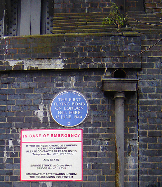
The name "Mile End" reflects its position about a mile from the old City boundary. Mile End figures in medieval and later history: in 1381 the leaders of the Peasants' Revolt met local authorities in the area. During the 19th and early 20th centuries it developed as a densely populated working‑class neighbourhood and has undergone waves of regeneration since the late 20th century.
Community and significance
Mile End is culturally diverse, with long‑established communities alongside students and professionals drawn by nearby universities and hospitals. Local amenities include parks, community centres and a range of shops and markets. The area illustrates wider patterns of change in London’s East End: historic roots, industrial and housing legacy, and ongoing urban renewal.
Quick facts
- Location: Tower Hamlets, East London
- Approximate distance: 3.6 miles from Charing Cross
- Key sites: Mile End Park, Queen Mary University, Mile End tube station
Related articles
Author
AlegsaOnline.com Mile End — East London district in the London Borough of Tower Hamlets Leandro Alegsa
URL: https://en.alegsaonline.com/art/64934
Sources
- hidden-london.com : "Mile End – Hidden London"