
Magdalena River
Principal river of Colombia, flowing north from the Andes to the Caribbean; central to the country's geography, transport, ecology, history and economy.
Overview
The Magdalena River is Colombia's most important fluvial artery, running generally from south to north across the western half of the country. It drains a large portion of the Colombian Andes and empties into the Caribbean Sea near the Atlantic coast. The river's total length is commonly given at about 1,538 kilometres (956 miles), and its watershed has long been the focus of settlement, agriculture and commerce. The river's approximate source coordinates are noted here for reference: 11°7′0″N 74°51′0″W.
Image gallery
5 Images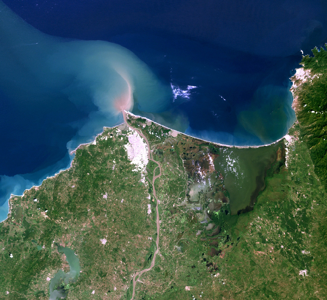


Course and characteristics
The Magdalena rises in the Andean highlands and travels northward, collecting many tributaries before reaching the Caribbean near Barranquilla. Its main characteristics include a long, meandering lowland reach, rapids and narrows in parts of the middle course, and a broad delta and estuarine zone at the mouth. Navigation is possible for much of its length, although rapids, seasonal flow variation and sedimentation limit continuous upstream traffic. Historically commercial navigation extended as far as the town of Honda, with additional passable stretches beyond the rapids.
Major tributaries and cities
- Significant tributaries include rivers that drain both the eastern and western slopes of the Andes; these tributaries form the backbone of the Magdalena basin.
- Important towns and ports along or near the river include historic river ports such as Honda and larger urban centers near the mouth like Barranquilla, which developed as a major Caribbean port. See local resources for place names: regional map.
History and human use
The Magdalena has been a primary travel corridor since pre-Columbian times and became the main inland route during the colonial era, connecting the interior highlands to the Caribbean coast. Over the centuries the river enabled trade, migration and the movement of goods. Large parts of Colombia's population live in the river basin, and the Magdalena supports agriculture, fishing, industry and urban centers. For historical navigation and settlement patterns, consult regional studies and archives: read more.
Ecology and environmental issues
Ecologically, the Magdalena basin contains diverse habitats—montane forests, floodplains and wetlands—that sustain many plant and animal species, some endemic. In modern times the river faces environmental pressures: pollution from urban and industrial sources, habitat loss from deforestation and riverbank alteration, overfishing and sedimentation from upstream erosion. Conservationists and government agencies have worked on restoration, pollution control and protected areas to address these challenges.
Navigation, economy and contemporary significance
Navigation on the Magdalena remains important for regional commerce and passenger transport. The river historically allowed movement of goods deep into the interior; rapids limit continuous passage, but navigable stretches and river ports continue to play economic roles in freight, petroleum services and local trade. Tourism and riverine communities depend on the river's health as well. For infrastructure and navigational details consult shipping and port authorities: port information and transport reports.
Notable facts: the Magdalena basin has been central to Colombia's development, serving as a cultural and economic spine. Its combination of navigable reaches, strategic geographic position and rich ecosystems makes it a river of national importance.
Related articles
Author
AlegsaOnline.com Magdalena River Leandro Alegsa
URL: https://en.alegsaonline.com/art/60567
Sources
- doi.org : 10.1016/j.jhydrol.2005.05.002
- siac.gov.co : "Sistema de informacion Ambiental de Colombia - SIAC"
- geotest.tamu.edu : "Chapter 14"