
Geographical location
Geographical location describes where a point or area lies on Earth, using relative descriptions or coordinate systems such as latitude/longitude and other mapping frameworks.
Geographical location is the description of where a point, place or region exists on the surface of the Earth. In everyday use it may be given as a place name, an address, or a description relative to nearby features. In scientific and cartographic contexts it usually means a set of coordinates within a mapping framework that identifies a precise position. For discussion of the field that studies such matters see geography.
Image gallery
1 Image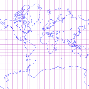
Coordinate systems and ways to express location
The most familiar global scheme uses latitude and longitude. Latitude measures angular distance north or south of the equator, while longitude measures angular distance east or west of a chosen meridian. The Prime Meridian passing through Greenwich is the conventional zero-longitude reference used by most global maps. Coordinates can be written in degrees, minutes and seconds or as decimal degrees. Other systems used for mapping and surveying include projected grids such as UTM, national grid systems, and local Cartesian frames.
Absolute vs relative location
Absolute location denotes a fixed coordinate (for example a set of latitude/longitude values) that is independent of viewpoint. Relative location describes a place in relation to other places or features, such as "north of the river" or "10 km from the city center." Both approaches are useful: absolute coordinates are essential for navigation and spatial data databases, while relative descriptions are common in everyday communication and wayfinding.
Historical development
Human societies have described location since prehistoric times using landmarks, distances and directions. Systematic methods emerged with ancient geographers who conceptualized a spherical Earth and began measuring latitude and longitude. Over centuries, improvements in instruments and international agreements — including the adoption of a common prime meridian in the late 19th century — standardized global reference frames. In the late 20th century satellite navigation systems such as GPS enabled real-time, high-precision absolute positioning for civilian and professional use.
Uses and importance
Accurate location information underpins navigation, mapping, land administration, emergency response, environmental monitoring and scientific research. Cartographers, surveyors and geographic information systems (GIS) combine location with descriptive attributes to produce maps and spatial analyses. Location data support logistics, urban planning, property law, disaster relief and many consumer applications on mobile devices.
Practical considerations and distinctions
- Coordinate precision and datum: The same numeric coordinates can refer to slightly different physical positions depending on the geodetic datum or reference ellipsoid in use.
- Scale and representation: A location useful at regional scale may be meaningless at local scale without added detail such as an address or building identifier.
- Contextual meaning: "Place" often combines location with human or physical characteristics (culture, landform), while "location" emphasizes spatial position.
For technical details on coordinate conventions and mapping frameworks, see material on coordinate systems such as coordinate systems and projections. Understanding how location is defined and used helps bridge everyday descriptions with the precise needs of navigation, science and planning.
Related articles
Author
AlegsaOnline.com Geographical location Leandro Alegsa
URL: https://en.alegsaonline.com/art/58751