
Google Earth: virtual globe and geovisualization platform
Google Earth is an interactive virtual globe that blends satellite and aerial imagery with 3D terrain, map layers, and tools for education, planning, research, and exploration.

Overview
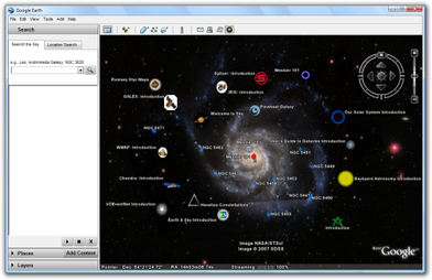
Google Earth is an interactive digital globe and mapping environment that lets users explore the surface of the planet using satellite and aerial photography, three-dimensional terrain and models, and a variety of map layers. It provides tools to pan, tilt, rotate and zoom to locations anywhere on Earth, view historical imagery, and overlay custom data. The application aims to make geographic information visually accessible to the general public while supporting more advanced uses in science, education and planning.
Image gallery
10 Images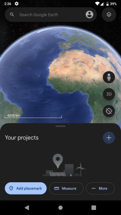




Key features and components
- Multi-resolution imagery: high- and medium-resolution satellite and aerial photographs stitched into a continuous globe.
- 3D terrain and buildings: elevation models and textured three-dimensional models that allow oblique viewing and realistic flyovers.
- Layers and overlays: selectable thematic layers such as roads, borders, labels, and user-created overlays that can show additional data.
- Historical Imagery: a timeline that lets users compare imagery from different dates to observe change.
- Measurement and analysis tools: rulers for distance and area, placemarks, paths, polygons, and support for the KML (Keyhole Markup Language) format to share annotations.
- Integration with other services: ties to street-level photographs, map services and data export/import features which broaden its usefulness.
History and development
The technology originated as a program called Earth Viewer developed by Keyhole, Inc., and was later acquired by Google. Under Google's stewardship the product was rebranded and expanded, adding new imagery sources, 3D content and public-facing tools. Over time it evolved into multiple delivery formats, including a desktop application, a web-based viewer and mobile apps. Some advanced capabilities originally sold as professional add-ons were later incorporated into freely available editions, increasing accessibility for diverse users.
Uses and examples
Google Earth is used across many fields. In education, it helps students build spatial thinking and global awareness by visualizing geography, ecosystems and human settlements. Urban planners, architects and real-estate professionals use the program to preview terrain and built environments. Environmental scientists and conservationists employ historical imagery and overlays to track land-use change, deforestation or coastal erosion. Humanitarian groups and emergency responders use rapid mapping and overlays to coordinate relief efforts after natural disasters. Journalists, hobbyists and travelers rely on the platform for storytelling, route planning and virtual exploration.
Notable distinctions and considerations
Google Earth is distinguished by its visual richness and the ability to combine imagery, 3D models and user data in one environment. It supports data exchange via KML, enabling researchers and the public to distribute georeferenced content. The product exists alongside related Google offerings focused on mapping and geospatial analysis; for example, some features connect with Google Maps and other mapping services. Its availability on desktop, web and mobile devices makes it widely accessible, but the platform has also prompted discussions about imagery resolution, privacy and responsible use. Users working with critical analyses should verify imagery dates and sources and consider complementary datasets for rigorous applications.
Whether used for casual exploration, classroom exercises or professional projects, Google Earth remains a prominent tool for visualizing and communicating information about the Earth's surface.
Related articles
Author
AlegsaOnline.com Google Earth: virtual globe and geovisualization platform Leandro Alegsa
URL: https://en.alegsaonline.com/art/39685