Doab — land between two rivers
Doab is a South Asian term for a tract of land lying between two converging rivers, known for fertile soils, dense settlement and major agricultural importance — notably the Ganges–Yamuna doab.
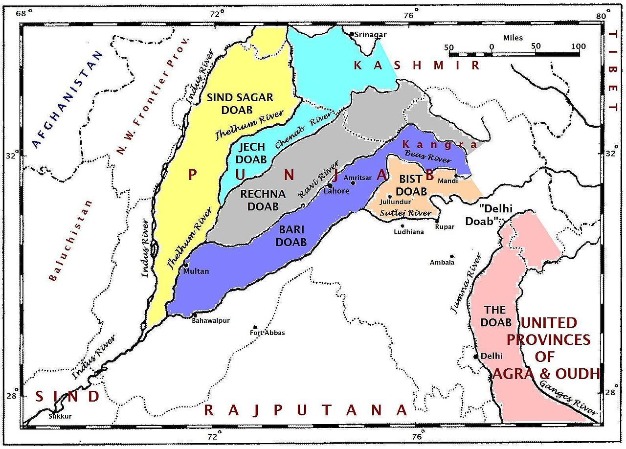
A doab is a geographic term used in South Asia for a stretch of land bounded by two rivers and extending downstream to their meeting point. The word comes from Persian roots meaning "two" (do) and "water" (ab). In everyday geography and regional planning the name highlights an area shaped by fluvial processes, fertile alluvium and a distinctive pattern of settlements and transport routes.
Image gallery
7 Images


Definition and name
Literally translated as "two waters," a doab corresponds roughly to what geomorphologists call an interfluve or inter-river tract. It is defined by the rivers that flank it rather than by political boundaries. In South Asian usage the term appears frequently in place names and regional descriptions.
Characteristics
- Soil and fertility: Seasonal flooding and river-borne silt create rich alluvial soils that support intensive agriculture.
- Hydrology: Doabs are influenced by the flow regimes of both rivers, so they may be prone to floods or benefit from irrigation networks.
- Settlement: Because of productive land and water access, doabs often have high population densities and well-developed transport links.
History and examples
The term is widely used in India and Pakistan, where historic states and modern administrations have identified doabs as distinct units for taxation, irrigation and administration. The most celebrated example is the region between the Ganges and the Yamuna, often simply called the Ganges–Yamuna doab. Other river-pair tracts in the Indus and Gangetic plains are also referred to as doabs, reflecting the cultural importance of river geography in the subcontinent.
Uses and modern significance
Doabs remain central to agriculture, groundwater recharge and regional economies. They are focal areas for irrigation projects, flood control measures and urban expansion. Understanding a doab’s limits helps planners decide where to build canals, levees or reservoirs and how to manage land sustainably.
Although rooted in regional language, the concept of a doab is useful for anyone studying river systems, land use or historical settlement patterns in South Asia. Its combination of physical geography and human activity makes the doab a key unit for environmental management and cultural geography.
Related articles
Author
AlegsaOnline.com Doab — land between two rivers Leandro Alegsa
URL: https://en.alegsaonline.com/art/28091