Districts of Israel (mahoz) — administrative regions and overview
The State of Israel is divided into six administrative districts (mahozot). This article explains their names, roles, subunits, historical background and notable distinctions.
The State of Israel is organized into six primary administrative districts that serve as the highest sub‑national level for many governmental functions. These divisions are commonly known in Hebrew as mahoz (מחוז) and in the plural as mehozot (מחוזות). For concise reference about the country itself see State of Israel and for the Hebrew terminology see mahoz / mehozot.
Image gallery
3 Images

List of districts
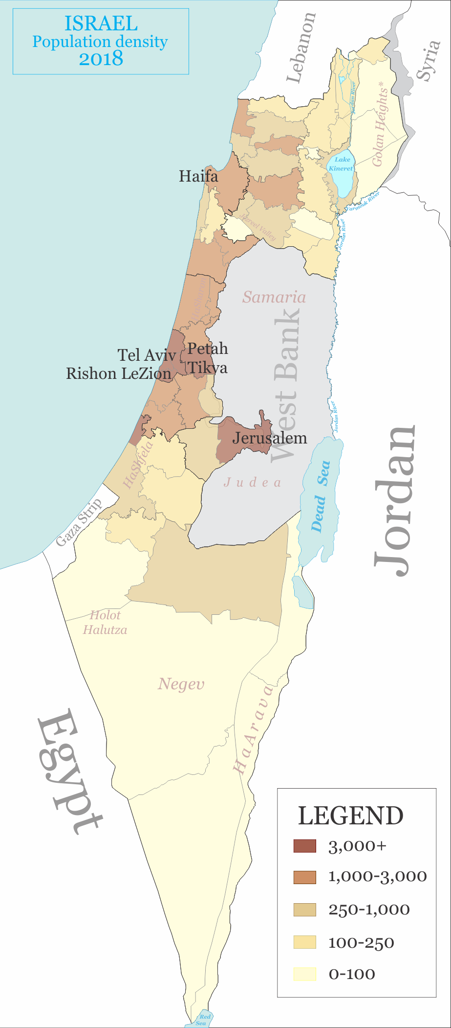
- Haifa District — centered on the city of Haifa, covering parts of the northern coastal plain and nearby hills.
- Jerusalem District — the district around Jerusalem; its municipal and administrative boundaries are sometimes described in political terms; more on the city at Jerusalem.
- Tel Aviv District — the compact, densely populated metro area around Tel Aviv and its immediate suburbs.
- Central District — includes the southern Sharon plain and the northern part of the Shfela lowlands; see regional notes at Central / Shfela.
- Northern District — the Galilee and adjacent northern areas, often referred to simply as the Galilee or northern region.
- Southern District — the Negev desert and southern lowlands, a large, sparsely populated territory anchored by cities in the south; background at Negev.
Each district is further divided into smaller administrative units, commonly called sub‑districts or nafot, and then into municipalities, local councils and regional councils. District borders are used by national ministries, courts, law enforcement and statistical agencies to organize services, allocate resources and report demographic or economic data.
Historically, these districts were put in place during the formative decades of the state as a practical framework for governance across a varied landscape of coastal plains, mountains and desert. The number and names of districts have been stable in modern times, though internal borders and the functions attached to districts have evolved with administrative reforms and urban growth.
Notable distinctions include contrasts in size and population: the Southern District covers the largest territory but is the most sparsely populated, while the Tel Aviv District is compact and highly urbanized. The Jerusalem District is often described with sensitivity because of the city's political and religious significance. Different arms of government may use alternate regional breakdowns for planning, electoral purposes or statistical reporting, so district lines are one of several ways Israel is organized administratively.
For overview maps, official descriptions and further administrative details consult national or regional resources and the relevant municipal pages linked above: State overview, language and terminology mahoz, and the district pages for Haifa, Jerusalem, Tel Aviv, Central, Northern and Southern.
Related articles
Author
AlegsaOnline.com Districts of Israel (mahoz) — administrative regions and overview Leandro Alegsa
URL: https://en.alegsaonline.com/art/27763