Chahar Burjak District — geography, population, and significance
Chahar Burjak District is a large, sparsely populated district in Nimruz Province, southwestern Afghanistan. This article covers its geography, people, economy, history, and environmental challenges.
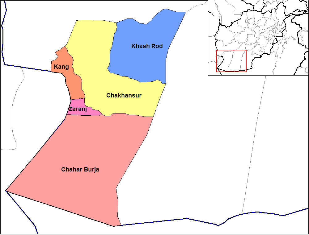
Chahar Burjak District lies in the southwest of Nimruz Province, in southern Afghanistan. The district is noted for its remote, arid landscape, limited infrastructure and small, dispersed settlements. It is part of the wider Sistan region, a borderland with a history of cross-border movement and seasonal wetlands.
Image gallery
2 Images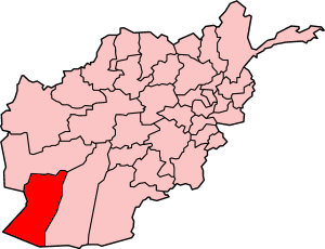
Geography and climate
The district occupies a largely desert plain punctuated by dry riverbeds and salt flats. Summers are hot and dry; winters are mild but can bring cold nights. Water is scarce and much local life revolves around access to groundwater, seasonal irrigation and traditional water-management systems adapted to arid conditions.
People and culture
Communities in the district tend to be small and village-based. Ethnic and tribal identities are locally important and shape social structures, livelihoods and dispute resolution. Rural life centers on pastoralism, small-scale farming where irrigation permits, and customary networks that link villages to market towns in Nimruz and beyond.
Economy and infrastructure
Economic activity is limited by remoteness and scarce water. Common livelihoods include livestock herding, subsistence agriculture and informal cross-border trade. Infrastructure such as paved roads, health facilities and schools is sparse; access to markets and services often requires long travel to provincial centers.
History and significance
The district forms part of the historic Sistan basin, a corridor for trade and seasonal migration for centuries. Its strategic importance reflects location and resources: control of routes and water sources has local political and humanitarian implications.
Environment and challenges
Key challenges include drought, groundwater depletion, periodic dust storms and the vulnerability of livelihoods dependent on fragile water supplies. Development priorities commonly cited by observers are improved water management, rural services, and measures to stabilize incomes while respecting local social structures.
Tags
Related articles
Author
AlegsaOnline.com Chahar Burjak District — geography, population, and significance Leandro Alegsa
URL: https://en.alegsaonline.com/art/18326