
Azawad: northern Mali — geography, history, and significance
Azawad is the term used for Mali's northern territories. This article explains its geography, peoples, the 2012 independence claim, later developments, and cultural and economic features.
Overview
Azawad is a name frequently used to describe the vast northern portion of the modern state of Mali. The term is often rendered as "savannah" in some translations and is associated with the Sahel and southern Sahara ecological zones. Administratively the area corresponds roughly to three Malian regions; it gained international attention in 2012 when a Tuareg-led movement proclaimed an independent state there. That declaration was not recognised and was followed by further conflict and international intervention.
Image gallery
10 Images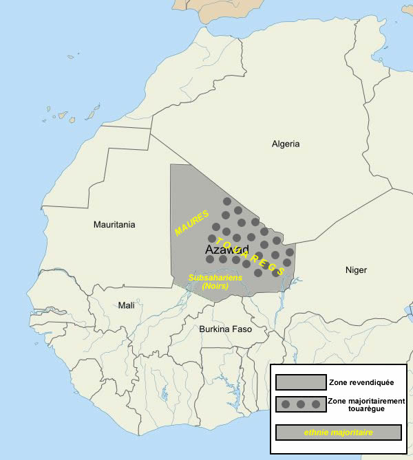






Geography and population
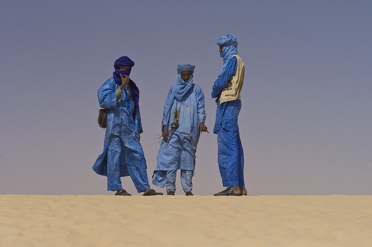
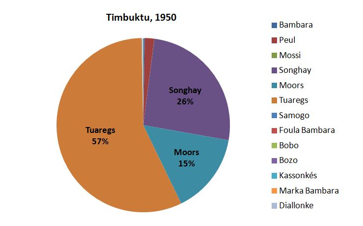
The territory commonly called Azawad is predominantly arid or semi-arid, combining desert plateaus, seasonal river valleys, and sparse savannah. Its surface area is large—on the order of several hundred thousand square kilometres—and it stretches across the northern extremes of Mali. The region is home to several ethnic groups, including Tuareg and Arab nomadic communities as well as settled populations such as the Songhai and Fulani. Major towns include Gao and Timbuktu (also written Tombouctou), with populations in the tens of thousands, and the more remote Kidal, which serves as a local centre for Tuareg communities.
History and the 2012–2013 crisis
Long-standing patterns of mobility, trade and seasonal herding have shaped the region, and Tuareg rebellions have recurred in the 20th and 21st centuries. In 2012 a coalition led by the National Movement for the Liberation of Azawad declared independence for Azawad. The announcement briefly removed those northern territories from Bamako's control, but rival Islamist groups soon contested the area. In early 2013 a French-led military intervention and subsequent Malian government actions regained control of major population centres. Since then, multiple peace initiatives and agreements have sought to address autonomy, security and governance, with mixed results.
Administration, economy and culture
Today the area is usually treated within Mali's regional framework and divided into the regions of Gao, Kidal and Timbuktu. Local economies rely on pastoralism, seasonal agriculture in riverine tracts, trade and small-scale salt extraction. Timbuktu's manuscript collections and historic mosques reflect a rich cultural heritage that has attracted scholarly interest and was recognised by international heritage bodies. Ongoing insecurity, however, has damaged cultural sites and limited tourism.
Notable facts and distinctions
- The name Azawad is commonly used in political and cultural contexts; it does not denote an internationally recognised sovereign state.
- Environmental conditions vary from Sahelian grasslands to near-desert; this affects livelihoods and settlement patterns.
- Conflicts since 2012 involved both separatist and Islamist actors, prompting international responses and peace negotiations.
Further information
Readers who wish to explore maps, regional studies or the details of recent agreements can consult specialist sources and summaries available through regional and international organisations. For general background on Mali and the northern provinces see Mali overview, discussions of the term's meaning at language sources, environmental context at Sahel and Sahara resources, and local administrative pages for Gao and Kidal.
Author
AlegsaOnline.com Azawad: northern Mali — geography, history, and significance Leandro Alegsa
URL: https://en.alegsaonline.com/art/134843