List of counties in Oklahoma
Overview of Oklahoma's 77 counties: their roles, organization, history, notable counties, and how to use and interpret county lists and codes.
Overview
The U.S. state of Oklahoma is divided into 77 counties. These civil subdivisions serve as primary local government units, carrying out state responsibilities at a regional level. Oklahoma is the 20th-largest state by area and, with 77 counties, ranks among states with a mid-range number of counties; see a formal list of counties for a complete enumeration.
Image gallery
1 Image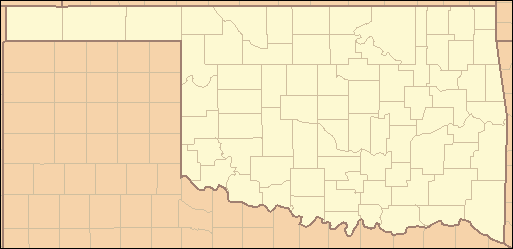
Characteristics and common features
Each county typically contains a county seat—an incorporated city or town where the courthouse and main administrative offices are located. Counties maintain public records, property deeds, tax assessments, local courts, and law-enforcement agencies led by elected officials such as a sheriff and a board of county commissioners. Counties also coordinate elections and deliver many social and infrastructure services.
Government and administration
County governments in Oklahoma are generally governed by a three-member board of commissioners, alongside other elected positions: sheriff, assessor, treasurer, clerk, and district attorney at the judicial district level. Counties implement state laws locally and manage budgets for roads, public health, and emergency services. For federal and interstate context, counties are part of the broader system of the United States local governance framework.
History and development
The present county map emerged around the time of statehood in 1907, when territories and tribal jurisdictions were reconfigured into a statewide county system. Many county names honor political figures, military leaders, or Native American heritage. Boundaries have been adjusted over time for administrative efficiency, population changes, and political decisions.
Notable counties and distinctions
Oklahoma County, home to the state capital region, and Tulsa County are the most prominent urban centers by population and economic activity. Osage County is notable for being the state's largest by land area. Counties vary widely—from urbanized, densely populated areas to large rural counties with sparse settlements. Counties are identified by names and by federal codes (FIPS) used for statistics and emergency planning.
Examples and how to use a county list
A representative sampling of counties includes the following:
- Oklahoma County
- Tulsa County
- Cleveland County
- Canadian County
- Comanche County
- Rogers County
- Wagoner County
- Creek County
- Payne County
- Osage County
- Garvin County
- Beckham County
For an authoritative alphabetical or coded state-level listing and maps, consult official state or archival resources. A complete roster gives county seats, FIPS identifiers, and formation dates; it is useful for genealogy, legal research, planning, and education.
Related articles
Author
AlegsaOnline.com List of counties in Oklahoma Leandro Alegsa
URL: https://en.alegsaonline.com/art/124627
Sources
- epa.gov : "EPA County FIPS Code Listing"
- naco.org : "NACo - Find a county"
- odl.state.ok.us : Oklahoma Encyclopedia Online
- odl.state.ok.us : Oklahoma Encyclopedia Online
- odl.state.ok.us : Oklahoma Encyclopedia Online
- odl.state.ok.us : Oklahoma Encyclopedia Online
- odl.state.ok.us : Oklahoma Encyclopedia Online
- odl.state.ok.us : Oklahoma Encyclopedia Online
- odl.state.ok.us : Oklahoma Encyclopedia Online
- odl.state.ok.us : Oklahoma Encyclopedia Online
- odl.state.ok.us : Oklahoma Encyclopedia Online
- odl.state.ok.us : Oklahoma Encyclopedia Online
- odl.state.ok.us : Oklahoma Encyclopedia Online
- odl.state.ok.us : Oklahoma Encyclopedia Online
- odl.state.ok.us : Oklahoma Encyclopedia Online