Counties of Washington (U.S. state): list, history and government
An overview of Washington state's 39 counties: their origin, administrative roles, notable counties, FIPS use, and a complete list of county names.
Overview
The U.S. state of Washington is divided into 39 counties. Counties are the primary administrative subdivisions of the state and provide local services such as public safety through sheriffs' offices, courts, property recording, public health programs, road maintenance, land use planning, and election administration. County boundaries and names are commonly used by residents, businesses, and state and federal agencies for legal, statistical and service-delivery purposes.
Image gallery
3 Images

Organization and government
Most Washington counties are governed by a board of county commissioners or supervisors who combine executive and legislative duties. Some counties operate under a charter that permits a different structure; for example, King County has a charter government with an elected county executive and a county council. County seats—cities that host the principal administrative offices and courthouses—serve as local centers of government. Counties vary widely in population, density and economic profile, from densely urban counties that include large cities to sparsely populated rural counties dominated by agriculture, forestry or public lands.
History and codes
The origin of counties in the region predates statehood: the first county organizations in what became Washington were created from previously unorganized territory in the mid-19th century. Washington was admitted to the Union in 1889 as the 42nd state following its development from Washington Territory. For statistical and administrative purposes, each county is assigned a Federal Information Processing Standard (FIPS) code, a unique numeric identifier used by federal agencies and the U.S. Census Bureau. Many county reference tables and data pages link to Census "quick facts" using those codes.
Notable counties
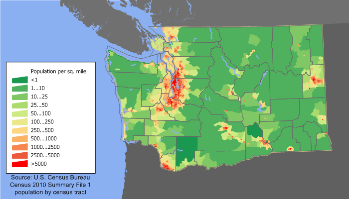
King County, which contains the city of Seattle, is the state's most populous county and a major economic center. Thurston County contains Olympia, the state capital. Other populous and economically significant counties include Pierce (Tacoma), Snohomish (Everett) and Spokane. Several counties on the eastern side of the state—such as Whitman (home to Pullman and Washington State University), Yakima and Benton—are important for agriculture. Island and San Juan counties are notable for their island geography; Okanogan and other eastern counties are among the largest by land area.
List of counties
Below is the complete list of Washington's 39 counties by name. For official county profiles and census information see the state's and federal references.
- Adams
- Asotin
- Benton
- Chelan
- Clallam
- Clark
- Columbia
- Cowlitz
- Douglas
- Ferry
- Franklin
- Garfield
- Grant
- Grays Harbor
- Island
- Jefferson
- King
- Kitsap
- Kittitas
- Klickitat
- Lewis
- Lincoln
- Mason
- Okanogan
- Pacific
- Pend Oreille
- Pierce
- San Juan
- Skagit
- Skamania
- Snohomish
- Spokane
- Stevens
- Thurston
- Wahkiakum
- Walla Walla
- Whatcom
- Whitman
- Yakima
For a tabular presentation that includes county seats, dates of creation, area, population and FIPS codes consult official resources and census profiles. See the state's county overview pages and federal data portals for authoritative statistics and downloadable tables: Washington state information and county lists county reference pages.
Questions and answers
Q: How many counties are there in the state of Washington?
A: There are 39 counties in the state of Washington.
Q: Where did Washington come from?
A: Washington came from the western part of Washington Territory.
Q: When was Washington admitted to the Union?
A: Washington was admitted to the Union as the 42nd state in 1889.
Q: When were the first counties in Washington created?
A: The first counties in Washington were created from unorganized territory in 1845.
Q: What is the Federal Information Processing Standard (FIPS) code used for?
A: The Federal Information Processing Standard (FIPS) code is used by the United States government to uniquely identify counties.
Q: Are the FIPS codes provided in the text?
A: Yes, the FIPS codes are provided with each entry in the table.
Q: What can the FIPS code links in the table point to?
A: The FIPS code links in the table point to U. S. Census "quick facts" pages for each county.
Related articles
Author
AlegsaOnline.com Counties of Washington (U.S. state): list, history and government Leandro Alegsa
URL: https://en.alegsaonline.com/art/124638
Sources
- wsulibs.wsu.edu : "Historical Timeline of Events Leading to the formation of Washington State"
- historylink.org : "Washington Counties"
- epa.gov : "EPA County FIPS Code Listing"
- naco.org : "NACo - Find A County"
- historylink.org : "Washington Territorial Legislature creates Sawamish (Mason) County on April 15, 1854"
- historylink.org : "Slaughter County is renamed Kitsap County on July 13, 1857"
- historylink.org : "Ferguson County is established on January 23, 1863"
- historylink.org : "Milestones for Washington State History -- Part 2: 1851 to 1900"