
Zira Tehsil — administration, geography and the 1947 boundary dispute
Zira Tehsil in Punjab, its administrative role and geography, and the tehsil’s involvement in the 1947 Radcliffe boundary controversy and subsequent diplomatic consequences.
Zira Tehsil is an administrative subdivision (tehsil) of the Punjab region with a small urban centre and surrounding agricultural villages. In South Asian administrative practice a tehsil is a subdistrict unit responsible for local land records, revenue collection and basic administration. Zira lies near the western edge of Indian Punjab and has historically been shaped by rural agriculture, market towns and transport links that connect it to larger district centres.
Image gallery
1 Image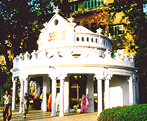
Location and characteristics
Geographically, Zira sits in the flat alluvial plains of Punjab, an area dominated by cereal and cotton crops and by irrigation networks. The tehsil contains a mix of villages and a central township that serves as a local commercial and administrative hub. Local economies in such tehsils typically rely on farming, small-scale trade and services linked to agriculture. Infrastructure patterns reflect the priorities of district administration: primary schools, basic health clinics and rural roads radiating from the principal town are common features.
Historical context to 1947
Under British rule, the districts and tehsils of Punjab were important units for census-taking, revenue collection and law-and-order administration. At the end of British India in 1947, drawing a new international frontier across Punjab became a major and contentious task. The boundary between the two new dominions was determined by a commission led by Sir Cyril Radcliffe. The process, often hurried and secretive, provoked confusion and strong reactions in several parts of Punjab.
The 1947 boundary controversy
Zira was one of the tehsils cited in accounts of the Partition boundary dispute. Contemporary reports and later historical accounts describe how early drafts of the Radcliffe award reportedly placed some western tehsils — including Zira and Ferozepur — on the Pakistan side, while the final published award allocated them to India. It has been reported that a draft description of the proposed boundary was conveyed to provincial officials before publication. Those developments led to fierce debate and public protest at the time.
Reactions and diplomatic aftermath
The change in allocation prompted protests from leaders in Pakistan; Muhammad Ali Jinnah and others described the outcome as unjust in their view. The circumstances of how early drafts were circulated and how the final award differed have been examined by historians as part of wider studies of the Partition. Officials linked to the high command and residency — including Mountbatten’s secretariat — appear in several accounts; for example, George Abell, who served as a secretary in that milieu, is mentioned in contemporary reporting and memoirs (George Abell). The broad international actors in the process included the nascent governments of India and Pakistan, and the decisions produced lasting political consequences for border management.
Legacy and notable facts
- Zira remains a functioning tehsil-level administrative unit and a local market centre in Punjab.
- The tehsil is frequently referenced in historical discussions of the Radcliffe Line because it illustrates how administrative subdivisions could be pivotal in boundary decisions.
- Some accounts note that disputes over allocations were addressed later through bilateral talks and administrative adjustments in the years after Partition; the episode contributed to ongoing India–Pakistan negotiations and the broader post-Partition legacy.
For readers seeking more detail about tehsils, the Partition and the principal figures involved, see the linked background resources on administrative units and the events of 1947. Further archival research and published histories provide more precise contemporaneous documents and analyses of how places like Zira were affected by one of the twentieth century’s most consequential boundary decisions.
Related topics: the broader Partition of India, the neighbouring tehsil of Ferozepur mentioned in many accounts, and the administrative roles of provincial governors and secretaries during the transition period.
Related articles
Author
AlegsaOnline.com Zira Tehsil — administration, geography and the 1947 boundary dispute Leandro Alegsa
URL: https://en.alegsaonline.com/art/110651
Sources
- pakistan.gov.pk : "Pakistan government website" · web.archive.org
- punjabrevenue.nic.in : "Punjab: Firozpur"