Walcheren: island region in Zeeland, the Netherlands
Walcheren is a former island in Zeeland, Netherlands — about 216 km² and roughly 114,000 inhabitants (2016). It includes Middelburg, Veere and Vlissingen and is noted for ports, coastal defenses and wartime history.
Overview
Walcheren is a coastal region in the southwest of the Netherlands that historically functioned as an island in the province of Zeeland. Today it is connected to adjacent land by dikes, dams and reclaimed terrain but still retains a distinct identity shaped by its maritime position on the North Sea and the mouth of the Scheldt estuary in the Netherlands. The area covers about 216 km² and had an estimated population of around 114,000 in 2016.
Image gallery
3 Images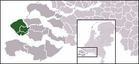


Geography and landscape
The terrain of Walcheren combines sandy beaches and dune ridges along the seafront with low-lying polders and channels inland. Its shoreline faces the Westerschelde estuary, the main deep-water approach to the port of Antwerp, which has influenced the island’s development as a transportation and trade corridor. Coastal defenses, sea walls and flood-management works are prominent features of the landscape.
Administration and towns
Walcheren is administered through several municipalities. The historic city of Middelburg serves as the provincial capital and cultural center. Other important towns are Veere, known for its historic harbor and townscape, and the port city of Vlissingen, which has ferry links and maritime services. The municipality of Veere preserves several tourist attractions and historic buildings.
History and notable events
Walcheren’s history spans medieval trade, coastal defence building and connectivity improvements that reduced its isolation. In the 20th century the island was heavily affected by conflict and flooding. Allied operations in 1944, often summarized as the Walcheren Campaign (Operation Infatuate), sought to open access to the Scheldt and resulted in breaches of sea defenses and extensive damage. The disastrous North Sea flood of 1953 further emphasized the need for robust flood protection and contributed to the nationwide Delta Works program.
Economy, transport and tourism
The local economy combines agriculture, fisheries, shipping and services linked to ports and logistics. Vlissingen’s harbour activity and ferry connections across the estuary are important for transport. Tourism is significant: visitors come for beaches, cycling routes, historic centers such as Middelburg and Veere, and maritime heritage. Small-scale industry and retail also serve local communities.
Distinctive features
- Former island status with strong maritime character and visible coastal engineering.
- Historic towns with preserved architecture and harbor-fronts attracting cultural tourism.
- Strategic location on the Scheldt estuary, affecting commerce and military history.
- Active flood management and landscape shaped by polders, dunes and dikes.
For practical information, travel options and municipal services consult local resources for Middelburg, Veere and Vlissingen, or provincial pages for Zeeland and national guidance via Dutch authorities.
Related articles
Author
AlegsaOnline.com Walcheren: island region in Zeeland, the Netherlands Leandro Alegsa
URL: https://en.alegsaonline.com/art/106192