Stepney: history, character, and redevelopment of an East London district
Stepney, in the London Borough of Tower Hamlets, grew from a medieval village around St Dunstan's. It became densely urban in the 19th century, suffered severe WWII damage, and was reshaped by post‑war redevelopment.
Overview
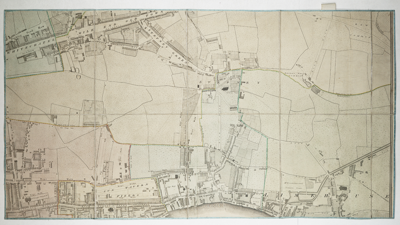
Stepney, often called Stepney Green, is a district in east London within the modern administrative area of the City of London region and the London Borough of Tower Hamlets. Historically a settlement beside the 15th‑century Mile End Road, Stepney developed from a village centered on the parish church of St Dunstan into a dense inner‑city neighbourhood. Its long history is visible in surviving Georgian squares, Victorian terraces and in the pattern of roads and estates that mark successive waves of growth and rebuilding.
Image gallery
10 Images


History
The area originated as a medieval parish whose boundaries extended beyond the original village around St Dunstan's. Stepney lay along an important east‑west route, the Mile End Road, and remained semi‑rural until the expansion of London accelerated after the 18th century. During the 19th century rapid industrialisation and housing development brought large numbers of workers to the East End, and Stepney became heavily urbanised. The district was known for its strong community networks but also for overcrowded housing and social hardship.
The 20th century brought dramatic change. Stepney was seriously affected by the air raids of the Second World War; more than a third of its housing stock was reported as completely destroyed during the Blitz, creating an acute post‑war housing crisis. In the 1950s and 1960s municipal slum clearance and large‑scale redevelopment replaced much of the older street pattern with new council housing, including tower blocks and planned estates.
Architecture and landmarks
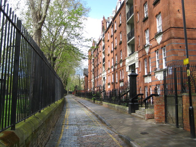
Despite intensive rebuilding, fragments of Stepney's older built environment survive. Small Georgian squares and terraces remain as reminders of the 18th‑ and early 19th‑century streetscape. Notable examples cited by local conservation advocates include Arbour Square and parts of the eastern side of Stepney Green, alongside rows around Matlock Street. Some of these areas are valued for their Georgian architecture and others for intact Victorian terraced housing.
- St Dunstan's church (historic parish church and focal point)
- Mile End Road (historic thoroughfare and commercial spine)
- Arbour Square (surviving Georgian square)
- Stepney Green park (public open space and local amenity)
Modern character and community
Today Stepney is a mixed neighbourhood. Waves of migration over two centuries have left a diverse population; historically Irish and Jewish communities were followed by later arrivals from South Asia and elsewhere. Many residents commute to central London, while local shops, markets and community organisations sustain a distinct East End culture. Redevelopment and rising housing costs have altered parts of Stepney, but community groups and heritage bodies have worked to protect surviving historic fabric and to document local memory.
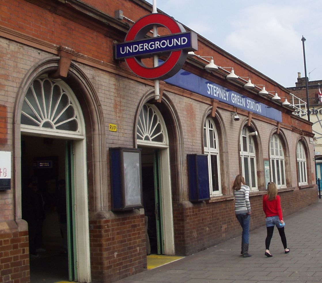
Transport links such as nearby Underground and bus services connect Stepney to wider London, and local initiatives focus on balancing housing need with conservation. The district's story—medieval parish, industrial expansion, wartime destruction and post‑war rebuilding—illustrates broader patterns in London's development and the continuing tensions between regeneration, social needs and historic preservation.
For further reading and maps consult local archives and borough resources via the links embedded above. These provide entry points to official histories, conservation area statements and community projects that document Stepney's changing landscape and social life.
Related articles
Author
AlegsaOnline.com Stepney: history, character, and redevelopment of an East London district Leandro Alegsa
URL: https://en.alegsaonline.com/art/93778
Sources
- books.google.com : The London Encyclopaedia, p 877
- timeout.com : "Hot neighbourhoods: Stepney, E1 – Time Out London"