Samegrelo-Zemo Svaneti (region of Georgia)
Samegrelo-Zemo Svaneti is a western Georgian region combining the lowland Mingrelia and mountainous Upper Svaneti. Capital Zugdidi; noted for Svan towers, Poti port, alpine peaks and cultural languages.
Overview
Samegrelo-Zemo Svaneti is an administrative region in western Georgia that brings together the historic lowland province of Samegrelo (Mingrelia) and the highland area known as Upper Svaneti. The region’s administrative center is Zugdidi, a regional city that serves as the main hub for government, services and transport. The territory spans coastal plains, river valleys and sections of the Greater Caucasus mountain range, producing a wide range of landscapes and climates within a relatively compact area.
Image gallery
5 Images


Geography and environment
The lowlands are part of the Colchis Plain, with fertile soils and a humid climate shaped by proximity to the Black Sea. In contrast, Upper Svaneti rises into the high Caucasus, where glaciers, alpine meadows and steep peaks define the terrain. Major rivers, including tributaries of the Rioni and the Enguri, cross the region. These diverse environments support agriculture in the lower elevations and alpine pastures, glacial landforms and mountain ecosystems at higher altitudes.
Administrative divisions
The region is organized into a mix of municipalities and cities that administer both urban and rural areas. Key subdivisions include:
- City of Poti
- Abasha Municipality
- Chkhorotsku Municipality
- Khobi Municipality
- Martvili Municipality
- Mestia Municipality (center of Upper Svaneti)
- Senaki Municipality
- Tsalenjikha Municipality
- Zugdidi Municipality
History and culture
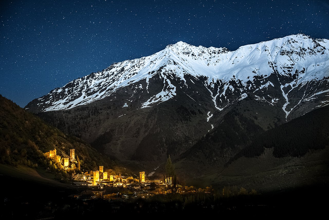
The area combines distinct historical identities. Samegrelo was long governed by the local Dadiani dynasty and developed its own Mingrelian (Megrelian) language and customs, while Svaneti preserved a mountain culture noted for defensive stone towers and medieval churches. The Svan and Mingrelian languages are part of the Kartvelian family and remain important markers of regional identity. Upper Svaneti is recognized for its concentration of medieval architecture and is often highlighted in discussions of Georgia’s cultural heritage.
Economy, transport and tourism
Economic activity varies by zone: coastal and lowland areas support agriculture (hazelnuts, maize, fruits and other crops), light industry and the port facilities at Poti, which link inland Georgia to the Black Sea. In the highlands, tourism—centered on trekking, mountaineering, winter sports and visits to historic villages—has grown, with villages such as Ushguli often mentioned as among Europe’s highest permanently inhabited settlements. Infrastructure needs and seasonal access remain practical challenges in the mountain districts.
Notable facts and location
Samegrelo-Zemo Svaneti contains dramatic altitude contrasts, from Black Sea-influenced plains to peaks that are part of the Greater Caucasus. Some of Georgia’s highest summits and glaciated valleys lie here, giving the region ecological and recreational importance. Its position also places it near politically sensitive borders: to the north the Greater Caucasus reaches the Russian border, and to the northwest the region faces the territory of Abkhazia, a subject of geopolitical dispute. Geographic coordinates commonly used for the region’s central area are 42°30′N 41°51′E, which illustrate its location in western Georgia.
Related articles
Author
AlegsaOnline.com Samegrelo-Zemo Svaneti (region of Georgia) Leandro Alegsa
URL: https://en.alegsaonline.com/art/86669