Oklahoma Panhandle
A narrow western extension of Oklahoma composed of three counties; covers its geography, history, economy, and notable distinctions.
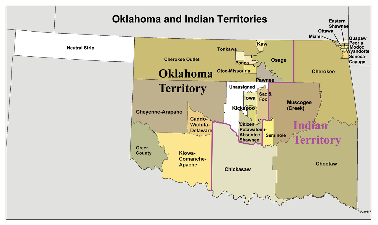
The Oklahoma Panhandle is a narrow strip of land projecting from the far western edge of the state of Oklahoma. Roughly 166 miles long and only about 34 miles wide at its widest, the Panhandle is distinct from the rest of the state because of its shape, low population density, and High Plains environment. Its informal name refers to a resemblance to a handle on a cooking pan, a comparison often used in maps and descriptions.
Image gallery
4 Images

Geography and counties
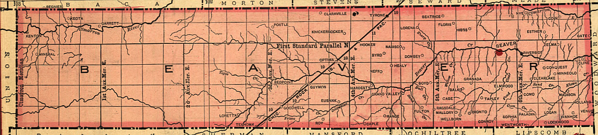
The region lies on the southern edge of the High Plains and is characterized by flat to rolling terrain, semi-arid climate, and grassland used for grazing and dryland farming. It contains three counties:
- Cimarron County – the westernmost county, bordering Colorado and New Mexico.
- Texas County – the central and most populous county in the Panhandle.
- Beaver County – the easternmost Panhandle county, adjoining Kansas.
History and development
During the 19th century the area was known as "No Man's Land" because it was not attached to any state or territorial government after certain borders were established. It was organized as part of Oklahoma Territory late in the territorial era and then admitted with the rest of the territory when Oklahoma became a state in 1907. Settlement patterns were shaped by cattle ranching, the arrival of homesteaders, and periodic droughts that influenced land use.
Economy, population and uses
Today the Panhandle remains largely rural. Agriculture—especially cattle ranching and the cultivation of wheat, sorghum and other dryland crops—dominates land use. There is also some energy production and local services centered on small towns; Guymon in Texas County is the region’s largest city and economic hub. Population densities are low compared with most of the state.
Notable facts and distinctions
A few features make the Panhandle notable: it is one of the most rectangular and isolated parts of any U.S. state, it spans two time zones (the far west observes Mountain Time while most of the state uses Central Time), and it has a unique legal and territorial history tied to the settlement of the American West. For further maps and resources, see related state and county pages linked above.
Related articles
Author
AlegsaOnline.com Oklahoma Panhandle Leandro Alegsa
URL: https://en.alegsaonline.com/art/72224