Muzaffarabad District
Muzaffarabad District is a mountainous administrative district in Pakistan-administered Kashmir, centered on the city of Muzaffarabad on the Jhelum and Neelum rivers and serving as a regional capital.
Overview
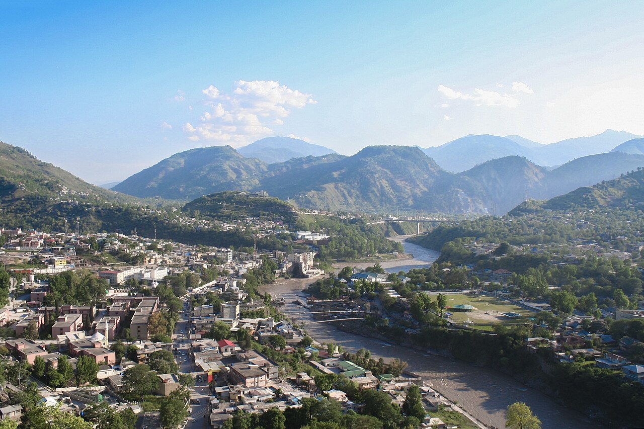
Muzaffarabad District lies in the northern part of Pakistan-administered Kashmir. The district follows the valleys of the Jhelum and the Neelum rivers and contains the city of Muzaffarabad, which serves as the capital of Azad Jammu and Kashmir. It is an administrative unit within the larger state-like territory that is often described in connection with Pakistan and the broader Kashmir region; an overview entry about the district may be found at Muzaffarabad district.
Image gallery
2 Images
Geography and boundaries
The district covers a largely mountainous area characterized by narrow river valleys, steep slopes and high ridges. Official summaries have reported an area of about 6,117 square kilometres. Muzaffarabad District borders areas administered by India to the east (including the districts of Kupwara and Baramulla) and Neelum District to the northeast; its western approaches lead into the plains and plateaus of Pakistan. Elevation, river corridors and climate create a mix of temperate valley climates and colder alpine conditions at higher elevations.
Administration and population
Administratively the district is subdivided into several local units: it is reported to contain three tehsils and some fifty-one union councils, with Muzaffarabad city functioning as the principal urban and governmental centre. Census material from the late 1990s recorded a population in the hundreds of thousands; demographic change since then has been influenced by natural growth, migration and the effects of natural disasters.
History and notable events
The district's history is tied to the broader history of Kashmir, with local settlements developing along river valleys for trade, agriculture and strategic passage. In recent decades Muzaffarabad became widely known internationally after a major earthquake in 2005 caused extensive damage across the city and surrounding areas; reconstruction and rehabilitation efforts have been an important part of the district's recent development. The district was formerly treated as part of the Muzaffarabad Division in older administrative arrangements.
Economy, society and environment
The local economy combines public administration, services, small-scale agriculture, forestry, and tourism. Rivers and steep terrain offer hydropower and irrigation potential, while scenic valleys attract visitors for trekking and nature tourism. Languages commonly spoken in the area include Kashmiri, Pahari and Hindko alongside Urdu; cultural life reflects Kashmiri traditions, rural village communities and the role of Muzaffarabad as a political and economic hub.
Significance and contemporary issues
Muzaffarabad District occupies a strategic and symbolic position in the Kashmir region. Its river corridors, transport links and administrative institutions make it a focal point for governance in the territory. Contemporary challenges include seismic risk management, sustainable development in mountain environments, infrastructure improvement and balancing tourism with environmental conservation. For further administrative or geographic references see the neighbouring Neelum District and related regional entries at Muzaffarabad district and other overview pages (Pakistan, Jhelum).
- Principal rivers: Jhelum, Neelum
- Administrative centre: Muzaffarabad city (Azad Jammu and Kashmir)
- Adjacent district: Neelum District
Related articles
Author
AlegsaOnline.com Muzaffarabad District Leandro Alegsa
URL: https://en.alegsaonline.com/art/67860