
Kerguelen Plateau
A large volcanic underwater plateau in the southern Indian Ocean, formed by hotspot activity and partly emergent as islands; important for geology, oceanography and subantarctic ecosystems.
Overview
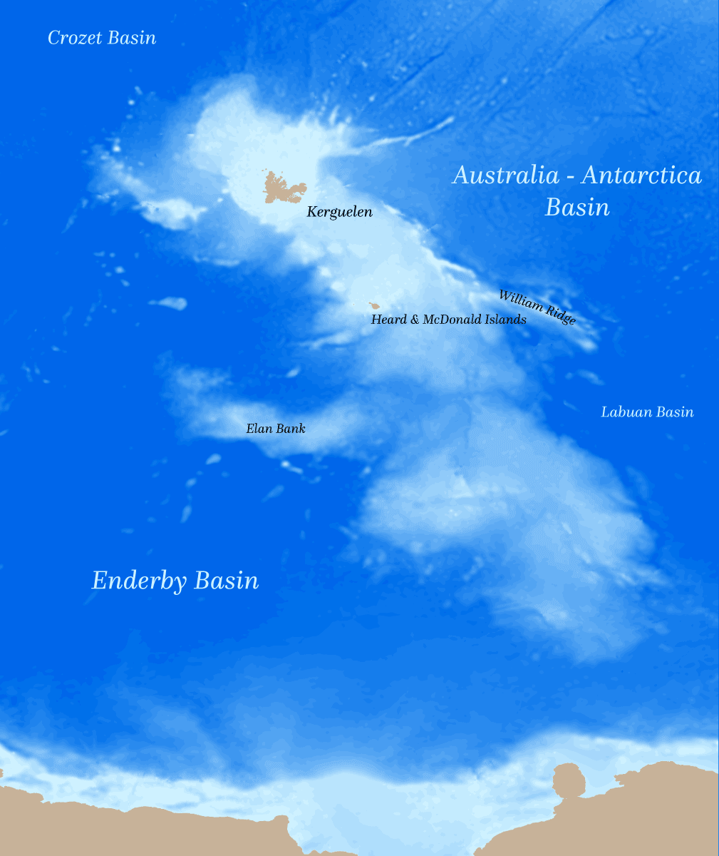
The Kerguelen Plateau is a vast submerged volcanic plateau in the southern Indian Ocean. It is often described as an oceanic microcontinent because of its size and the thickness of its crust. The plateau covers roughly a million square kilometres—about three times the area of Japan—and rises above the surrounding seafloor to form several island groups.
Image gallery
5 Images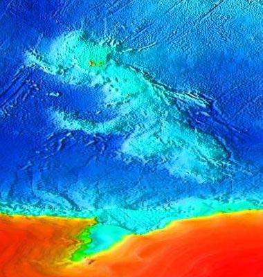

Geology and formation
The plateau was built by prolonged volcanic activity associated with the Kerguelen hotspot. Activity began in the Mesozoic, after breakup events related to the fragmentation of Gondwana, and continued episodically through the Cenozoic. The result is an elevated region of thickened oceanic crust and volcanic deposits overlain in places by sediment.
Geography and surface expressions
Parts of the Kerguelen Plateau reach sea level and form islands. The best known emergent areas are the Kerguelen Islands (a French territory) and the Heard Island and McDonald Islands (administered by Australia). These islands display active or recent volcanism and rugged, glaciated terrain in the subantarctic climate.
Characteristics and significance
- Volcanic origin: large basaltic eruptions produced thick crustal sequences.
- Microcontinental traits: crustal thickness and composition differ from normal oceanic plateaus, giving the plateau some continental-like features.
- Oceanographic influence: the elevation affects local currents, upwelling and marine productivity.
Biological and scientific importance
The emergent islands and the surrounding marine environment host specialised subantarctic flora and fauna, nesting seabirds and rich marine communities sustained by nutrient upwelling. Scientific interest includes studies of plate tectonics, large igneous provinces, paleoclimate reconstructions and modern ecosystem dynamics. Research expeditions and remote sensing continue to refine the plateau's geological history and role in Southern Ocean systems.
Notable facts and human context
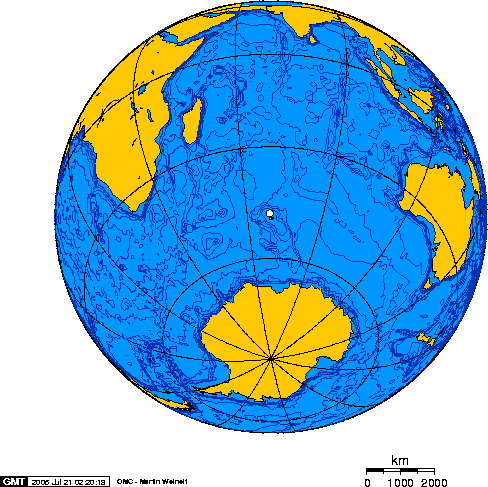
Although remote, the plateau features in territorial considerations and scientific cooperation. It lies relatively near Australia in the broad sense of proximity in the southern hemisphere. Volcanism on parts of the plateau has been intermittent into recent geological times, and seafloor mapping and drilling programs have helped characterise its structure. For more technical resources and maps see specialist publications and institutional databases (plateau overview). Additional general references and datasets are available through marine research portals and national polar research agencies (geological summary, hotspot studies, territorial information).
Related articles
Author
AlegsaOnline.com Kerguelen Plateau Leandro Alegsa
URL: https://en.alegsaonline.com/art/53010