Jarvis Island — uninhabited U.S. coral island in the South Pacific
Jarvis Island is an uninhabited U.S. coral island near the equator, historically mined for guano and now managed for wildlife. It has no fresh water, minimal vegetation, and a history of brief occupation and wartime activity.
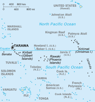
Jarvis Island is a small, uninhabited coral island in the central South Pacific Ocean that is administered by the United States. It forms part of the United States Minor Outlying Islands and lies close to the equator. Although compact in size and lacking permanent residents, Jarvis has a distinctive environmental character and an eventful human history that includes 19th‑century resource extraction, early 20th‑century shipwrecks, temporary settlement for weather and aviation purposes, and wartime actions in the Pacific theater. Today it is maintained as a protected area and habitat for seabirds and other wildlife. For an official reference to ownership see Jarvis Island overview and to its national status visit U.S. administration.
Image gallery
10 Images


Geography, climate and landscape
Jarvis is a low, flat coral island formed from an uplifted reef and surrounded by fringing coral. It is located about 25 miles south of the equator and has no significant elevation; the highest ground is only a few meters above sea level. The island has no natural, reliable freshwater sources and receives relatively little rainfall for a tropical location, giving it a hot, windy, and arid seaside climate often described as a tropical desert. Soils are thin and saline in parts, and wave action, storms, and sea spray strongly shape the shoreline. Because natural harbors are absent and offshore coral reefs ring the island, landing by sea is difficult; historical attempts to improve access included explosives to clear portions of reef to allow ships to anchor.
Plants, animals and ecological role
Vegetation on Jarvis is sparse and low-growing: grasses, vines, salt-tolerant shrubs and herbaceous plants adapted to drought and salt spray dominate the surface. The island serves primarily as nesting, roosting and foraging habitat for seabirds and marine life rather than supporting larger terrestrial fauna. Seabird colonies, shorebirds, and marine reptiles historically used the island for breeding. The island’s relative isolation and absence of permanent human habitation have made it important for conservation of seabird populations and as a reference site for studies of undisturbed tropical island ecosystems.
Human history and economic uses
Jarvis came to wider attention in the 19th century because of guano — the accumulated droppings of seabirds valued as a fertilizer. American claims to many remote islands for guano extraction were enabled by the Guano Islands Act of 1856, and Jarvis was subsequently claimed and brought under U.S. control in the mid‑19th century; see the legal background at Guano Islands Act and a dated annexation reference at 1858 claim. Mining operations were intermittent, and crews lived briefly on the island while extracting deposits before the guano resources were exhausted or operations were abandoned.
Maritime incidents and short‑term occupations punctuate Jarvis’s modern history. In 1913 the sailing vessel Amaranth ran aground on Jarvis’s southern shore; observers at the time reported wooden structures remaining from earlier occupations. In the 1930s the U.S. established a small, temporary settlement known as Millersville to operate a weather station and to prepare for an airfield and occasional aircraft landings. During World War II the island was shelled in 1942 and the personnel were evacuated; afterward there was no return to permanent habitation.
Conservation, management and present status
Jarvis is currently treated as a protected area. The United States manages it for conservation, restricting access to protect wildlife and fragile habitats. It is administered along with other remote islands under federal conservation programs and is part of broader efforts to preserve Pacific island ecosystems and migratory bird populations. Scientific expeditions and occasional management visits are the primary human presence today, conducted under permits and with the aim of monitoring wildlife, removing debris, and maintaining historical records.
Characteristics and notable facts
- Location: central South Pacific, about 25 miles south of the equator; part of the U.S. Minor Outlying Islands — see territorial grouping.
- Geology: low coral island/reef structure with fringing reefs, vulnerable to storms and sea level changes.
- Climate: tropical with low rainfall (often characterized as a tropical desert), high temperatures, strong trade winds, and intense sun.
- Fresh water: none permanent or reliable; historically a key factor limiting permanent settlement.
- Human use: historic guano mining under the Guano Islands Act, short‑term weather and aviation facilities in the 1930s, and wartime evacuation in 1942.
Timeline summary
- Mid‑19th century: Claimed for guano extraction under the Guano Islands Act; U.S. control established in the 1850s–1858 period.
- Late 19th to early 20th century: Periodic guano mining and transient camps; occasional shipwrecks reported near the island.
- 1913: Ship Amaranth wrecked on the southern shore, contemporary accounts noted remaining structures.
- 1935: Short‑term settlement (Millersville) and weather station established; airfield planning conducted.
- 1942: Japanese naval action in the region and evacuation of the island’s caretakers.
- Late 20th century to present: Managed as a wildlife refuge and protected marine area; access restricted to scientific and management missions.
Further details about Jarvis’s legal status, ecological surveys, and historical records are available through official resources and scientific reports; for more information see general references on U.S. remote islands and conservation programs at historical claims and guano history, or consult administrative summaries at Jarvis Island overview and U.S. administration.
Related articles
Author
AlegsaOnline.com Jarvis Island — uninhabited U.S. coral island in the South Pacific Leandro Alegsa
URL: https://en.alegsaonline.com/art/49581
Sources
- cia.gov : "Jarvis Island" at CIA World Factbook