
United States Minor Outlying Islands
Collective name for nine small U.S. territories in the Pacific and Caribbean, mostly uninhabited, administered separately, and notable for wildlife protection, strategic uses, and large maritime zones.
Overview
The United States Minor Outlying Islands is a statistical grouping used to identify nine small insular territories of the United States. The grouping is referenced in official and statistical sources as a way to treat these widely separated places together for data and coding purposes (grouping). The islands lie either in the central Pacific or in the Caribbean and are administered individually rather than as a single political unit.
Image gallery
4 Images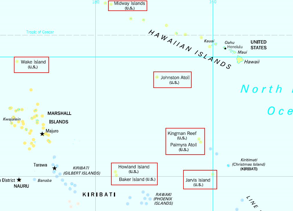
Composition and geography
The group comprises seven atolls and coral islands in the Pacific and one island in the Caribbean. The Pacific components lie far from continental landmasses and are surrounded by very large exclusive economic zones; the Caribbean member is located near Hispaniola. The principal named territories are:
- Baker Island
- Howland Island
- Jarvis Island
- Johnston Atoll
- Kingman Reef
- Midway Atoll
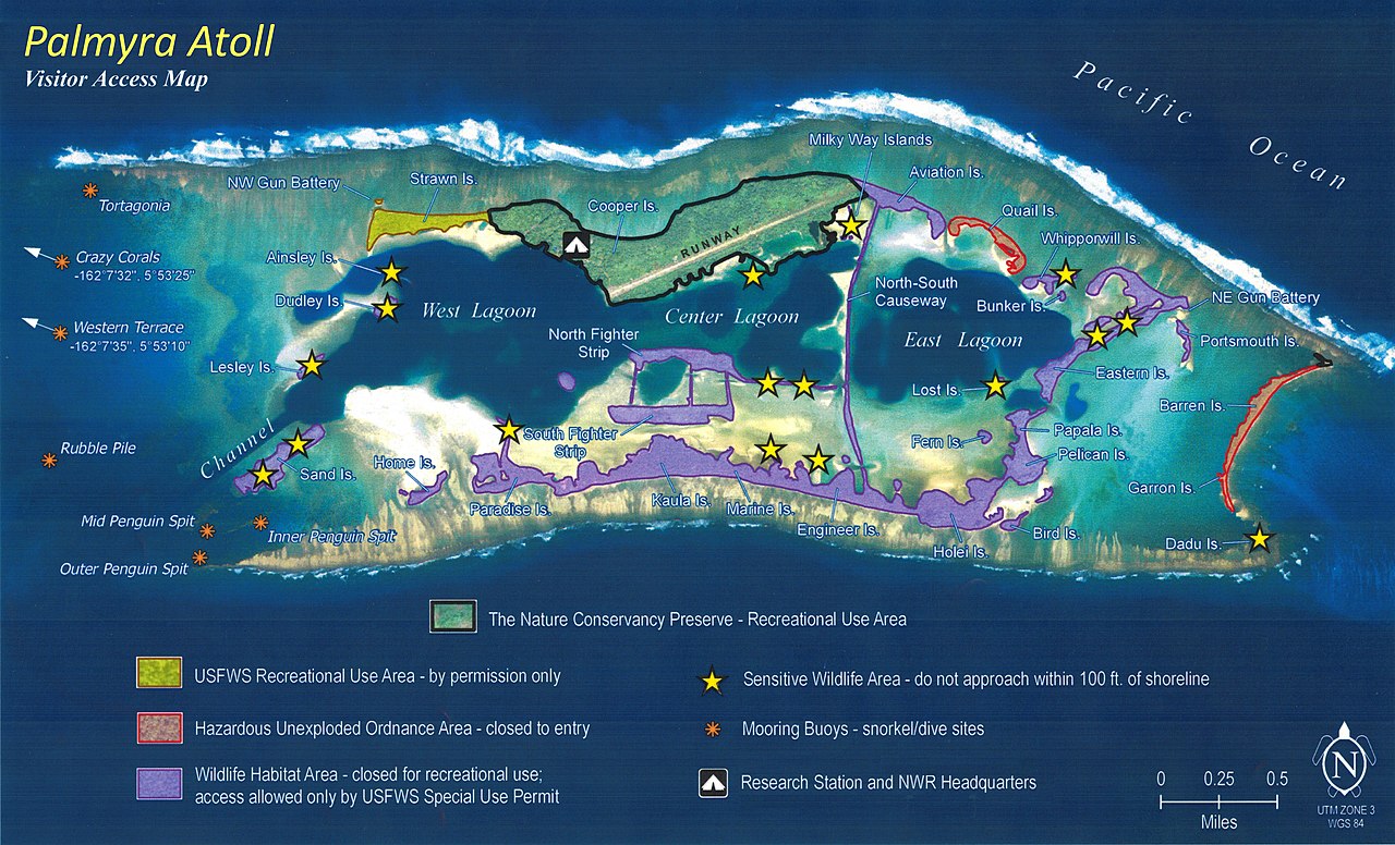
- Palmyra Atoll (unique in legal status among the group)
- Wake Island
- Navassa Island
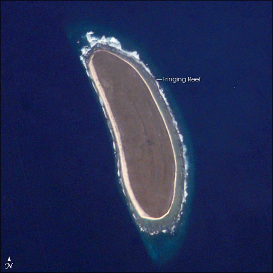
Most Pacific members are ringed by coral and lack permanent freshwater sources; the Caribbean member sits on a different marine shelf and has its own local ecology. The Pacific sites are widely dispersed across the central Pacific Ocean, while Navassa Island lies in the Caribbean Sea.
Status, governance and codes
These territories are not administered together and have varying legal and administrative arrangements. Many are uninhabited and are managed by federal agencies for conservation or limited military purposes. The set is identified in international coding systems: ISO 3166-1 assigns the alpha-2 code UM for the group. Earlier ISO groupings and codes applied differently in past decades; for example, several Pacific islands were once listed under a different code (PU), reflecting changes in how the territories were grouped for statistical use.
Human presence and history
None of the islands have a permanent indigenous population in modern times; historical records noted limited or temporary habitation in certain periods (indigenous and related census entries). The United States carried out a colonization effort of some islands during the 1930s known as the American Equatorial Islands colonization project; that initiative and related settlement attempts are sometimes described as a colonization scheme that sought to settle Americans on remote islets. Those settlements and others were interrupted by global events such as World War II, and later wartime activity led to evacuation of civilians and expanded military use.
Census records have occasionally registered transient populations connected to military or scientific missions. For example, the United States census counted personnel at some locations in specific years; historical tabulations include entries from the 2000 census and earlier, including a 1940 enumeration referenced in archival material (1940 census). In most modern years civilians have not lived on these islands permanently.
Uses, conservation and notable facts
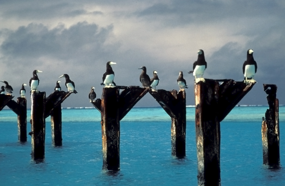
The islands are important for seabird colonies, nesting sea turtles, coral habitats and other sensitive ecosystems; many have been set aside as wildlife refuges or designated conservation areas. Several of the Pacific sites form parts of broader marine conservation efforts to protect reef and pelagic habitats, and the large exclusive economic zones that surround them are relevant for fisheries and research (statistical and environmental reporting often note these zones).
Today human activity is typically limited to short-term scientific research, refuge management, or periodic military operations. The combined group serves mainly as a legal and statistical convenience to identify these small, scattered territories while recognizing their ecological importance and occasional strategic roles.
Further reading and official references are available through agency pages and legal codifications that document the islands' histories, management, and international coding (official grouping, ISO entry UM and earlier ISO listing PU).
Questions and answers
Q: What are the United States Minor Outlying Islands?
A: The United States Minor Outlying Islands are nine island territories of the United States, including Baker Island, Howland Island, Jarvis Island, Johnston Atoll, Kingman Reef, Midway Atoll, Palmyra Atoll and Wake Island in the Pacific Ocean; and Navassa Island in the Caribbean Sea.
Q: Are these islands administered together?
A: No, they are not administered together. They are grouped together for statistical reasons only.
Q: Is there a permanent human population on any of these islands?
A: As of 2008, none of the islands have any people living there permanently. The only human population consists of temporarily stationed scientific and military personnel.
Q: How many people were counted on Johnston Atoll during the 2000 census?
A: During the 2000 census 315 people were counted on Johnston Atoll.
Q: Was there ever an indigenous population on any of these islands?
A: There has been no modern indigenous population except at the 1940 census. In 1936 a colonization scheme began to settle Americans on Baker, Howland and Jarvis but all three islands were evacuated in 1942 because of World War II.
Q: What is the ISO 3166-1 alpha-2 code for all these islands collectively?
A: All these islands are collectively represented by the ISO 3166-1 alpha-2 code UM. From 1974 until 1986 five of them (Baker Island, Howland Island, Jarvis Island, Palmyra Atoll and Kingman Reef) were grouped under the term "United States Miscellaneous Pacific Islands" with ISO 3166 code PU while Midway Atoll was MI , Johnston Atoll was JT , and Wake Island was WK .
Q: Are these island surrounded by large Exclusive Economic Zones?
A Yes they are surrounded by large Exclusive Economic Zones
Related articles
Author
AlegsaOnline.com United States Minor Outlying Islands Leandro Alegsa
URL: https://en.alegsaonline.com/art/103074
Sources
- census.gov : US Census 2000 Population Summary
- doi.gov : "Office of Insular Affairs: Baker and Howland Islands - History"
- doi.gov : "Office of Insular Affairs: Jarvis Island - History"
- nga.mil : "NGA.mil" · web.archive.org
- fws.gov : "Presidential Proclamation 8336"
- fdsys.gpo.gov : "Weekly Compilation of Presidential Documents: Monday, January 12, 2009 Volume 45—Number 1, Page 14"
- doi.gov : "Office of Insular Affairs: Johnston Island - History"
- fws.gov : "Executive Order 13022: Administration of the Midway Islands"
- elips.doi.gov : "Department of the Interior: Secretary's Order #3223"
- elips.doi.gov : "Department of the Interior: Secretary's Order #3224"
- elips.doi.gov : "Department of the Interior: Secretary's Order #3210"