
Allahabad District (Prayagraj): Geography, Administration, History and Culture
District in Uttar Pradesh centered on the city of Allahabad (Prayagraj). Covers the Sangam confluence, administrative divisions, history, education, economy, festivals and notable facts.
Overview
Allahabad District, officially referred to in recent years as Prayagraj District, is a prominent administrative district in the state of Uttar Pradesh in India. The district is anchored by the city of Allahabad (Prayagraj), which serves as its administrative headquarters and as a regional centre for government, education and transport. Historically and culturally important, the district combines urban centres with agricultural plains of the larger Gangetic basin.
Image gallery
5 Images


Geography and the sacred confluence
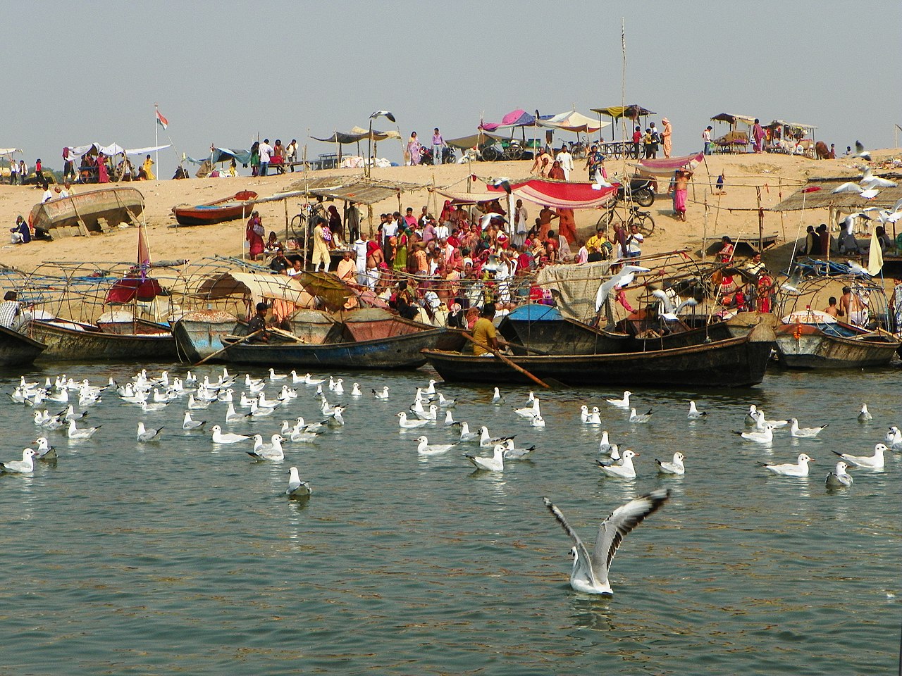
One of the district's defining features is the confluence or Sangam where the Ganges and the Yamuna rivers meet; traditional belief also recognizes a mythical third stream, the Sarasvati. The Sangam is a major pilgrimage destination and a focal point for ritual bathing and ceremonies. The district lies within the fertile Gangetic plain and its landscape and river systems have shaped agriculture, settlements and transport routes for centuries.
Administration and divisions
The district is organised into several subordinate administrative units. As an administrative entity it falls under the wider Allahabad Division alongside neighbouring districts. Local government is arranged through tehsils and blocks: as recorded in the 2011 census period there were 20 development blocks grouped into eight tehsils. Major tehsils include:
- Phulpur
- Koraon
- Meja
- Sadar
- Soraon
- Handia
- Bara
- Karchana
Periodic reorganisation of districts and boundaries has altered the district's extent; portions of western Allahabad were separated to form or augment the neighbouring Kaushambi district during administrative changes.
History and notable sites
Allahabad has a long recorded history and has been an important centre under various empires and administrations. Under British rule it served as a provincial administrative centre at times and retained political importance into the twentieth century. Several historic sites survive in the district: forts, colonial-era buildings and residences associated with prominent political families. These monuments, together with riverfront ghats, attract scholars, tourists and pilgrims.
Education, economy and infrastructure
The district is an established educational hub with a concentration of higher-education institutions and professional colleges. Notable centres include the University of Allahabad and technical and medical institutions such as the Moti Lal Nehru National Institute of Technology and various degree and professional colleges. These institutions draw students from across the region and contribute to a scholarly atmosphere.
Economically, the district combines urban services and industry with a rural agricultural base; crops typical of the Gangetic plains and small-scale manufacturing coexist with trading, transport and education-related services. The city of Allahabad is a transport junction with road and rail connections linking it to other parts of the state and country.
Culture, festivals and significance
Culturally, the district is best known for large religious gatherings held at the Sangam. The Kumbh Mela, in its full and intermediate forms, brings millions of pilgrims for ritual bathing and ritual observances; such events have major religious, social and logistical significance. Local religious traditions, fairs and pilgrimages play an ongoing role in the civic life of the district.
Distinctive facts and contemporary context
Today the district's dual identity as both an administrative region and a major pilgrimage centre shapes policy, planning and daily life. The 2018 formal adoption of the name Prayagraj for the city highlighted longstanding cultural connections to the sacred confluence. Administrators balance heritage conservation, infrastructure needs and the seasonal pressures created by mass pilgrimages. For further administrative details and local resources consult official district pages or regional guides.
Note: This article uses widely known facts about the district, its geography and institutions. For maps, demographic statistics and official notices see the appropriate government or municipal resources.
Questions and answers
Q: What is Allahabad District?
A: Allahabad District, also called Prayagraj District, is one of the major and largest districts of Uttar Pradesh state of India, and Allahabad city is the district headquarters.
Q: What is Allahabad Division?
A: Allahabad Division includes the districts of Fatehpur, Kaushambi, and Allahabad, with the western Allahabad District becoming part of the new Kaushambi district.
Q: How many blocks are there in Allahabad District?
A: As of 2011, there are 20 blocks in eight tehsils in Allahabad District.
Q: What are the administrative divisions of Allahabad District?
A: The administrative divisions of Allahabad District are Phulpur, Koraon, Meja, Sadar, Soraon, Handia, Bara, and Karchana.
Q: What is Sangam in Allahabad District?
A: The point where the three rivers of India - Ganges, Yamuna, and the mythical river of Sarasvati - meet is known as Sangam in Allahabad District. It is considered holy by Hindus.
Q: What is the significance of Allahabad in terms of education?
A: Allahabad is one of the largest educational hubs in India with many major educational institutes such as the Indian Institute Of Information Technology, Moti Lal Nehru National Institute Of Technology, University Of Allahabad, CMP Degree College, Ewing Christian College, and Gautam Buddh Technical University affiliated number of Engineering Colleges, MotiLal Nehru Medical College, JK Institute - these provide higher education.
Q: Was Allahabad once the capital of United Province?
A: Yes, Allahabad was once the capital of United Province before independence.
Related articles
Author
AlegsaOnline.com Allahabad District (Prayagraj): Geography, Administration, History and Culture Leandro Alegsa
URL: https://en.alegsaonline.com/art/2737
Sources
- districtcourtallahabad.up.nic.in : "Development Blocks under Tehsils"
- books.google.com : Village Development Planning
- books.google.com : Co-operative Credit in Rural India: A Study of Its Utilisation
- exploreallahabad.com : "Maps, Tahsils and villages of Allahabad"
- census2011.co.in : "District Census 2011"
- cia.gov : "Country Comparison:Population"
- 2010.census.gov : "2010 Resident Population Data"
- articles.timesofindia.indiatimes.com : "Allahabad has highest literacy rate in region"