
Chicago Riverwalk
A pedestrian waterfront promenade along the south bank of the Chicago River in downtown Chicago, offering public space, dining, boating access, and views of the city's architecture.
The Chicago Riverwalk is a publicly accessible, linear waterfront promenade on the south bank of the main branch of the Chicago River in downtown Chicago, Illinois. Stretching east–west from the area near Lake Shore Drive toward Franklin Street, the Riverwalk is often described as the city's "second lakefront" because it creates continuous pedestrian access to the water and connects streets, bridges, and civic destinations.
Image gallery
6 Images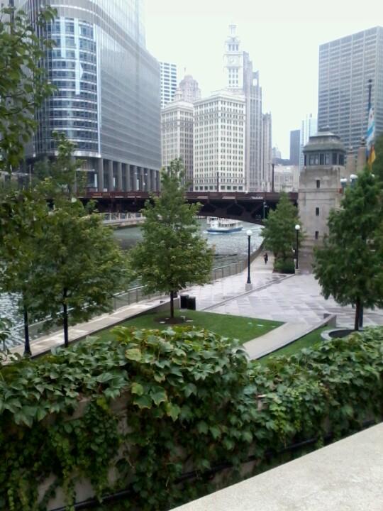


Design and features
The Riverwalk combines paved promenades, terraced seating, landscaped plazas and small pocket parks. Amenities typically found along the route include cafés and restaurants, public art and interpretive signage, kayak and small-boat access points, and mooring for tour boats. The design emphasizes sightlines to Chicago's skyline and the waterfront while providing places to sit, eat and socialize. In warm months the Riverwalk is a popular spot for both workers from nearby offices and families seeking outdoor space close to the Loop.
History and development
Plans to improve the river edge date from the late 20th century, with major redevelopment undertaken in phases during the early 21st century. The transformation sought to reclaim the riverfront for pedestrians after decades when much of the shoreline was devoted to traffic and industrial uses. Construction and design work proceeded in stages, expanding available public space and adding new bridges, terraces and landscaping.
Uses and significance
Today the Riverwalk functions as a recreational corridor, an informal civic gathering place and a component of Chicago's tourism infrastructure. It supports dining and retail that face the river, hosts seasonal programming and provides access for small watercraft and sightseeing vessels. The corridor enhances urban biodiversity in planted areas and contributes to stormwater management in some sections.
Notable facts and visitor information
- The Riverwalk is accessible from multiple downtown streets and connects to pedestrian and transit routes, making it a convenient extension of the Loop's public realm.
- Different segments of the Riverwalk have distinctive names and design themes, from more active restaurant zones to quieter green spaces for relaxation.
- Seasonal businesses and events change through the year; visitors are advised to check local resources for current offerings and boat schedules.
For maps, event listings and management information, consult official city resources and local visitor guides. Additional background on the river and related projects is available through sources that cover the riverfront and urban design initiatives, municipal planning pages and regional tourism materials. Related topics include the broader history of the Chicago River corridor and waterfront planning across downtown Chicago.
Related articles
Author
AlegsaOnline.com Chicago Riverwalk Leandro Alegsa
URL: https://en.alegsaonline.com/art/19526
Sources
- featuresblogs.chicagotribune.com : "Cityscapes: City's second waterfront: Riverwalk improved, but hurdles remain"
- cityofchicago.org : "Chicago Riverwalk"