Breithorn — Pennine Alps mountain on the Swiss–Italian border
Breithorn is a glaciated massif in the Pennine Alps on the Switzerland–Italy border, known for its accessible 4,000‑metre summits and popular glacier routes from the Klein Matterhorn and surrounding valleys.
Overview
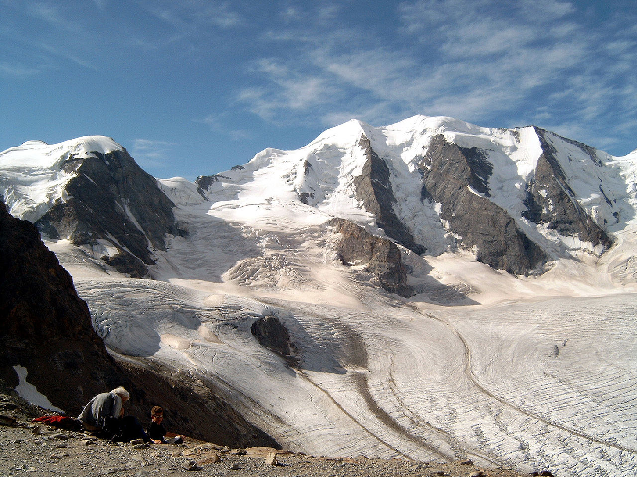
The Breithorn is a compact mountain massif of the Pennine Alps straddling the international frontier between Switzerland and Italy. The range takes its name from its highest top, commonly referred to as the Breithorn (Western Summit). It lies on the main Alpine ridge roughly between the iconic Matterhorn to the west and the Monte Rosa group to the east, and sits near the Theodul Pass. The massif is heavily glaciated and presents as a short east–west crest of several closely spaced summits.
Image gallery
8 Images


Geography and key features
The Breithorn forms a compact, snowy crest that rises above high glacier basins. Its summits are often climbed in sequence as part of a single excursion across firm snow and blue-ice slopes. The mountains offer broad views of surrounding peaks and valleys and are visible from alpine settlements in both countries. The nearest notable settlements providing access to the massif are Zermatt on the Swiss side and St‑Jacques in the Aosta Valley; Zermatt lies in the canton of Valais.
Climbing, access and typical routes
The Breithorn is well known among mountaineers for being one of the more accessible of the Alps' 4,000‑metre summits, which has made it a common choice for guided groups and for acclimatisation climbs. The usual approach begins from high cable‑car stations on the Swiss side, which reduce the altitude gain required and give direct access onto the glacier. Climbs typically follow a straightforward snow and ice route across crevassed terrain; although technical rock climbing is minimal on the normal line, travel on glacier requires proper equipment and avalanche and crevasse awareness.
- Typical equipment: crampons, ice axe, rope for glacier travel, warm clothing and navigation aids.
- Typical hazards: crevasses, sudden weather changes, and icy conditions on steep snow slopes.
- Seasonal use: summer alpine climbs and spring/early‑season ski mountaineering.
History and first ascent
The massif attracted attention early in the development of alpinism. The Breithorn was first recorded as climbed in the early 19th century; a documented ascent in 1813 was made by Henry Maynard together with a party of local guides and companions. Since then the Breithorn has grown in popularity, particularly after the construction of high mountain transport that allows easier approaches to the glacier basins.
Importance and distinctions
Although not the highest of the Pennine peaks, the Breithorn is significant for its accessibility and for the panoramic perspectives it offers of neighbouring giants such as the Matterhorn and Monte Rosa. It serves both as an introduction to high‑altitude alpine travel for less experienced climbers and as a popular objective for ski‑tourers. Conservation concerns typical of high mountain environments—glacier retreat, changing snow conditions and visitor impacts—apply here as they do elsewhere in the Alps.
Practical notes
Anyone attempting the Breithorn should consult up‑to‑date route information and local guiding services, carry appropriate safety gear, and consider guided ascent if unfamiliar with glacier travel. For regional information, tourist and mountaineering resources based in Zermatt and local mountain huts offer practical guidance and current conditions. More general references on the Breithorn and the surrounding range may be found via regional Alpine organisations and climbing guides.
Additional context and maps are available from resources linked to the broader Pennine Alps and to the valleys on either side of the border; readers may consult publications and official services in both Switzerland and Italy for access, safety and conservation information.

Related articles
Author
AlegsaOnline.com Breithorn — Pennine Alps mountain on the Swiss–Italian border Leandro Alegsa
URL: https://en.alegsaonline.com/art/13902