Pennine Alps: High Glaciated Range on the Switzerland–Italy Border
Pennine Alps — a glaciated high-mountain range on the Switzerland–Italy border, featuring Monte Rosa and the Matterhorn, major glaciers, historic passes, and popular mountaineering, hiking and ski areas.
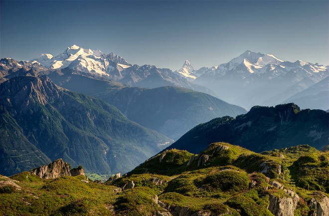
Pennine Alps refers to the range of high mountains in the western sector of the Alps. The chain runs along the frontier between Switzerland and Italy. In Switzerland the massifs and valleys lie largely within the canton of Valais, while on the Italian side they extend into parts of Piedmont and the Aosta Valley.
Image gallery
10 Images


Geography and boundaries
The Pennine Alps rise south of the Rhone valley and form a natural divide above several valleys that drain toward the Po basin. The range is characterised by steep, glaciated peaks and deep alpine valleys. Its position makes it an important watershed and a prominent part of the western alpine arc.
Principal summits
- Dufourspitze (Monte Rosa massif) — 4,634 m. The highest point of the Pennine Alps and of Switzerland.
- Dom — 4,545 m. One of the tallest mountains located entirely within Switzerland.
- Liskamm — 4,527 m. A sharp, glaciated ridge shared by both countries.
- Weisshorn — 4,506 m. Noted for its elegant pyramidal shape.
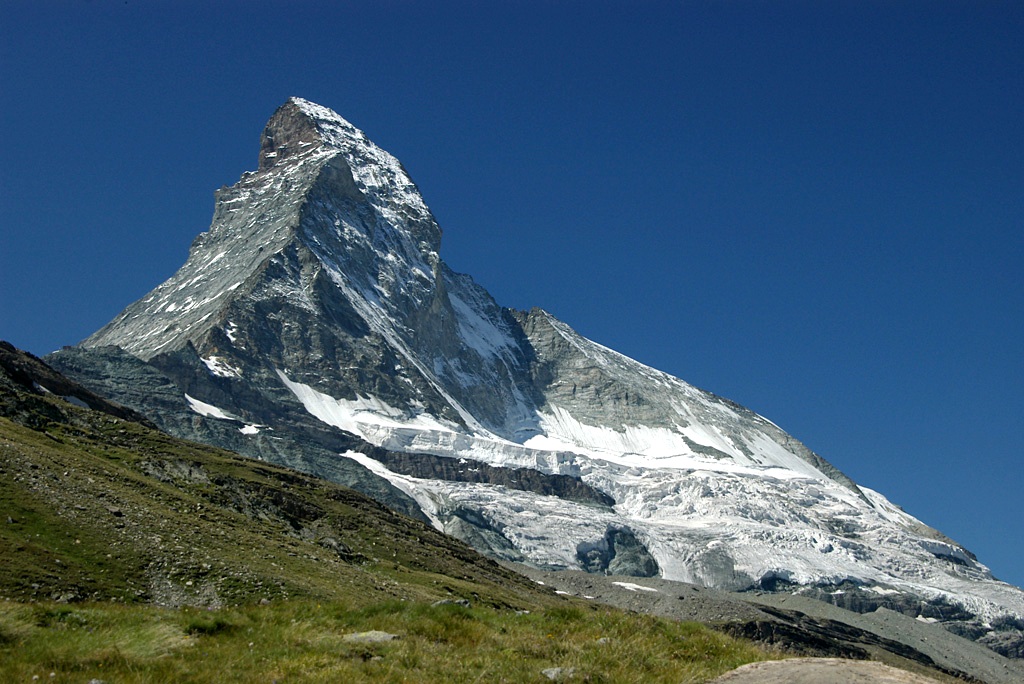
- Matterhorn — 4,478 m. Iconic peak on the border between Switzerland and Italy, famous in mountaineering and tourism.
Glaciers, routes and human use
The Pennine Alps host extensive glacier systems and a network of climbing routes, ski areas and mountain huts. Large glaciers such as the Gorner and Theodul glaciers (near the Monte Rosa and Matterhorn sectors) feed cold alpine streams and shape the landscape. Historic passes — including routes used since Roman times — connect valleys on either side and accommodate modern roads and tunnels.
Recreation and conservation
Because of their height and scenic character, the Pennine Alps are a major destination for mountaineering, hiking and winter sports. Several protected areas and management efforts seek to conserve fragile alpine environments while supporting sustainable tourism in the surrounding communities.
Related articles
Author
AlegsaOnline.com Pennine Alps: High Glaciated Range on the Switzerland–Italy Border Leandro Alegsa
URL: https://en.alegsaonline.com/art/75576
Sources
- tools.wmflabs.org : 46°05′N 7°50′E