List of tectonic plates: major, minor and microplates
Overview and examples of Earth's tectonic plates, including commonly recognized major plates, examples of minor and microplates, boundary types, motion, and their geological significance.
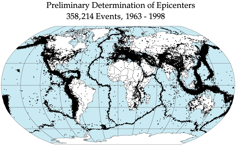
Earth's lithosphere is divided into rigid pieces called tectonic plates. These plates float on the hotter, more ductile asthenosphere and interact along boundaries that produce earthquakes, volcanic activity, mountain building, and seafloor spreading. Geologists recognize several major plates and many smaller ones; when microplates and transient fragments are counted, roughly a hundred distinct plates have been described. For a more detailed list see detailed plate listings.
Image gallery
6 Images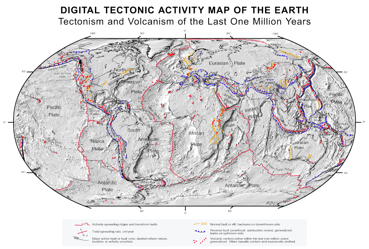


Major tectonic plates
- Pacific Plate — the largest oceanic plate, central to Pacific Basin tectonics.
- North American Plate — spans North America and parts of the Atlantic floor.
- Eurasian Plate — covers much of Europe and Asia west of the Indian subcontinent.
- African Plate — includes the continental crust of Africa and adjacent oceanic regions.
- South American Plate — carries the South American continent and adjacent oceanic crust.
- Antarctic Plate — a large polar plate surrounding Antarctica.
- Indo-Australian Plate — sometimes treated as two plates (Indian and Australian); responsible for collisions in southern Asia.
Minor and microplates (examples)
In addition to the largest plates, numerous smaller plates influence regional geology. Examples include the Nazca, Cocos, Caribbean, Scotia, Philippine Sea, Arabian, Anatolian, Juan de Fuca, Rivera and Somali plates. Microplates such as the Capricorn, Bird's Head, and several fragments around plate boundaries are often mapped as independent units by specialists.
Boundaries, motion and measurement
Plates interact at three main boundary types: divergent (moving apart), convergent (moving together) and transform (sliding past). These interactions control the distribution of earthquakes and volcanoes. Motions are slow on human timescales — typically a few centimeters per year — and are measured precisely today using satellite geodesy and GPS.
History and significance
The theory of plate tectonics, developed in the mid-20th century from concepts of continental drift and seafloor spreading, unified many geological observations. Mapping plates and their boundaries is essential for understanding seismic risk, resource distribution, past climate changes, and the evolution of Earth's surface. Regional studies continue to refine the number and limits of plates as new data reveal complex fragmentations and interactions.
Related articles
Author
AlegsaOnline.com List of tectonic plates: major, minor and microplates Leandro Alegsa
URL: https://en.alegsaonline.com/art/125173