List of rivers of the Philippines
An overview of Philippine rivers, their characteristics, major examples by region, historical and economic significance, and notable distinctions among the country's waterways.
The rivers of the Philippines form an essential network of freshwater systems that drain the archipelago's islands. This article provides an organized overview and examples rather than an exhaustive index. For a compiled list of rivers and further references about waterways in the Philippines, see linked resources.
Image gallery
2 Images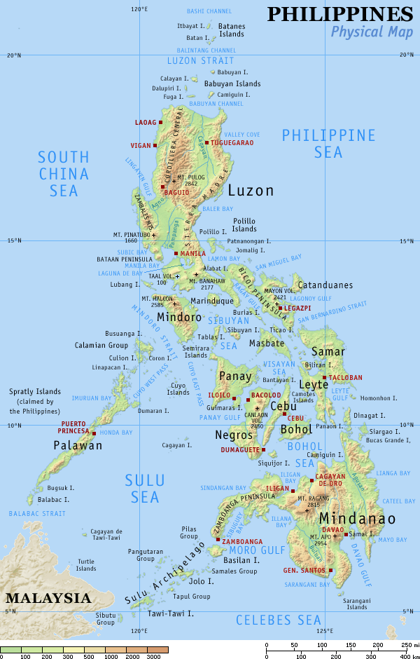

Characteristics and terminology
Rivers in the Philippines vary from short coastal streams to long inland channels with extensive floodplains. Many rivers are seasonal, influenced by monsoon rains and typhoons. Common features include upstream headwaters in upland forests, midstream channels that support irrigation and towns, and estuaries or deltas where they meet the sea.
Major rivers by island group
- Luzon: Cagayan River (the country's longest), Pampanga River, Abra River.
- Visayas: Major rivers tend to be shorter; examples include the Panay rivers and tributaries that drain central islands.
- Mindanao: Mindanao River (also called Rio Grande de Mindanao), Agusan River, which drain large basins and support lowland agriculture.
Uses and importance
Rivers supply water for irrigation, domestic use, and hydroelectric power; they also support fisheries, transportation in remote areas, and cultural practices. Flood control, watershed management, and pollution reduction are ongoing public-policy concerns in many river basins.
History and environmental concerns
Historically, rivers shaped settlement patterns and trade routes. Today, deforestation, mining, urbanization, and climate change affect river health and flood risk. Conservation efforts focus on reforestation, pollution control, and sustainable watershed planning.
Notable distinctions
Notable facts include which rivers are the longest, which have the largest drainage basins, and which form important estuaries or deltas. Rivers differ widely between the mountainous islands of Luzon and the broad lowland plains of Mindanao. For lists organized by province or basin, consult region-specific compilations and the broader list of rivers.
Related articles
Author
AlegsaOnline.com List of rivers of the Philippines Leandro Alegsa
URL: https://en.alegsaonline.com/art/125090