List of rivers of South Africa — overview and major waterways
An organized overview of South Africa's rivers: major systems, regional patterns, uses, and how rivers are classified and listed by basin, province and name. Includes notable rivers and key distinctions.
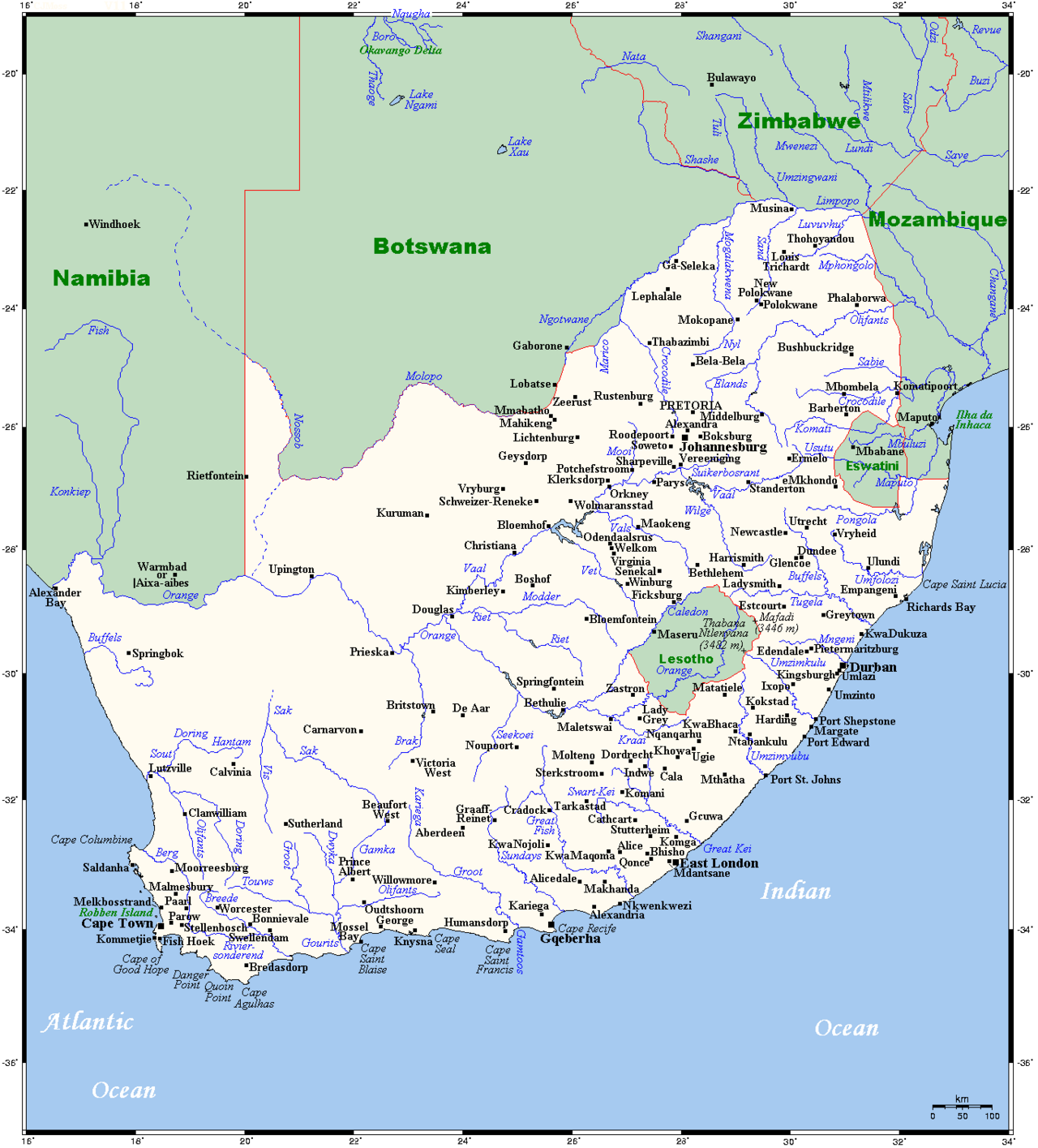
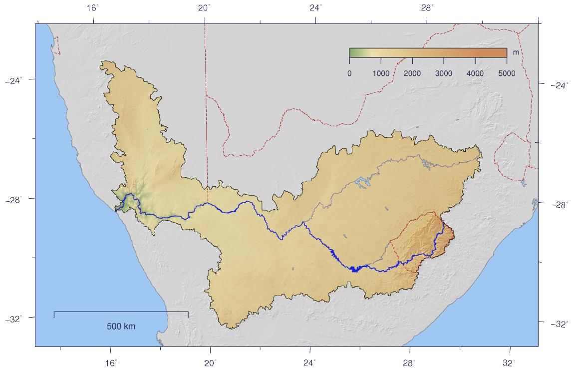
South Africa's rivers form a varied network that reflects the country's diverse climate and topography. From the high-rainfall east to the arid west, rivers may be perennial or ephemeral, join inland basins, or run directly to the Atlantic or Indian Oceans. Several major systems dominate national hydrology and have shaped settlement, agriculture and industry.
Image gallery
9 Images


Major river systems and examples
Among the best known rivers are the Orange (Gariep), the country's longest and a principal westward draining artery; the Limpopo in the north; the Vaal, a major tributary of the Orange; and the Tugela in KwaZulu‑Natal. Other notable names include the Breede, Berg, Olifants (a name borne by more than one river), Great Fish and Kei rivers. Estuaries such as St Lucia and numerous coastal mouths are important ecological zones.
Characteristics and regional patterns
Rivers in the eastern highlands and coastal belts tend to be perennial with higher flows, fed by reliable rainfall and mountain catchments. By contrast, rivers across parts of the Karoo and the west are often ephemeral, running only after rains. Some river systems are heavily regulated by dams and transfers to support agriculture, towns and mining.
Uses, management and conservation
South African rivers supply urban water, irrigation and hydroelectric power, and support fisheries and estuarine habitats. Large engineering projects move water between basins to meet demand. At the same time, rivers face pressures from pollution, invasive species, water abstraction and altered flow regimes, prompting conservation and catchment management efforts.
Lists and classifications
Rivers can be catalogued in several ways: alphabetically, by drainage basin (Atlantic, Indian, interior basins), by province, or by attributes such as length and mean discharge. Many published and online lists provide comprehensive name‑by‑name inventories; see a representative compilation at listed resource.
Notable facts and distinctions
- Some river names repeat in different regions; context (province or basin) helps to disambiguate them.
- Several important rivers cross or form international boundaries, linking South Africa hydrologically with neighboring countries.
- Rivers have been central to historical settlement patterns and remain critical for future water security.
Related articles
Author
AlegsaOnline.com List of rivers of South Africa — overview and major waterways Leandro Alegsa
URL: https://en.alegsaonline.com/art/125075
Sources
- dwaf.gov.za : Dep. of Water Affairs; Republic of South Africa