Rivers of Suriname: major waterways and drainage basins
Overview and organized list of Suriname's rivers by drainage basin, with principal tributaries, uses, ecological importance, and notable facts such as borders and hydropower.
Overview
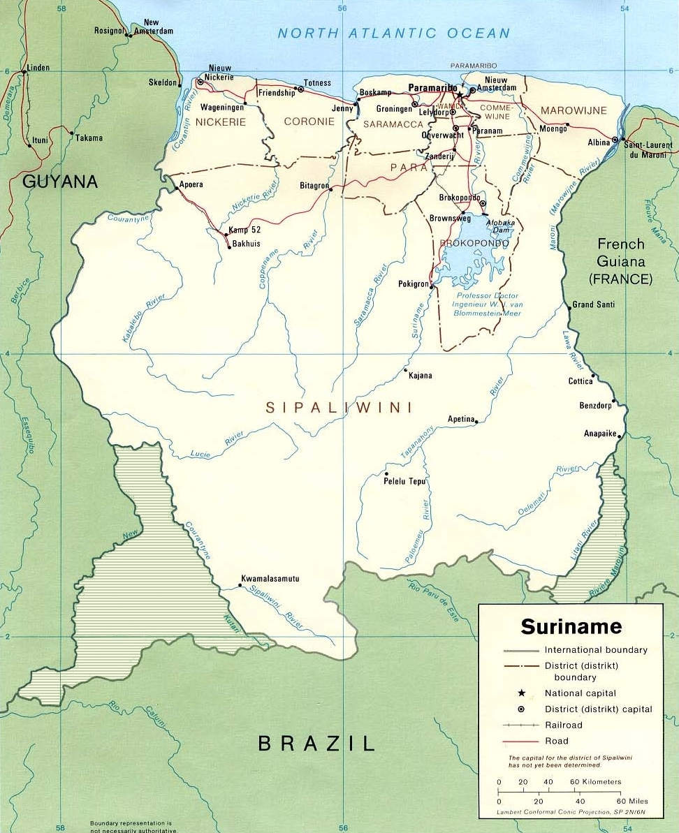
Suriname is drained by a dense network of rivers that flow northward from the Guiana Shield to the Atlantic Ocean. These waterways shape the country's geography, support transport and subsistence fishing, sustain rainforest ecosystems, and have been central to hydroelectric development and small-scale mining.
Image gallery
2 Images
Arrangement and how to read the list
The rivers below are grouped by where they empty—generally the Atlantic coast—and major tributaries are indented beneath their parent streams. For a more detailed registry or map consult the national list. Explanatory notes about how tributaries are shown can be found via tributaries.
Major rivers and principal tributaries
- Corantijn (Courantyne) River — western border with Guyana
- Nickerie River
- Kabalebo River (upper basin tributary)
- Coppename River — central-west coastal basin
- Saramacca River — central basin
- Suriname River — central-east; principal waterway for Paramaribo
- Commewijne River (joins near Paramaribo)
- Para River
- Marowijne (Maroni) River — eastern border with French Guiana
- Lawa River (upper course)
- Tapanahony River
- Smaller coastal rivers and creeks — numerous short streams and estuaries
Uses and significance
Rivers in Suriname are vital for transportation in remote areas, supply drinking water, and support fisheries and traditional livelihoods of Indigenous and Maroon communities. The Suriname River hosts the Afobaka Dam and Brokopondo Reservoir, which supply hydroelectric power used historically by bauxite and aluminum industries.
Environmental and historical notes
Many river basins are covered by intact tropical rainforest and high biodiversity, but some waters are affected by mercury and sedimentation from artisanal gold mining. The Courantyne and Marowijne rivers are geopolitically significant as border rivers. Conservation and sustainable management of these waterways are ongoing priorities in national planning and international cooperation.
Further reading
For maps, basin boundaries, and a more comprehensive catalog of smaller tributaries and creeks, consult official hydrological resources and regional atlases at governmental or mapping portals.
Related articles
Author
AlegsaOnline.com Rivers of Suriname: major waterways and drainage basins Leandro Alegsa
URL: https://en.alegsaonline.com/art/125078