Counties of Mississippi — overview and complete list
Overview and complete list of Mississippi's 82 counties, describing their roles, origins, notable examples, and administrative importance.
Overview
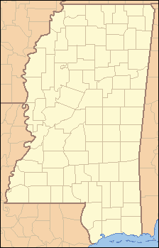
This article presents an authoritative list of the 82 counties in the U.S. state of Mississippi. Counties are the principal local government subdivisions of the state: they provide basic services, maintain local courts and records, collect some taxes, and serve as administrative units for state and federal programs. The number 82 has remained stable in modern times, and each county typically contains one county seat where the main courthouse and administrative offices are located.
Image gallery
2 Images
Organization and functions
Mississippi counties vary widely in population, area, and economic character. County governments commonly include an elected board of supervisors (or equivalent), a sheriff's office, tax assessor and collector, and clerks who keep land, marriage and court records. Counties administer local roads, zoning in unincorporated areas, public health programs, and coordinate emergency response with municipalities and the state. Federal and state agencies also use counties as units for statistics, voting precincts, and funding allocations, often identifying them by standardized codes.
History and naming
The state's counties were established over the 19th century as Mississippi grew from territory to statehood and as settlement expanded. County boundaries and seats were adjusted over time in response to population shifts, transportation routes and economic development. County names reflect a range of influences: Native American place-names and tribal names, early American statesmen and military leaders, and local pioneers. Many names preserve the region's mixed cultural heritage and historical figures associated with national and regional history.
Notable examples and distinctions
Some Mississippi counties are known for containing the state capital, major cities, or coastal ports. Hinds County, for example, includes Jackson, the state capital. Coastal counties host important shipping and tourism centers. Others in the Delta and interior are agriculturally focused and have smaller, more dispersed populations. A few rural counties rank among the least populous in the nation, while suburban counties near metropolitan areas have seen rapid growth. For federal data and mapping, counties are referenced by FIPS codes and are the common unit for census, public health, and infrastructure statistics.
Complete list of counties
- Adams
- Alcorn
- Amite
- Attala
- Benton
- Bolivar
- Calhoun
- Carroll
- Chickasaw
- Choctaw
- Claiborne
- Clarke
- Clay
- Coahoma
- Copiah
- Covington
- DeSoto
- Forrest
- Franklin
- George
- Greene
- Grenada
- Hancock
- Harrison
- Hinds
- Holmes
- Humphreys
- Issaquena
- Itawamba
- Jackson
- Jasper
- Jefferson
- Jefferson Davis
- Jones
- Kemper
- Lafayette
- Lamar
- Lauderdale
- Lawrence
- Leake
- Lee
- Leflore
- Lincoln
- Lowndes
- Madison
- Marion
- Marshall
- Monroe
- Montgomery
- Neshoba
- Newton
- Noxubee
- Oktibbeha
- Panola
- Pearl River
- Perry
- Pike
- Pontotoc
- Prentiss
- Quitman
- Rankin
- Scott
- Sharkey
- Simpson
- Smith
- Stone
- Sunflower
- Tallahatchie
- Tate
- Tippah
- Tishomingo
- Tunica
- Union
- Walthall
- Warren
- Washington
- Wayne
- Webster
- Wilkinson
- Winston
- Yalobusha
- Yazoo
Researchers, planners, and residents use this list for reference when working with demographic data, legal jurisdictions, electoral rolls, and regional planning. For more details on individual counties—such as population, area, county seat, and governing structure—consult state and local government records or databases maintained for public reference.
Related articles
Author
AlegsaOnline.com Counties of Mississippi — overview and complete list Leandro Alegsa
URL: https://en.alegsaonline.com/art/124616